3rd Grade Geography Printables (by price, high to low)

Montessori Store Bundle: Math Facts, Worksheets, Task Cards, Printing, Clip Art
By Jessica Renee Montessori - JRMontessori
This bundle includes every single Montessori-friendly MATH ACTIVITY in my store as well as some PRE-WRITING and PRINTING worksheets, and lots of Montessori clip art!
Everything is appropriate for Lower Elementary children and is designed with independence in mind, which means even children who are not yet reading can use the material. I've also made everything as easy to prepare as possible.
The SNAKE GAME task cards all have the answer printed on the back so children can check their own work. In fact, this control of error is true of all the math cards! The Place Value BRING ME GAME cards even have the answers represented visually with the Golden Beads.
✅ Click on the PREVIEW to take a closer look at this amazing Montessori bundle!
⚠️ BUNDLE & SAVE! ⚠️ Save up to 30% on this resource and others by purchasing this item in a comprehensive bundle. Check out the Montessori Store Bundle and the Montessori Math Materials Bundle to see both amazing bundle options!
►► Have a question or need help with this resource? Please visit the FAQ Section, submit a help ticket, or ask a question on the Q&A tab!
✨ Keep up with all things Jessica Renee Montessori by completing any of the actions below:
- Become a Store Follower on TeachShare
- Follow Me on Instagram
- Like My Facebook Page
Get TeachShare credits toward future purchases:
After logging in, go to "My Purchases" and find the "Provide Feedback" button beside each product. Leave a fair rating and a comment about the resource, and that's it!
___________________________________
Copyright © JRMontessori
Permission to copy for single classroom use only.
Please purchase additional licenses if you intend to share this product.
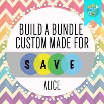
By Geography & Math Made Easy
This is a bundle designed for Alice.
Includes 8 Lessons:
Geography: Ten Worst Natural Disaster of the 20th Century
Geography & Science "Shake, Rattle, and Roll": Plate Tectonics Task Cards
Geography & World History: World Map Quizzes / Quiz Bundle
Geography: Halloween Around The World
Geography: Road Trip_Learning To Use A Map Scale
Monster Mash: A Study of Mystical Monsters of The World (Geography Halloween)
Geography: Push and Pull Factors on Human Migration (Includes lesson, PP & Game)
Geography Game: Around The World (Countries and Continents)
Total after 20% off is 32.34.
OR BUILD YOUR OWN BUNDLE HERE
Susan Wise Bauer: The Story of the World (Book #1 to Book #4)
By Peter D
This is a bundle of four sets of worksheets to accompany Susan Wise Bauer's series The Story of the World.
There is one PDF file (over 90 pages each) for each of the four books in the series.
For each chapter in each book, there is one page of comprehension questions (multiple choice and short answer questions).
For each set of six chapters, there are seven review pages:
* comprehension questions (multiple choice)
* comprehension questions (short answer questions)
* vocabulary (two pages)
* review activity
* compare and contrast
* paragraph summaries
Also, there is an answer key included at the end of each PDF file.

December Holidays Nonfiction Reading Comprehension Passages Bundle: Cyber Monday
By True Line Texts
Boost your classroom’s reading comprehension skills with this Ultimate Holiday & Seasonal Nonfiction Reading Comprehension Passages Bundle! This comprehensive bundle includes 32 engaging, themed passages perfect for Kindergarten to 2nd grade students. Each passage is paired with thought-provoking questions to assess comprehension and enhance critical thinking. With topics ranging from Kwanzaa and Thanksgiving to Winter Holidays, Human Rights, Food, Landforms, and much more, your students will enjoy learning about a wide variety of subjects.
This bundle is perfect for teaching students about diverse cultures, historical events, holiday traditions, and essential topics like cybersecurity, marketing, and animal rights. Ideal for use throughout the year, the passages also cover winter, fall, and other key seasons. Perfect for classroom activities, assessments, and independent practice!
Key Features:
- 32 nonfiction reading comprehension passages
- Covers holidays like Kwanzaa, Thanksgiving, New Year's Eve, Cyber Monday, and more
- Topics on Diversity, Human Rights, AIDS Awareness, and Food (including Cotton Candy, Fruitcake, and Pumpkin Pie)
- Includes a variety of subjects like Landforms, Marketing, Winter Traditions, and Kindness
- Easy to print, with questions that reinforce learning
- Suitable for holiday celebrations, theme days, and special events
Enhance your classroom with this versatile bundle, which helps your students connect with the world around them through fun and informative passages. Perfect for creating engaging lesson plans, holiday-themed activities, or year-round practice!
Tags: Kwanzaa, Thanksgiving, Winter Holidays, Diversity, Human Rights, Food, Marketing, Reading Comprehension, Holiday Activities, Teaching Bundle, K-2 Literacy, Seasonal Reading, Classroom Activities

Special Education Science Bundle: Adapted Books and Task Box Activity Bundle
By Specifically Sped
This special education science bundle includes nine topics with the use of adapted books and corresponding task boxes. All of the visual supports are repeated through the adapted books and task boxes to provide repetition and retention. Task boxes provide students the opportunity to practice fine motor skills with the unique puzzle designs.
☞Whether you are working on science iep goals or science standards in your curriculum these science adapted books and puzzles will have you set for the year!
Topics Covered
**►**Bodies of Water
►Landforms
►Continents
►Planets
►My Body
►My Organs
►Weather
►Animal Habitats
►Force and Motion
Adapted Books:
This special education science activity helps students learn through adapted books. Students can engage in this activity by matching visuals to each page as they learn about the different science concepts.
Science Task Box Picture Puzzle:
Have students cut and glue the puzzle pieces to match the board for fine motor practice or laminate and velcro for repeated use.
Related Products
• Special Education Lesson Plan/Scope and Sequence for Elementary Science ALL YEAR
• Special Education Science Adapted Book Bundle: Science Lesson and Goal Practice
• Special Education Science Task Box Activity Bundle (Life Skills Activities)
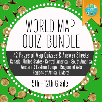
Geography and World History, World Map Quizzes, Quiz Bundle
By Geography & Math Made Easy
These 8 pre-numbered maps and 16 quizzes will save you hours upon hours of creation and make preparation for assessing students on geographic locations effortless. Each has been designed with a numbered map, reproducible answer sheet and teacher’s answer key.
When the class reaches the larger continents such as Europe, Asia, and Africa, it is suggested that the instructor assess the student in sections or regions before assessing them over the entire continent. This will allow students to learn a sections/regions of countries at a time rather than overwhelming students with learning the entire continent at once.
These can be used over and over again throughout the year!
Thank you in advance for your purchase. I hope these will save you time so that you can regain some of your personal time. Enjoy!
Includes 42 Pages:
- Canada & United States
- Central America
- South America
- Western & Eastern Europe
- Continent of Europe
- Western & Southern Asia
- Central & Eastern Asia
- South East Asia
- Continent of Asia
- North Africa
- North & East Africa
- South Africa
- Western Africa
- Continent of Africa
Do you need to have your students retake the quiz, but need to modify the test to be different, check out Make Your Own Map Quiz.
☑ Check out the preview to see what is included.
Visit our store Geography & Math Made Easy to view other related resources:
Simliary Resources & Skills
✧ Beginning of the Year Activities
✧ Pre- & Post Assessments
✧ Geography Basic Skills
✧ Other Quizzes
.........................................................................................................................................................
Disclaimer:
One purchase is for the use of one teacher. If additional teachers would like to use this product, please purchase additional licenses.
.........................................................................................................................................................
CUSTOMER TIPS
When do I post new products? Throw sales? Be the first to know:
- Click the green star next to my picture to become my newest follower.
Leave A Review and Earn TeachShare Credit to Use on Future Purchases:
- Go under “My TeachShare”, and click on “My Purchases”. Then, click the provide feedback button next to your purchase. Every time you leave feedback on a purchase, TPT gives you credits that you can use to save money on future purchases. I value your feedback as it helps me determine what types of new products I should create for you and other buyers.
........................................................................................................................................................
CREATE A CUSTOM BUNDLE & SAVE UP TO 20%
Do you need 25 dollars or more of lessons and want to save up to 20%? Just let me know and a customized bundle can be created for you. Learn more about how to Create Your Custom Bundle.
.........................................................................................................................................................
© Geography & Math Made Easy Resources. Created by Martha Boykin ^ Will Boykin. All rights reserved. Purchase of this product grants the purchaser the right to reproduce pages for classroom use only. If you are not the original purchaser, please download the item from my store before making copies. Copying, editing, selling, redistributing, or posting any part of this product on the internet is strictly forbidden. Violations are subject to the penalties of the Digital Millennium Copyright Act.
.........................................................................................................................................................
Related Topics:
Beginning of the year activities, getting to know you activities, get to know you activities, beginning of the year, assessment, beginning of the year, geography, world geography, geography, geography activitie. geography unit, geography skills, preassessment, post assessment, beginning of the year first assessment, getting to know you, map quizzes, map quiz, template

By Nardine Mettry
This resource is packed with festive and interactive ways to practice multiplication facts. From holiday-themed shopping sprees to thrilling escape room, students will love mastering their times tables while having a blast.
What's Included:
- Dice Game: Roll the dice and multiply to be the first to reach the finish line.
- Thanksgiving Grocery Shopping: Practice multiplication while planning the perfect Thanksgiving feast.
- Christmas Shopping Spree: Help Santa stay on budget while purchasing Christmas gifts.
- Multiplication Board Game: Race to the finish line while answering multiplication questions.
- Haunted House Escape Room: Solve multiplication puzzles to escape a spooky house.
Why this resource:
- Reinforces multiplication facts in a fun and interactive way
- Promotes problem-solving and critical thinking skills
- Aligns with real-world math applications
- Provides opportunities for cooperative learning and competition
Don't forget to share with me how it went with your little ones. I hope it was useful in your classroom.
If you like this product, follow my store -Mettry Teaches- for more.
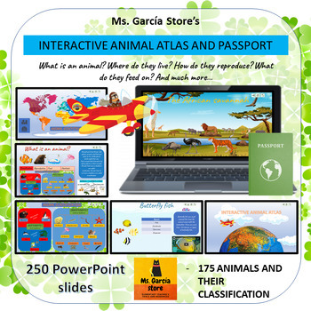
Interactive Animal Atlas and Ecologic Passport
By Ms Garcia Store
Journey through the Animal Kingdom with this captivating PowerPoint presentation! Join me aboard my plane and explore over 150 animals in their natural habitats and ecosystems. Discover their unique characteristics and classification within the animal world. Each animal has its own dedicated file, featuring an image, classification, and a 3 to 5-minute video about their fascinating lives. By clicking on different features, you'll be transported to new tabs that enhance your understanding of this incredible world.
This interactive resource ensures that all tiles are interconnected, providing a seamless learning experience. Plus, customization is a breeze. On slide 3, simply replace "Ms Garcia Store" with your own class name. For example, "Ms. Garcia's Class."
In addition, you'll receive two PDF files to complement your journey:
1. Ecological Passport: Print the 3 double-sided letter-size sheets (8.5 x 11") from this PDF and obtain a fantastic passport. Your students can familiarize themselves with this document while exploring different ecosystems.
2. Travel Stamps: Also print this 2-page PDF (single-sided). It features 20 travel stamps for your students to affix to their eco-passports as they learn about each location. The 20 stamps represent the following destinations:
- Amazon Rainforest
- Australia
- Andes Mountains
- The Arctic
- The Antarctic
- African Savannah
- American Grasslands
- American Swamps
- Pacific Coast
- Sahara Desert
- African Jungle
- Himalayan Mountains
- Indonesian Islands
- Galapagos Islands
- Asian Monsoon Rainforest
- Northern Forests
- European Forests
- Coral Reefs
- Farm Animals
- City Animals
Content:
- What is an animal?
Vertebrates
- Mammals
- Birds
- Fish
- Reptiles
- Amphibians
Invertebrates
- Poriferans
- Flatworms
- Annelids
- Echinoderms
- Cnidarians
- Mollusks
- Arthropods
- Arachnids
- Insects
- Crustaceans
- Myriapods
- Where do they live?
- 10 habitats
- 20 ecosystems
Travel around the world and explore 20 ecosystems while discovering the animals that inhabit them.
- How do they reproduce?
- Viviparous, oviparous, and ovoviviparous
- What do they eat?
- Carnivores
- Herbivores
- Omnivores
Students will practice form completion by providing the following information in the Passport, either their own personal information or that of an invented character:
- Surname
- Given Names
- Nationality
- Date of Birth
- Place of Birth
- Sex
- Date of Issue (the date the form is filled out)
- Date of Expiry (5 years after the date of issue)
- Signature
- Photo or Drawing of the Student's Face
Immerse yourself in this exciting virtual safari and let your students explore the captivating world of animals in diverse corners of the planet. Acquire this resource now and provide an unforgettable educational experience!
Note: This resource can be used in the classroom or for homeschooling purposes.
Related Products
⭐ Interactive animal atlas, animal classification, reproduction, habitats, etc.
⭐ Interactive Animal Atlas and Ecologic Passport
⭐ Safari virtual field trip around the world
⭐ Safari Virtual Fieldtrip and Ecologic Passport
⭐ Ecologic Passport and 20 Travel Stamps of different Ecosystems
Productos Relacionados
⭐ Atlas animal interactivo. Clasificación, reproducción, habitats...
⭐ Atlas animal interactivoy PasaporteEcológico
⭐ Safari virtual interactivoalrededordel mundo
⭐ Safari Virtual Interactivoy PasaporteEcológico
⭐ PasaporteEcológicoy sellosde viajede 20 ecosistemas
Click here to visit my TeachShare store
I would like to thank all the graphic designers whose work I took borrowed from these webs to do this educational resource:
Clipartkey.com
Background vector created by brgfx - www.freepik.com
Dog vector created by brgfx - www.freepik.com
Background vector created by macrovector - www.freepik.com
Tree vector created by upklyak - www.freepik.com
Vector de Fondo creado por macrovector - www.freepik.es
Nature Vectors by Vecteezy
Antarctica Vectors by Vecteezy
Antarctica Vectors by Vecteezy
Kids vector created by macrovector - www.freepik.com
Cartoon Jungle Vectors by Vecteezy
Animales Vectores por Vecteezy
Naturaleza Vectores por Vecteezy
Vintage vector created by rawpixel.com - www.freepik.com
Imagen de Clker-Free-Vector-Images en Pixabay
Image by Clker-Free-Vector-Images from Pixabay
Duck-billed platypus
Animals vector created by brgfx - www.freepik.com
Imagen de tony241969 en Pixabay
Imagen de Mostafa Elturkey en Pixabay
Food vector created by macrovector - www.freepik.com
Background vector created by rawpixel.com - www.freepik.com
Vintage photo created by rawpixel.com - www.freepik.com
Poster vector created by rawpixel.com - www.freepik.com
Nature Vectors by Vecteezy
Snow vector created by brgfx - www.freepik.com
Tree vector created by brgfx - www.freepik.com
Background vector created by brgfx - www.freepik.com
Texture photo created by freepik - www.freepik.com
Image by macrovector on Freepik
Image by brgfx on Freepik
Imagen de macrovector en Freepik
Imagen de macrovector en Freepik

Social Emotional Learning Bundle: Google Slides and Printables
By Inspired By MlG
Empower your students to navigate the ever-changing landscape of emotions with our comprehensive Social-Emotional Learning Bundle!
This interactive, Google-compatible resource pack provides everything you need to equip your students with the tools for emotional mastery.
Here's what sets this bundle apart:
- 3 Engaging Presentations: Dive deep into different emotions and situations with our interactive presentations. Students will gain valuable insights and discover effective strategies for managing their feelings.
- Master the Art of Self-Regulation: Promote stress relief and emotional control with our library of deep breathing exercises.
- Unlock Self-Discovery: Foster self-reflection and emotional intelligence with 19 captivating writing prompts.
- Practice Makes Perfect: Solidify learning with 5 engaging worksheet activities that reinforce social-emotional skills.
This isn't just about managing emotions – it's about building a foundation for success!
By utilizing this bundle, your students will develop:
- Resilience: Equip them to bounce back from challenges with confidence.
- Empathy: Foster stronger connections with classmates through understanding others' feelings.
- Emotional Intelligence: Cultivate the ability to understand and manage their own emotions effectively.
Invest in your students' social-emotional well-being today!
This comprehensive and effective resource empowers them to navigate life's emotional terrain with confidence and clarity.
pen_spark
Tips for Buyers
☺ Earn TeachShare credits for future purchases by providing feedback for paid products. (Feedback on free products is also greatly appreciated!)
☺ Follow me to receive notifications when new products are posted. You will also receive occasional messages alerting you to sales, promotions, and other exciting news.
☺ Don’t quite see what you are looking for? Leave me a note in the “Ask a Question” tab. I would be happy to create a product to meet the needs of you and your students.
⭐Questions? Send me an email at

Safari Virtual Fieldtrip and Ecologic Passport
By Ms Garcia Store
Embark on an exciting journey around the world and discover 175 fascinating animals in their natural habitats and ecosystems with this fully interactive PowerPoint presentation! Learn about their main characteristics and classification in the animal kingdom.
Each animal has its own card with an image, classification, and an informative video lasting approximately 3 to 5 minutes. By clicking on each feature, you will access new tabs that will help you understand this wonderful world.
Almost everything is editable. On slide number 3, you can customize the name of your class instead of "Ms Garcia Store." For example, you can write "Mrs. Garcia's Class."
In addition, you will find two additional PDF files:
1. Ecological Passport: Print the 3 letter-sized (8.5 x 11") pages of this PDF, and you will obtain an incredible passport that your students can familiarize themselves with while learning about different ecosystems.
2. Travel Stamps: Print this 2-page PDF (not double-sided). It contains a total of 20 travel stamps that your students can paste in the ecological passport as they discover these fascinating locations. The 20 stamps correspond to the following places:
- The Amazon Rainforest
- Australia
- The Andes Mountains
- The Arctic
- Antarctica
- The African Savannah
- The American Grasslands
- The American Swamps
- The Pacific Coasts
- The Sahara Desert
- The African Jungle
- The Himalayan Mountains
- Indonesian Islands
- Galapagos Islands
- Asian Monsoon Rainforest
- Northern Forests
- European Forests
- Coral Reefs
- Farm Animals
- City Animals
Content:
- Animal Classification
- Where do they live?
- 10 habitats
- 20 ecosystems
Travel around the world through 20 ecosystems and discover the animals that inhabit them.
- How do they reproduce?
- Viviparous, oviparous, and ovoviviparous
- What do they eat?
- Carnivores
- Herbivores
- Omnivores
Students will practice form completion by providing the following information in the Passport, either their own personal information or that of an invented character:
- Last Name
- First Name
- Nationality
- Date of Birth
- Place of Birth
- Gender
- Date of Issue (date when the form is completed)
- Expiration Date (5 years after the date of issue)
- Signature
Dive into this exciting virtual safari excursion and allow your students to explore the fascinating world of animal life in different corners of the planet. Get this resource now and provide them with an unforgettable educational experience!
Related Products
⭐ Interactive animal atlas, animal classification, reproduction, habitats, etc.
⭐ Interactive Animal Atlas and Ecologic Passport
⭐ Safari virtual field trip around the world
⭐ Safari Virtual Fieldtrip and Ecologic Passport
⭐ Ecologic Passport and 20 Travel Stamps of different Ecosystems
Productos Relacionados
⭐ Atlas animal interactivo. Clasificación, reproducción, habitats...
⭐ Atlas animal interactivoy PasaporteEcológico
⭐ Safari virtual interactivoalrededordel mundo
⭐ Safari Virtual Interactivoy PasaporteEcológico
⭐ PasaporteEcológicoy sellosde viajede 20 ecosistemas
I would like to thank all the graphic designers whose work I took borrowed from these webs to do this educational resource:
Clipartkey.com
Background vector created by brgfx - www.freepik.com
Dog vector created by brgfx - www.freepik.com
Background vector created by macrovector - www.freepik.com
Tree vector created by upklyak - www.freepik.com
Vector de Fondo creado por macrovector - www.freepik.es
Nature Vectors by Vecteezy
Antarctica Vectors by Vecteezy
Antarctica Vectors by Vecteezy
Kids vector created by macrovector - www.freepik.com
Cartoon Jungle Vectors by Vecteezy
Animales Vectores por Vecteezy
Naturaleza Vectores por Vecteezy
Vintage vector created by rawpixel.com - www.freepik.com
Imagen de Clker-Free-Vector-Images en Pixabay
Image by Clker-Free-Vector-Images from Pixabay
Duck-billed platypus
Animals vector created by brgfx - www.freepik.com
Imagen de tony241969 en Pixabay
Imagen de Mostafa Elturkey en Pixabay
Food vector created by macrovector - www.freepik.com
Background vector created by rawpixel.com - www.freepik.com
Vintage photo created by rawpixel.com - www.freepik.com
Poster vector created by rawpixel.com - www.freepik.com
Nature Vectors by Vecteezy
Snow vector created by brgfx - www.freepik.com
Tree vector created by brgfx - www.freepik.com
Background vector created by brgfx - www.freepik.com
Texture photo created by freepik - www.freepik.com

Safari Virtual Interactivo y Pasaporte Ecológico
By Ms Garcia Store
Excursión Virtual de Safari en Español
¡Embárcate en un emocionante viaje alrededor del mundo y descubre 175 fascinantes animales en sus hábitats y ecosistemas naturales con esta presentación PowerPoint totalmente interactiva! Conoce sus características principales y su clasificación en el reino animal.
Cada animal tiene su propia ficha con una imagen, su clasificación y un video informativo de aproximadamente 3 a 5 minutos. Al hacer clic en cada función, accederás a nuevas pestañas que te ayudarán a comprender este maravilloso mundo.
Casi todo es editable. En la diapositiva número 3, podrás personalizar el nombre de tu clase en lugar de "Ms Garcia Store". Por ejemplo, puedes escribir "Clase de la Sra. García".
Además, encontrarás dos archivos PDF adicionales:
1. Pasaporte Ecológico: Imprime en tamaño carta (8.5 x 11") las 3 hojas de este PDF y obtendrás un increíble pasaporte con el que tus estudiantes podrán familiarizarse mientras aprenden sobre diferentes ecosistemas.
2. Sellos de Viaje: Imprime también este archivo PDF de 2 hojas (no a doble cara). Contiene un total de 20 sellos de viaje que tus alumnos podrán pegar en el pasaporte ecológico a medida que vayan descubriendo estos fascinantes lugares. Los 20 sellos corresponden a las siguientes ubicaciones:
- La selva amazónica
- Australia
- La cordillera de los Andes
- El Ártico
- La Antártida
- La sabana africana
- El pastizal americano
- Los pantanos americanos
- Las costas del Pacífico
- El desierto del Sáhara
- La jungla africana
- Montañas del Himalaya
- Islas de Indonesia
- Islas Galápagos
- Selva monzónica asiática
- Bosques del Norte
- Bosques Europeos
- Arrecifes de coral
- Animales de granja
- Animales de ciudad
Contenido:
- Clasificación de los animales
- ¿Dónde viven?
- 10 hábitats
- 20 ecosistemas
Viaja alrededor del mundo a través de 20 ecosistemas y descubre los animales que los habitan.
- ¿Cómo se reproducen?
- Vivíparos, ovíparos y ovovivíparos
- ¿De qué se alimentan?
- Carnívoros
- Herbívoros
- Omnívoros
Los estudiantes practicarán la cumplementación de formularios aportando la siguiente información en el Pasaporte, ya sea la suya personal o la de un personaje inventado:
- Apellido
- Nombre
- Nacionalidad
- Fecha de nacimiento
- Lugar de nacimiento
- Sexo
- Fecha de expedición (fecha en la que se completa el formulario)
- Fecha de caducidad (5 años después de la fecha de expedición)
- Firma
Sumérgete en esta emocionante excursión virtual de safari y permite que tus estudiantes exploren el fascinante mundo de la vida animal en diferentes rincones del planeta. ¡Adquiere este recurso ahora y bríndales una experiencia educativa inolvidable!
Nota: Este recurso es compatible con el aprendizaje en español y es adecuado para su uso en el aula o en educación en el hogar.
Related Products
⭐ Interactive animal atlas, animal classification, reproduction, habitats, etc.
⭐ Interactive Animal Atlas and Ecologic Passport
⭐ Safari virtual field trip around the world
⭐ Safari Virtual Fieldtrip and Ecologic Passport
⭐ Ecologic Passport and 20 Travel Stamps of different Ecosystems
Productos Relacionados
⭐ Atlas animal interactivo. Clasificación, reproducción, habitats...
⭐ Atlas animal interactivoy PasaporteEcológico
⭐ Safari virtual interactivoalrededordel mundo
⭐ Safari Virtual Interactivoy PasaporteEcológico
⭐ PasaporteEcológicoy sellosde viajede 20 ecosistemas
Click here to see all my resources in Spanish
Click here to visit my TeachShare store
I would like to thank all graphic designers whose work I took borrow from these webs to do this educational resource:
Clipartkey.com
Background vector created by brgfx - www.freepik.com
Dog vector created by brgfx - www.freepik.com
Background vector created by macrovector - www.freepik.com
Tree vector created by upklyak - www.freepik.com
Vector de Fondo creado por macrovector - www.freepik.es
Nature Vectors by Vecteezy
Antarctica Vectors by Vecteezy
Antarctica Vectors by Vecteezy
Kids vector created by macrovector - www.freepik.com
Cartoon Jungle Vectors by Vecteezy
Animales Vectores por Vecteezy
Naturaleza Vectores por Vecteezy
Vintage vector created by rawpixel.com - www.freepik.com
Imagen de Clker-Free-Vector-Images en Pixabay
Image by Clker-Free-Vector-Images from Pixabay
Duck-billed platypus
Animals vector created by brgfx - www.freepik.com
Imagen de tony241969 en Pixabay
Imagen de Mostafa Elturkey en Pixabay
Food vector created by macrovector - www.freepik.com
Background vector created by rawpixel.com - www.freepik.com
Vintage photo created by rawpixel.com - www.freepik.com
Poster vector created by rawpixel.com - www.freepik.com
Nature Vectors by Vecteezy
Snow vector created by brgfx - www.freepik.com
Tree vector created by brgfx - www.freepik.com
Background vector created by brgfx - www.freepik.com
Texture photo created by freepik - www.freepik.com
Image by macrovector on Freepik
Image by brgfx on Freepik
Imagen de macrovector en Freepik
Imagen de macrovector en Freepik
By Creative Soul Printables
Explore the diverse and fascinating United States of America with our 50 States Notebook Pages. This educational and engaging product is designed to help students and travelers of all ages learn more about each of the 50 states that make up this vast and culturally rich nation. Whether you're a student researching state history, a traveler planning a road trip, or an educator looking for engaging teaching resources, these notebook pages are the perfect companion.
Key Features:
- Comprehensive Coverage: Each state has its dedicated page, providing an in-depth overview of its history.
- Beautifully Illustrated: Vibrant and detailed illustrations bring each state to life, making the learning experience more enjoyable and visually appealing.
- Customizable Format: The notebook pages are thoughtfully designed to be easily printable and fit into standard notebooks or binders. You can create your personalized 50 States Notebook by arranging the pages in any order that suits your needs.
- State Flags and Symbols: Learn about the unique state flags, official seals, and other symbols that represent the identity and heritage of each state.
- Great for All Ages: Whether you're a curious youngster or an adult seeking to expand your knowledge, these notebook pages are suitable for learners of all ages and backgrounds.
- Educational Tool: Ideal for homeschooling, classroom teaching, or self-study, the 50 States Notebook Pages are a valuable resource for educators, parents, and students alike.
Uses:
- Education: Perfect for integrating state-specific knowledge into social studies, geography, or history lessons.
- Travel Planning: Plan your dream road trip across the United States, knowing more about each state you'll visit.
*************************************************************
What is included:
Map to write in abbreviations of states to know locations
Notebook Pages for all 50 States
Images for state trees, seals, flags, flowers, birds and flowers
*************************************************************
Other Related Products that May Interest You:
⭐ 50 States Abbreviations BINGO
⭐ 50 States BINGO
**************************************************************
How to get TeachShare credit to use on future purchases:
Please go to your “My Purchases” page (you may need to login). Beside each purchase you'll see a Provide Feedback button. Simply click it and you will be taken to a page where you can give a quick rating and leave a short comment for the product.
Each time you give feedback, TeachShare gives you feedback credits that you use to lower the cost of your future purchases. I value your feedback greatly as it helps me determine which products are most valuable for your classroom so I can create more for you.
Be the first to know about my new discounts, freebies and product launches: Check out my store to know first! **************************************************************

World Map Worksheets | 7 Continents and 5 Oceans Blank Map Skills & Activities
By Innovative Classroom Ideas
Kids enjoy studying about the world in which they live! With the help of these entertaining printable Continents and Oceans Worksheets, they will love learning about the seven continents and the corresponding geography. For students in kindergarten, first grade, second grade, third grade, fourth grade, fifth grade, and sixth grade, these worksheets offer a fun and interactive way to explore our planet. Through engaging activities like coloring, labeling, and matching, students will develop a solid understanding of the continents and oceans while sparking their curiosity about the diverse cultures and natural wonders of the world. Let’s embark on a global adventure together!
By completing the various activities, children will enhance their map skills, vocabulary, and critical thinking abilities. These printable resources are perfect for homeschooling, classroom use, or simply as a fun activity to do at home.
These no prep worksheets offer a wide range of activities to keep young learners engaged. From simple tracing and coloring to more challenging puzzles and word searches, there’s something for everyone. With these worksheets, learning about the continents and oceans is both educational and enjoyable.
✅ Save more than 50% when you get a bundle ✅
This bundle contains the following resources:
⭐ Blank World Map with Countries | 7 Continents and 5 Oceans | United States Map
These printable maps will be useful whether you are studying geography, world history, countries around the world, or you are just trying to show your kids the route you are taking on your next vacation! For kids learning about states, we’ve included a printable map of the world, as well as maps of North and South America, Europe, Asia, Australia, Africa, and Antarctica. Furthermore, the world map printable set comprises labeled and blank options for printing. To print the printable map pdf file simply download this ressource and use it for students in pre-kindergarten, first grade, second grade, third grade, fourth grade, fifth grade, sixth grade, seventh grade, junior high, and even high school.
The blank world map is particularly useful for providing a bird’s eye perspective of the globe, oceans, continents, and major nations. It also helps locate me on the map with children of various ages.
That ressource countains:
- Blank World Map (with /without country names)
- North America Map (with / without country names)
- South America Map (with / without country names)
- Australia Map (with / without country names)
- Asia Map (with / without country names)
- Europe Map (with / without country names)
- Antarctica Map (with / without country names)
- Africa Map (with / without country names)
- United States Map (with / without country names)
⭐ World Map with Countries Worksheets | 7 Continents and 5 Oceans Blank Map
Kids enjoy studying the world they live in! They will enjoy learning about the seven continents and the corresponding geography with these fun and printable Continents Worksheets. For kindergarteners, first graders, second graders, third graders, fourth graders, and fifth graders, use these continents and oceans worksheets. You may start playing and learning as soon as you print the continents and oceans worksheet PDF.
These 7 continents and 5 oceans worksheets are perfect for parents, teachers, and homeschoolers who want to assist their kids learn about the globe we live in and improve their science skills. For kindergarteners, first-graders, second-graders, third-graders, fourth-graders, and fifth-graders, this pack is ideal. Use these no prep 7 Continents worksheets for science centers, additional practice, at home or at school, or as a component of a continent study. Children will learn about the seven continents that today make up the world in which we live with this bundle. Answers are provided and this pack comes mainly in black and white with a few color pages thrown in.
There are lots of activities in this pack:
- Continent poster in color
- Color in the continents on the world map following the key
- Cut out and paste the labels onto the continents
- Write the names of the seven continents next to the corresponding number
- Color in the continents using the key
- Unscramble the names of the continents
- One page for each of the seven continents with facts that include the hemisphere the continent is in, the oceans that surround it, and the amount of countries that are in that continent
- Write the names of the continents in alphabetical order
- Continent word search
⭐ Continents and Oceans Worksheets | Blank World Map with Countries | Map Skills
This set of printable pages on the seven continents is a fantastic way to practice geography. With the help of this continents and oceans worksheet pdf, students will enjoy learning about the seven major continents. Use these maps with kindergarten, first, second, third, fourth, fifth, and sixth grade elementary students as part of a social studies subject, as a stand-alone review, or as additional practice.
These 7 Continents and 5 Oceans worksheets will be a hit with your pupils as they practice labeling the different continents and discover fascinating facts about each one. You only need to print the continents and oceans worksheet to begin teaching kindergarteners, first-graders, second-graders, third-graders, fourth-graders, fifth-graders, and sixth-graders. This no-prep geography lesson will help children learn about Asia, Africa, Australia, North America, Antarctica, South America, and Europe. It is perfect for parents, teachers, and homeschoolers. Now that you have these continents worksheets, you can start learning! The answer key is provided!!
⭐ World Map Skills Worksheets | 7 Continents and 5 Oceans | Geography Activities
This printable page pack featuring the seven continents is an excellent tool for honing geography skills. These continents and oceans worksheet pdf will make learning about the seven major continents enjoyable for students. Utilize these no prep worksheets with kindergarten, first, second, third, fourth, fifth, and even sixth graders! With vibrant colors and engaging activities, these worksheets turn geography into an adventure. Children will love coloring the continents, labeling oceans, and matching animals to their habitats. Perfect for homeschooling, classroom use, or simply for curious young minds. Let’s explore the world together!
From basic map skills to understanding cultural differences, these no prep continents and oceans worksheets provide a solid foundation for future learning. Download your set today and start your global exploration! Students will love searching for hidden objects, solving puzzles, and creating their own maps. These engaging activities will spark their curiosity and inspire a lifelong love of geography. Plus, they’re a great way to reinforce essential skills like following directions and problem-solving.
>>>> ⭐ More Similar Activities ⭐ <<<<<
We adore FEEDBACK! You also obtain CREDITS! :
- Access your TeachShare account by logging in.
- Select "My TeachShare" from the drop-down menu.
- Click on "My Purchases."
- Select ratings and provide feedback.
Terms of Use: By purchasing and/or downloading this electronic file, you are allowed to use the product for personal use as you like, but you are not allowed to resell or redistribute.
Follow my store and get all the newest product updates and freebies by clicking the green star ★ above.
♥ Search Key Terms: World map, world maps, world, world geography, map of the world, world map is wrong, world map for kids, world facts, map of world, #world, new world map, free world map, accurate world map, world puzzle, world oceans, fixing the world map, World map, world,blank map, how to draw world map easily, world map drawing, how to draw world map, world maps,European school draw world map, world map drawing easy, world map draw kaise kare, world map flat, world map draw in ias mains exam, how to draw a world map in easy steps, world map quiz, easy world map, how to draw world map in examination, how to dry world map in upsc mains exam, Continents and oceans, the continents and oceans of the world worksheet, continents and oceans for kids, continents and oceans for kids, continents and oceans workbook, continents and oceans free course, continents and oceans printables, homeschool continents and oceans, classroom continents and oceans resources, homeschool continents and oceans resources, oceans and continents, Map skills, map skills for kids, map skill, skills,map symbols,, map,map skills tutorial, map skills geography,map skill of India, reading a map, map reading skills, map skill for third grade, map scales, how to teach map skills to students, how to teach map skills to students, mapping skills, map skill of ch 3 drainage class 9 geography, navigational skills., #maps, reading a map for kids, map legends, hiking skills, how to make a map, how to read a map

¡Aventura Animal: Exploración Interactiva de 150 Animales y Ecosistemas
By Ms Garcia Store
¡Embárcate en una emocionante aventura con nuestro bundle educativo interactivo sobre el fascinante mundo de los animales! Este completo conjunto de recursos incluye:
1. Presentación Interactiva en PowerPoint: Sube a bordo de nuestro avión virtual y explora más de 150 animales en sus hábitats y ecosistemas. Cada animal cuenta con una ficha informativa que incluye una imagen, clasificación y un video de 3 a 5 minutos que resalta sus características únicas. Interactúa con los elementos de cada diapositiva para profundizar en el conocimiento de cada especie. Personaliza fácilmente la presentación reemplazando "Ms Garcia Store" con el nombre de tu clase.
2. Pasaporte Ecológico: Imprime y arma un encantador pasaporte ecológico con 3 hojas a doble cara (tamaño carta, 8.5 x 11"). Este pasaporte introduce a los estudiantes en los diferentes ecosistemas y les ayuda a comprender la diversidad de hábitats.
3. Sellos de Viaje: Incluye un PDF de 2 páginas con 20 sellos de viaje representando destinos como la Selva Amazónica, el Ártico y las Islas Galápagos. Los estudiantes pueden pegar estos sellos en sus pasaportes ecológicos mientras aprenden sobre cada ubicación.
4. Diario del Explorador de Animales: Un recurso educativo que cubre:
- Clasificación de los animales (vertebrados e invertebrados).
- Hábitats y ecosistemas globales.
- Reproducción y alimentación de los animales.
- Ejercicios para completar formularios en el Pasaporte Ecológico.
¡Permite que tus estudiantes se sumerjan en un safari virtual y descubran el magnífico mundo animal en sus diversos hábitats! Ideal para uso en el aula, en el hogar o en educación a distancia. ¡Adquiere este recurso ahora para ofrecer una experiencia educativa inolvidable!
Related Products
⭐ Interactive animal atlas, animal classification, reproduction, habitats, etc.
⭐ Interactive Animal Atlas and Ecologic Passport
⭐ Safari virtual field trip around the world
⭐ Safari Virtual Fieldtrip and Ecologic Passport
⭐ Ecologic Passport and 20 Travel Stamps of different Ecosystems
Productos Relacionados
⭐ Atlas animal interactivo. Clasificación, reproducción, habitats...
⭐ Atlas animal interactivoy PasaporteEcológico
⭐ Safari virtual interactivoalrededordel mundo
⭐ Safari Virtual Interactivoy PasaporteEcológico
⭐ PasaporteEcológicoy sellosde viajede 20 ecosistemas
Click here to see all my resources in Spanish
Click here to visit my TeachShare store
I would like to thank all the graphic designers whose work I took borrowed from these webs to do this educational resource:
Clipartkey.com
Background vector created by brgfx - www.freepik.com
Dog vector created by brgfx - www.freepik.com
Background vector created by macrovector - www.freepik.com
Tree vector created by upklyak - www.freepik.com
Vector de Fondo creado por macrovector - www.freepik.es
Nature Vectors by Vecteezy
Antarctica Vectors by Vecteezy
Antarctica Vectors by Vecteezy
Kids vector created by macrovector - www.freepik.com
Cartoon Jungle Vectors by Vecteezy
Animales Vectores por Vecteezy
Naturaleza Vectores por Vecteezy
Vintage vector created by rawpixel.com - www.freepik.com
Imagen de Clker-Free-Vector-Images en Pixabay
Image by Clker-Free-Vector-Images from Pixabay
Duck-billed platypus
Animals vector created by brgfx - www.freepik.com
Imagen de tony241969 en Pixabay
Imagen de Mostafa Elturkey en Pixabay
Food vector created by macrovector - www.freepik.com
Background vector created by rawpixel.com - www.freepik.com
Vintage photo created by rawpixel.com - www.freepik.com
Poster vector created by rawpixel.com - www.freepik.com
Nature Vectors by Vecteezy
Snow vector created by brgfx - www.freepik.com
Tree vector created by brgfx - www.freepik.com
Background vector created by brgfx - www.freepik.com
Texture photo created by freepik - www.freepik.com
Image by macrovector on Freepik
Image by brgfx on Freepik
Imagen de macrovector en Freepik
Imagen de macrovector en Freepik
Geography - Dive Deep into the Seven Continents! Worksheet Booklet
By Yugen Learning
Overview: Introduce your students to the wonders of our world with this comprehensive 7-page no prep for you or an emergency sub Geography research booklet! Each page is dedicated to one of the seven continents, providing a detailed map and thought-provoking questions that will ignite their curiosity and deepen their understanding of global geography.
What's Inside:
Detailed Maps: Each continent is beautifully illustrated, offering students a clear visual representation to aid their research.
Research Questions: For every continent, students will delve into:
- Size/Area: Understand the vastness of each landmass.
- Number of Countries: Not just the count, but labeling them too!
- Population & Largest City: Dive into demographics.
- Highest Point: Reach the peak of knowledge!
- Climate: Discover the diverse weather patterns.
- Top Landmark: Identify iconic sights.
- Major Rivers and Lakes: Flow with the world's waterways.
- Mountain Ranges: Scale the heights of knowledge.
- Nearby Oceans and Seas: Explore the surrounding waters.
Benefits:
- Integrated Learning: This booklet promotes research skills, reading comprehension, and map reading all in one!
- Flexibility: Suitable for independent study, group work, or as a homework assignment.
- Engagement: The hands-on approach ensures students are actively involved in their learning journey.
Why Choose This Resource? As educators, we understand the importance of making learning engaging and relevant. This booklet has been meticulously designed to ensure students not only learn but also appreciate the diverse wonders our world has to offer. Whether you're introducing continents for the first time or looking for a resource to deepen existing knowledge, this booklet is your perfect companion.
Embark on a global adventure with your students today!
In this fun and back to school, no prep lesson your Geography program, students will embark on a geographical journey to find specific countries using an atlas or google earth skills to develop their country finding ability, before labelling and coloring in the map. All neatly contained within a single A4 sheet.
Enjoy this resource! Don't forget to follow my store for more awesome products and rate this product for your TeachShare credits :)
People that have purchased this resource have also purchased -
Geography | What Causes Hunger lesson activity
Geography | Analysing and Interpreting Population Pyramids
Geography | Geographical Scavenger Hunt
Geography | Hemispheres, Continents and Lines of Latitude Worksheet
Please leave a review.
Susan Wise Bauer "Volume 3: Early Modern Times" worksheets
By Peter D
This is a 98-page set of worksheets to accompany Susan Wise Bauer's book "Volume 3: Early Modern Times" from the Story of the World.
These worksheets are compatible with both the original edition and the revised edition (published in 2021). Both editions have essentially the same content, and the publisher states that in the revised edition, improvements were made to maps, illustrations, and typesetting, but no new content was added.
For each chapter, there is one page of comprehension questions (multiple choice and short answer questions).
For each set of six chapters, there are eight review pages:
* comprehension questions (multiple choice)
* comprehension questions (short answer questions)
* vocabulary (two pages)
* review activity
* compare and contrast
* illustrations
* paragraph summaries
Also, there is an answer key included at the end of the file.
Worksheets for nonfiction books:
* Carl Sagan: Cosmos
* I Am Malala
* Malala's Magic Pencil
* Roald Dahl: Boy (Tales of Childhood)
* Roald Dahl: Going Solo
* Steck-Vaughn textbook: History of our World Volume 1
* Steck-Vaughn textbook: History of our World Volume 2
* Elie Wiesel: Night
* Susan Wise Bauer: Volume 1 (Ancient Times)
* Susan Wise Bauer: Volume 2 (The Middle Ages)
* Susan Wise Bauer: Volume 3 (Early Modern Times)
Susan Wise Bauer "Volume 2: The Middle Ages" worksheets
By Peter D
This is a 98-page set of worksheets to accompany Susan Wise Bauer's book "Volume 2: The Middle Ages" from the Story of the World.
These worksheets are compatible with both the original edition and the revised edition (published in 2021). Both editions have essentially the same content, and the publisher states that in the revised edition, improvements were made to maps, illustrations, and typesetting, but no new content was added.
For each chapter, there is one page of comprehension questions (multiple choice and short answer questions).
For each set of six chapters, there are eight review pages:
* comprehension questions (multiple choice)
* comprehension questions (short answer questions)
* vocabulary (two pages)
* review activity
* compare and contrast
* illustrations
* paragraph summaries
Also, there is an answer key included at the end of the file.
Worksheets for nonfiction books:
* Carl Sagan: Cosmos
* I Am Malala
* Malala's Magic Pencil
* Roald Dahl: Boy (Tales of Childhood)
* Roald Dahl: Going Solo
* Steck-Vaughn textbook: History of our World Volume 1
* Steck-Vaughn textbook: History of our World Volume 2
* Elie Wiesel: Night
* Susan Wise Bauer: Volume 1 (Ancient Times)
* Susan Wise Bauer: Volume 2 (The Middle Ages)
* Susan Wise Bauer: Volume 3 (Early Modern Times)

Special Education Science Task Box Activity Bundle (Life Skills Activities)
By Specifically Sped
Special Education Science Task Box Puzzle Bundle
This special education science task box bundle is perfect for life skills classes. It is differentiated to meet the needs or multi-level students. The visuals provide students access to the material who may need more academic support.
Students can practice cutting and gluing these visuals to the matching board or laminate and add velcro for repeated use.
Included in the bundle are the following task box puzzles:
- Bodies of Water
- Landforms
- Continents
- Planets
- My Body
- My Organs
- Weather
- Animal Habitats
- Force and Motion
***FREEBIE INCLUDED
There is a free copy of "My Life Cycle Puzzle" available for you to download with this purchase of this bundle.
Mega Bundle
These task box puzzles are included in a mega bundle with corresponding adapted books. For each task box in this bundle their is an adapted book with matching visuals to reinforce the retention of each topic. With nine topics included, you are able to change these out each month.
Check out the Mega Bundle HERE!
Susan Wise Bauer "Volume 1: Ancient Times" worksheets
By Peter D
This is a 99-page set of worksheets to accompany Susan Wise Bauer's book "Volume 1: Ancient Times" from the Story of the World.
These worksheets are compatible with both the original edition and the revised edition (published in 2021). Both editions have essentially the same content, and the publisher states that in the revised edition, improvements were made to maps, illustrations, and typesetting, but no new content was added.
For each chapter, there is one page of comprehension questions (multiple choice and short answer questions).
For each set of six chapters, there are eight review pages:
* comprehension questions (multiple choice)
* comprehension questions (short answer questions)
* vocabulary (two pages)
* review activity
* compare and contrast
* illustrations
* paragraph summaries
Also, there is an answer key included at the end of the file.
Worksheets for nonfiction books:
* Carl Sagan: Cosmos
* I Am Malala
* Malala's Magic Pencil
* Roald Dahl: Boy (Tales of Childhood)
* Roald Dahl: Going Solo
* Steck-Vaughn textbook: History of our World Volume 1
* Steck-Vaughn textbook: History of our World Volume 2
* Elie Wiesel: Night
* Susan Wise Bauer: Volume 1 (Ancient Times)
* Susan Wise Bauer: Volume 2 (The Middle Ages)
* Susan Wise Bauer: Volume 3 (Early Modern Times)
Geography - Dive Deep into the Seven Continents! Worksheet Booklet
By Yugen Learning
Overview: Introduce your students to the wonders of our world with this comprehensive 7-page no prep for you or an emergency sub Geography research booklet! Each page is dedicated to one of the seven continents, providing a detailed map and thought-provoking questions that will ignite their curiosity and deepen their understanding of global geography.
What's Inside:
Detailed Maps: Each continent is beautifully illustrated, offering students a clear visual representation to aid their research.
Research Questions: For every continent, students will delve into:
- Size/Area: Understand the vastness of each landmass.
- Number of Countries: Not just the count, but labeling them too!
- Population & Largest City: Dive into demographics.
- Highest Point: Reach the peak of knowledge!
- Climate: Discover the diverse weather patterns.
- Top Landmark: Identify iconic sights.
- Major Rivers and Lakes: Flow with the world's waterways.
- Mountain Ranges: Scale the heights of knowledge.
- Nearby Oceans and Seas: Explore the surrounding waters.
Benefits:
- Integrated Learning: This booklet promotes research skills, reading comprehension, and map reading all in one!
- Flexibility: Suitable for independent study, group work, or as a homework assignment.
- Engagement: The hands-on approach ensures students are actively involved in their learning journey.
Why Choose This Resource? As educators, we understand the importance of making learning engaging and relevant. This booklet has been meticulously designed to ensure students not only learn but also appreciate the diverse wonders our world has to offer. Whether you're introducing continents for the first time or looking for a resource to deepen existing knowledge, this booklet is your perfect companion.
Embark on a global adventure with your students today!
In this fun and back to school, no prep lesson your Geography program, students will embark on a geographical journey to find specific countries using an atlas or google earth skills to develop their country finding ability, before labelling and coloring in the map. All neatly contained within a single A4 sheet.
Enjoy this resource! Don't forget to follow my store for more awesome products and rate this product for your TeachShare credits :)
People that have purchased this resource have also purchased -
Geography | What Causes Hunger lesson activity
Geography | Analysing and Interpreting Population Pyramids
Geography | Geographical Scavenger Hunt
Geography | Hemispheres, Continents and Lines of Latitude Worksheet
Please leave a review.