$5 - $10 6th Grade Geography Resources (by price, high to low)

Ancient Egypt Massive Vocabulary Game and Activity Bundle!
By The Magical Avocado
Gamify your vocabulary lessons with this massive Ancient Egypt Vocabulary Game Bundle!
This bundle includes BINGO, Matching Cards, Crossword Puzzles, and Word Searches using the same set of words to encourage recognition through repetition!
This bundle also includes the Ancient Egypt Vocabulary Presentation and Word Wall Slides to help introduce the vocabulary terms, as well as three scaffolded vocabulary sheets for students to keep track of the terms and definitions!
**Vocabulary included** amulet, ankh, book, of the dead, bureaucrat, Canopic jars, caravans, cartouche, cataract, delta, demotic, dynasty, embalming, hieroglyphics, ideogram, monotheistic, mummification, obelisk, papyrus, pharaoh, phonogram, pictograms, polytheistic, pyramid, sarcophagus, scarab, shadoof, theocracy, vizier
Blue Planet - Season 1 - Complete Set of Episode Questions
By Quick Assignment Central
Includes a set of 10 questions for each of the 8 episodes from season 1 of Blue Planet. Each episode comes with a separate answer key.
Written at a 9th grade level.
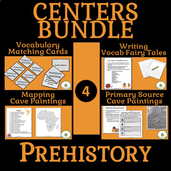
Prehistory Centers BUNDLE- Vocabulary, Writing, Maps, Primary Sources
By The Magical Avocado
Bring Prehistory to life in your class with this centers bundle! Have students practice vocabulary recognition with a ready to print and cut matching game, integrate ELA in a prehistory story assignment, work on geography skills while mapping cave paintings online, and use the tools of historians and anthropologists while analyzing primary sources.
Centers are a great way to keep students engaged while introducing a variety of information and skills.
In addition to the four activities included, this bundle introduces a Prehistory Centers Teaching Guide which includes:
- An overview of the centers as activities working together
- A planning guide describing the skills, knowledge, materials, and grading for each center
- A plan for introducing the centers along with directions for the INCLUDED fully editable centers introduction powerpoint slide
- A guide on timing of centers based on class schedules
- Center Rotation Suggestions for using four or five centers
- Printable Title Pages for the Centers
****** Also included is a list of 15 Suggested Reflection Questions to use as closure for the centers

Geography - ALL CONTINENTS BUNDLE - 20 Atlas / Google Maps Questions
By Quick Assignment Central
Includes an individual assignment for each continent. 7 Individual assignments.
Unlock an exciting geography quiz that brings the continent to life! This set features 20 thoughtfully designed questions covering landforms, countries, capitals, and more.
Students will need an atlas or Google Maps to answer the questions, making it a fun and interactive learning experience.
Includes a complete answer key for easy review.
Perfect for sparking curiosity and building knowledge!
Don’t forget to explore my store for more engaging educational resources!

Geography & Map Types & Skills & Activities 4th 5th 6th grades Social Studies
By The Magical Avocado
Teaching Geography? This bundle has everything you need to teach different map types, map skills, latitude and longitude, and more! This bundle includes a combination of ready-to-print reading and response, activity sheets, maze puzzles, cut-and-paste activities, writing prompts, and assessments. Perfect for upper elementary (4th, 5th, and 6th grade), this complete bundle is great for substitute work, centers, the beginning of the year, introduction and review of geography, enrichment, home school assignments, and centers!
Specifically, this bundle includes:
- 8 read and respond
- 6 Maze Activities
- 4 Cut and Paste
- 4 skills practice pages
- 2 USA Maps for practice
- 2 writing pages
- 1 short answer quiz
- 1 matching quiz
- 1 mini project
- 3 Teaching Guides
This bundle covers the following concepts:
- Absolute Location
- Cardinal Directions
- Cartographer
- Compass Rose
- Coordinates
- Equator
- Intermediate Directions
- Latitude
- Legend
- Longitude
- Prime Meridian
- Relative Location
- Scale
- Symbols
and the following map types
- choropleth
- general reference map
- globe
- physical map
- political map
- special purpose map
- topographical map
- weather map

THREE French Virtual Field Trip Video Projects: Paris, France, & Countries!
By Churros and Croissants
Are you looking for an engaging and immersive way to explore francophone cultures without leaving the classroom? Look no further! This 3-pack bundle of of video projects offers thrilling virtual field trips that combine creativity, language learning, and a touch of friendly competition. Includes an additional bonus file!
Includes:
Discovering Paris- Unveil the magnificence of France's capital! Explore the iconic Notre-Dame Cathedral, the vibrant Champs-Élysées, and more renowned landmarks. Students will showcase Paris' cultural treasures in captivating commercials.
Regions of France- A visual feast of geography! From Normandie's rich history to the breathtaking landscapes of Provence, this project encourages students to discover the unique charm of France's diverse regions.
Francophone Countries- Embrace global diversity! In this project, students will travel beyond France's borders, exploring the rich cultures of various French-speaking countries worldwide.
SURPRISE Bonus file!
Features:
Friendly Competition: The bundle includes an extra credit element, where students select the top three locations they find most intriguing. This adds a dash of excitement as they advocate for their favorite destinations.
Teacher Savings: By investing in this bundle, you'll not only save money but also empower your students to thrive in their language learning journey.
Multimedia Mastery: Students will unleash their creativity as they curate captivating visuals, engaging soundtracks, and persuasive scripts, making each video a true work of art!
From Classroom to Global Adventure: This bundle brings the world into your classroom, transporting students to iconic sites, beautiful landscapes, and vibrant cultures. It's the perfect blend of education and adventure!
Collaborative Fun: Foster a collaborative spirit as students exchange ideas, collaborate on scripts, and support each other in crafting exceptional travel commercials.
Are you ready to take your students on an unforgettable journey through Francophone cultures? Unlock the gateway to exploration, creativity, and language mastery - Allons-y!
*Projects can be created in either French or English depending on Language level.

World Map Worksheets | 7 Continents and 5 Oceans Blank Map Skills & Activities
By Innovative Classroom Ideas
Kids enjoy studying about the world in which they live! With the help of these entertaining printable Continents and Oceans Worksheets, they will love learning about the seven continents and the corresponding geography. For students in kindergarten, first grade, second grade, third grade, fourth grade, fifth grade, and sixth grade, these worksheets offer a fun and interactive way to explore our planet. Through engaging activities like coloring, labeling, and matching, students will develop a solid understanding of the continents and oceans while sparking their curiosity about the diverse cultures and natural wonders of the world. Let’s embark on a global adventure together!
By completing the various activities, children will enhance their map skills, vocabulary, and critical thinking abilities. These printable resources are perfect for homeschooling, classroom use, or simply as a fun activity to do at home.
These no prep worksheets offer a wide range of activities to keep young learners engaged. From simple tracing and coloring to more challenging puzzles and word searches, there’s something for everyone. With these worksheets, learning about the continents and oceans is both educational and enjoyable.
✅ Save more than 50% when you get a bundle ✅
This bundle contains the following resources:
⭐ Blank World Map with Countries | 7 Continents and 5 Oceans | United States Map
These printable maps will be useful whether you are studying geography, world history, countries around the world, or you are just trying to show your kids the route you are taking on your next vacation! For kids learning about states, we’ve included a printable map of the world, as well as maps of North and South America, Europe, Asia, Australia, Africa, and Antarctica. Furthermore, the world map printable set comprises labeled and blank options for printing. To print the printable map pdf file simply download this ressource and use it for students in pre-kindergarten, first grade, second grade, third grade, fourth grade, fifth grade, sixth grade, seventh grade, junior high, and even high school.
The blank world map is particularly useful for providing a bird’s eye perspective of the globe, oceans, continents, and major nations. It also helps locate me on the map with children of various ages.
That ressource countains:
- Blank World Map (with /without country names)
- North America Map (with / without country names)
- South America Map (with / without country names)
- Australia Map (with / without country names)
- Asia Map (with / without country names)
- Europe Map (with / without country names)
- Antarctica Map (with / without country names)
- Africa Map (with / without country names)
- United States Map (with / without country names)
⭐ World Map with Countries Worksheets | 7 Continents and 5 Oceans Blank Map
Kids enjoy studying the world they live in! They will enjoy learning about the seven continents and the corresponding geography with these fun and printable Continents Worksheets. For kindergarteners, first graders, second graders, third graders, fourth graders, and fifth graders, use these continents and oceans worksheets. You may start playing and learning as soon as you print the continents and oceans worksheet PDF.
These 7 continents and 5 oceans worksheets are perfect for parents, teachers, and homeschoolers who want to assist their kids learn about the globe we live in and improve their science skills. For kindergarteners, first-graders, second-graders, third-graders, fourth-graders, and fifth-graders, this pack is ideal. Use these no prep 7 Continents worksheets for science centers, additional practice, at home or at school, or as a component of a continent study. Children will learn about the seven continents that today make up the world in which we live with this bundle. Answers are provided and this pack comes mainly in black and white with a few color pages thrown in.
There are lots of activities in this pack:
- Continent poster in color
- Color in the continents on the world map following the key
- Cut out and paste the labels onto the continents
- Write the names of the seven continents next to the corresponding number
- Color in the continents using the key
- Unscramble the names of the continents
- One page for each of the seven continents with facts that include the hemisphere the continent is in, the oceans that surround it, and the amount of countries that are in that continent
- Write the names of the continents in alphabetical order
- Continent word search
⭐ Continents and Oceans Worksheets | Blank World Map with Countries | Map Skills
This set of printable pages on the seven continents is a fantastic way to practice geography. With the help of this continents and oceans worksheet pdf, students will enjoy learning about the seven major continents. Use these maps with kindergarten, first, second, third, fourth, fifth, and sixth grade elementary students as part of a social studies subject, as a stand-alone review, or as additional practice.
These 7 Continents and 5 Oceans worksheets will be a hit with your pupils as they practice labeling the different continents and discover fascinating facts about each one. You only need to print the continents and oceans worksheet to begin teaching kindergarteners, first-graders, second-graders, third-graders, fourth-graders, fifth-graders, and sixth-graders. This no-prep geography lesson will help children learn about Asia, Africa, Australia, North America, Antarctica, South America, and Europe. It is perfect for parents, teachers, and homeschoolers. Now that you have these continents worksheets, you can start learning! The answer key is provided!!
⭐ World Map Skills Worksheets | 7 Continents and 5 Oceans | Geography Activities
This printable page pack featuring the seven continents is an excellent tool for honing geography skills. These continents and oceans worksheet pdf will make learning about the seven major continents enjoyable for students. Utilize these no prep worksheets with kindergarten, first, second, third, fourth, fifth, and even sixth graders! With vibrant colors and engaging activities, these worksheets turn geography into an adventure. Children will love coloring the continents, labeling oceans, and matching animals to their habitats. Perfect for homeschooling, classroom use, or simply for curious young minds. Let’s explore the world together!
From basic map skills to understanding cultural differences, these no prep continents and oceans worksheets provide a solid foundation for future learning. Download your set today and start your global exploration! Students will love searching for hidden objects, solving puzzles, and creating their own maps. These engaging activities will spark their curiosity and inspire a lifelong love of geography. Plus, they’re a great way to reinforce essential skills like following directions and problem-solving.
>>>> ⭐ More Similar Activities ⭐ <<<<<
We adore FEEDBACK! You also obtain CREDITS! :
- Access your TeachShare account by logging in.
- Select "My TeachShare" from the drop-down menu.
- Click on "My Purchases."
- Select ratings and provide feedback.
Terms of Use: By purchasing and/or downloading this electronic file, you are allowed to use the product for personal use as you like, but you are not allowed to resell or redistribute.
Follow my store and get all the newest product updates and freebies by clicking the green star ★ above.
♥ Search Key Terms: World map, world maps, world, world geography, map of the world, world map is wrong, world map for kids, world facts, map of world, #world, new world map, free world map, accurate world map, world puzzle, world oceans, fixing the world map, World map, world,blank map, how to draw world map easily, world map drawing, how to draw world map, world maps,European school draw world map, world map drawing easy, world map draw kaise kare, world map flat, world map draw in ias mains exam, how to draw a world map in easy steps, world map quiz, easy world map, how to draw world map in examination, how to dry world map in upsc mains exam, Continents and oceans, the continents and oceans of the world worksheet, continents and oceans for kids, continents and oceans for kids, continents and oceans workbook, continents and oceans free course, continents and oceans printables, homeschool continents and oceans, classroom continents and oceans resources, homeschool continents and oceans resources, oceans and continents, Map skills, map skills for kids, map skill, skills,map symbols,, map,map skills tutorial, map skills geography,map skill of India, reading a map, map reading skills, map skill for third grade, map scales, how to teach map skills to students, how to teach map skills to students, mapping skills, map skill of ch 3 drainage class 9 geography, navigational skills., #maps, reading a map for kids, map legends, hiking skills, how to make a map, how to read a map
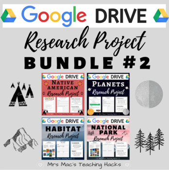
Google Drive Research Project BUNDLE #2
By Abigail J McClellan
Are you looking for online resources to assign your students so they can continuing learning from home? Look no further! This comprehensive GOOGLE DRIVE research project BUNDLE is everything you need in order for students to complete independent research from home or paperless assignments at school. This product encourages research skills using National Geographic Kids & various graphic organizers, content-specific vocabulary knowledge, and self-reflection skills! This resource comes with over 12 pages per product of graphic organizers (with examples!), vocabulary terms, and Google Survey/Quizzes for easy grading. It is easy to use and an awesome independent research project that your students will love! Be sure to check out the individual products for a more detailed description / preview of what is included :)
What is included?
- Access to all 4 Google Drive products, each containing 8-9 resources (30 files total!!):
- How-to-Use Guide - Includes main ideas, student outcomes, materials, standards/curriculum connections, and assessment/grading.
- National Geographic Kids Website Guide - Provides a detailed description of how to use the National Geographic Kids website, including pictures and steps.
- Vocabulary Terms - ½ sheet definitions of 8 vocabulary words related to each project.
- Vocabulary Quiz - This 8 question quiz assesses the students on their knowledge of the vocabulary words from the vocabulary terms given.
- Individual Research Graphic Organizers - Graphic organizers for students to record their individualized research. It includes an example.
- Student Checklist and Project Reflection - This is the final part of the research project. Students are asked to fill out a checklist marking if they completed all aspects of the research project. They then can reflect on a few short answer questions.
- Terms of Use page
THIS BUNDLE #2 INCLUDES:
Google Drive Planet Research Project
Google Drive Native American Research Project
Google Drive Habitat Research Project
Google Drive National Parks Research Project
E-Learning / Home Learning / Remote Learning / Distance Learning / COVID-19 / Coronavirus / Paperless
Freebies & Discounts:
Be sure to follow my store by clicking HERE to stay up to date on all my new products, including products that are FREE and on discount!
Ratings & Reviews:
Please leave a review if you enjoyed this product and found it useful. I really love reading how you are using my products in your classroom :) Every time you give feedback, TeachShare gives you feedback credits that you use towards future products!! Thank you in advance for taking the time to leave a rating & review!
By TxMAP Teacher
In this multiplayer geography-themed board game, players roll dice to move around the game board, answering questions and collecting points and monuments.
Included in the product:
- 2 different board games (dimensions set at 17x11)
- Monument Cards and other game cards
- Question Cards about the Geographical Regions of the World.
- Game Instructions
Not Included:
- Dice and Player Pieces
Blue Planet Season 2 - Complete Question Set Episodes 1-7
By Quick Assignment Central
Includes a set of 10 questions with separate answer key. Written at a 9th grade level.
Includes 1 set for each of the 7 episodes of season 2 of Blue Planet.
NEW! Geography, 5 Geographical Themes Puzzle & Printables (High Res, 300DPI)
By Geography & Math Made Easy
These 5 Geography Themes Posters & Printable will come in useful when revisiting the themes throughout the year through activities and assignments.
These are high-resolution images (300dpi) and can be printed as small as 8.5 x 10 or as large as poster size to hang on your wall. Simply print and laminate. Place a set at each group station or place them on our wall for reference. Upload to Google and give access to your students (not other teachers, please). Add them to your online lessons. As you know, it is important that students use the themes regularly to grasp them fully.
Comes in both PDF & JPG formats. All-in-one PDF document is also included.
☑Check out the preview to see what is included.
Visit our store Geography & Math Made Easy to view other related resources.
OTHER RESOURCES YOU MAY LIKE:
✧ Other Related Resources
✧ Beginning-of-the-Year Resources
✧ Assessments Resources
........................................................................................................................................................
CREATE A CUSTOM BUNDLE & SAVE UP TO 20%
Do you need $25 or more of resources from our store and want to save up to 20%? Just let me know and a customized bundle can be created for you. Learn more about how to Create Your Custom Bundle.
.........................................................................................................................................................
Disclaimer:
One purchase is for the use of one teacher. If additional teachers wish to use this product, please purchase additional licenses.
.........................................................................................................................................................
CUSTOMER TIPS
When do I post new products? Throw sales? Be the first to know:
- Click the green star next to my picture to become my newest follower and be notified of up-to-date information, sales and new resources.
Leave A Review and Earn TeachShare Credit to Use on Future Purchases:
- Go under “My TeachShare”, and click on “My Purchases”. Then, click the provide feedback button next to your purchase. Every time you leave feedback on a purchase, TeachShare gives you credits that you can use to save money on future purchases. I value your feedback as it helps me determine what types of new products I should create for you and other buyers.
........................................................................................................................................................
© Geography & Math Made Easy Resources. Created by Martha Boykin ^ Will Boykin. All rights reserved. Purchase of this product grants the purchaser the right to reproduce pages for classroom use only. If you are not the original purchaser, please download the item from my store before making copies. Copying, editing, selling, redistributing, or posting any part of this product on the internet is strictly forbidden. Violations are subject to the penalties of the Digital Millennium Copyright Act.
.........................................................................................................................................................
Related Topics:
5 themes of geography, poster, five geographical themes, beginning of the year, location, place, movement, human-environment interaction, region, geography, geography activities, geography unit, world geography, my world social studies, geography, geography activities, geography unit, world geography, world history, world history curriculum, ap world history, social studies, social studies activities, social studies december, social studies worksheets, social studies, history, word wall, word wall vocabulary cards
Geography 7 Continents Pretest Pre-assessment Test
By Geography & Math Made Easy
Are you always looking for a good pretest & post-test for your students? We have worked hard to develop a pretest bundle that includes a pretest for each continent: North America, South American, Europe, Asia, Antarctica, Australia. Use these pretests to gain knowledge of where your students are before you begin your unit and then use the test as a post-test to see what students gained during the unit. All answers included. Tests questions are centered around: Physical, economic, cultural, government. Take a moment to view the preview. Don't want to use it as a pretest? Use it as a scavenger hunt or a simple handout.
☑ 7 Individual Pretests (Pre-assessments): North America, Central & South America, Europe, Asia, Africa, Australia, Antarctica
☑ Check out the preview to see what is included.
Visit our store Geography & Math Made Easy to view other related resources:
Similar Resources & Skills
✧ Beginning of the Year Activities
✧ Pre- & Post Assessments
✧ Geography Basic Skills
✧ Map Quizzes
.........................................................................................................................................................
CREATE A CUSTOM BUNDLE & SAVE UP TO 20%
Do you need 25 dollars or more of lessons and want to save up to 20%? Just let me know and a customized bundle can be created for you. Learn more about how to ****Create Your Custom Bundle.
.........................................................................................................................................................
Disclaimer:
One purchase is for the use of one teacher. If additional teachers would like to use this product, please purchase additional licenses.
.........................................................................................................................................................
CUSTOMER TIPS
When do I post new products? Throw sales? Be the first to know:
- Click the green star next to my picture to become my newest follower.
Leave A Review and Earn TeachShare Credit to Use on Future Purchases:
- Go under “My TeachShare”, and click on “My Purchases”. Then, click the provide feedback button next to your purchase. Every time you leave feedback on a purchase, TPT gives you credits that you can use to save money on future purchases. I value your feedback as it helps me determine what types of new products I should create for you and other buyers.
........................................................................................................................................................
© Geography & Math Made Easy Resources. Created by Martha Boykin ^ Will Boykin. All rights reserved. Purchase of this product grants the purchaser the right to reproduce pages for classroom use only. If you are not the original purchaser, please download the item from my store before making copies. Copying, editing, selling, redistributing, or posting any part of this product on the internet is strictly forbidden. Violations are subject to the penalties of the Digital Millennium Copyright Act.
.........................................................................................................................................................
Related Topics:
Beginning of the year activities, getting to know you activities, get to know you activities, beginning of the year, assessment, pre-assessment, preassessment, pretest beginning of the year, geography, world geography, geography, geography activities. geography unit, geography skills, preassessment, post-assessment, beginning of the year first assessment, getting to know you
200+ Premade Geography Terms for Word Wall + Blank Strips to Make Your Own
By Geography & Math Made Easy
121+ Geography term for use of a Word Wall + blank strip for extra words. Font: 39 Smooth
Absolute location
Accessibility resource
Acculturation
Acid rain
Active volcano
Agriculture
Altitude
Archipelago
Ash
Atlas
Atmosphere
Axis
Bay
Bedrock
Biosphere
Birth rate
Boundary
Butte
Canal
Cape
Capital goods
Capitalism
Cardinal directions
Carrying capacity
Cartographer
Cinder cone
Climate
Colonialism
Command economy
Commercial farming
Communism
Compass rose
Geography
Coniferous
Constitutional monarchy
Consumer
Continent
Continental climate
Continental divide
Contour lines
Country
Crater
Crust
Cryosphere
Cultural traits
Cultural diffusion
Cultural perspective
Cultural product
Culture
Death rate
Deciduous forest
Deforestation
Degrees
Delta
Demography
Developed nation
Dictatorship
Direct democracy
Distortion
Dome
Dormant volcano
Dry farming
Earth-sun relationships
Economy
Ecosystem
Elevation
Emergent coastline
Enclave
Equator
Erosion
Escarpment
Estuary
Extended family
Extinct volcano
Fault
Fault zone
Fjord
Fossil fuel
Geosphere
Glacier
Globe
Goods
Government
Great circle route
Grid
Gulf
Hemisphere
High latitudes
Horizon
Hot spot
Human features
Human resource
Human-environment Interaction
Hydrosphere
Ice age
Igneous rock
Immigrant
Imperialism
Intermediate directions
International Date Line
Intracoastal waterway system
Island
Key
Latitude lines
Lava
Legend
Legume
Life expectancy
Life-cycle stage
Lithosphere
Longitude lines
Low latitudes
Magma
Mantle
Manufacturing
Map
Maritime climate
Market economy
Mediterranean climate
Meridian
Mesa
Mesquite
Middle class
Middle latitudes
Migration
Minute
Mixed economy
Monarchy
Movement
Mudflow
Multilingual
Nation
Nationalism
Natural resource
Nonrenewable resource
Nuclear family
Ocean
Orbit
Parallel
Permafrost
Physical features
Place
Plain
Plate tectonics
Population
Population density
Population distribution
Precipitation
Primary sector
Prime Meridian
Producer
Push factor
Pull factor
Push-pull theory
Quaternary sector
Raw material
Recyclable resource
Region
Relative location
Renewable resource
Representative democracy (republic)
Resource
Rotation
Revolution
Rural area
Scale
Sea level
Secondary sector
Sedimentary rock
Seismograph
Services
Sharecropping
Shield
Shield volcano
Sinkhole
Snowline
Social class
Social structure
Socialism
Soluble
Standard of living
Staple product
Stratovolcano
Subduction zone
Subsistence farming
Suburban area
Sustainable yield
Taiga
Territory
Tertiary sector
Theocracy
Threshold
Time distance
Topographic map
Topography
Tropic of Cancer
Tropics
Tundra
Underemployment
Underpopulation
Urban area
Urbanization
Valley
Vent
Vertical climate
Volcanic avalanche
Volcano
Want
Water pollution
Water table
Weather
Weathering
Zoning

By Nardine Mettry
Spare some time in your class? How about this FUN & DIVERSE TASK CARDS BUNDLE!
How to Use This Resource?
- Whole Class Game: Scoot! Get your students moving with a fun game of Scoot. Place the task cards around the classroom and have students rotate, answering the question at each station before moving on.
- Fast Finishers' Challenge: Challenge early finishers to tackle these task cards as an enriching activity to solidify their understanding.
- Scientific Scavenger Hunt: Turn your classroom or schoolyard into a scientific scavenger hunt! Hide the task cards around the designated area and have students hunt for them, answering the questions they find.
- Science Jenga! Add a scientific twist to the classic game of Jenga! Number the Jenga blocks and assign each number to a specific task card. When a player pulls a block, another player reads the corresponding card and the first player answers the question.
- Formative Assessments: Use these task cards as quick quizzes or formative assessments to gauge student understanding of various science concepts.
- Interactive Whiteboard Fun: Project the task cards on your interactive whiteboard and have students brainstorm answers together as a class.
World Geography - Geographical Scavenger Hunt Printable and Digital activity
By Yugen Learning
If you are looking for a creative and no-prep, self contained for emergency sub resource for middle of high school to teach about world geography Map Labelling Challenge. This printable and digital activity works as bellringer or ongoing task to teach or assess your students about geographical knowledge locations from oceans to countries for your Geography program.
In this no prep lesson, Geographical Scavenger Hunt to identify continents, oceans, seas, mountains ranges, bays, gulfs, rivers, countries, latitude & longitude lines on world map and is suitable for students for a back to school tasks to to test and revise their geographical information.
Geographical Map Labelling Challenge
Objective: To enhance students' knowledge of the world's geography by identifying and naming various geographical features using a numbered world map.
Task:
Using the numbers as references, students must identify and label the following:
- Continents: All the continents marked on the map.
- Oceans: All the major oceans indicated.
- Rivers: Major rivers that are numbered.
- Mountain Ranges: Identify the mountain ranges marked on the map.
- Bays and Gulfs: Label the bays and gulfs indicated.
- Lines of Latitude & Longitude: Identify and label the major lines of latitude (e.g., Equator, Tropics) and longitude (e.g., Prime Meridian).
- Countries: Label as many countries as possible that are numbered on the map.
Resources includes
- Digital worksheet
- Printable worksheet
- Marking key
I like starting with them working singly to answer as many as they can, then moving on working in groups. Finally using an atlas to complete the sheet. Or you can use it as an ongoing start/end of lesson task for the first/last 5 minutes. Student love the challenge.
Extension Activities:
- Ask students to research and write a brief description of a geographical feature they found challenging to identify.
- Organize a group discussion where students can share interesting facts about a particular country or geographical feature they labeled.
- Encourage students to create a visual presentation or poster showcasing a specific continent and its unique geographical features.
This task promotes active learning as students engage with the map, utilize their geographical knowledge, and collaborate with peers to identify and label the world's major features.
Common Core
RH.6-8.7 Integrate visual information (e.g., in charts, graphs, photographs, videos, or maps) with other information in print and digital texts.
Australian Geography Curriculum link:
Challenges to food production, including land and water degradation, shortage of fresh water, competing land uses, and climate change, for Australia and other areas of the world (ACHGK063)
Upon completing your purchase, you will click on the green button that says Add to Google Drive. Then, you will be able to find this resource in the TeachShare Purchases folder of your Google Drive account! If you have any technical issues, reach out to us at yugenlearning@gmail.com or contact TeachShare.
Enjoy this resource! Don't forget to follow my store for more awesome products and rate this product for your TeachShare credits :)
People that have purchased this resource have also purchased -
Curriculum resources can be accessed here
Geography
$ Economics
Medieval History
✅ ➡ World War One
✅ ➡ Nazi Germany
✅ ➡ ✈ World War Two
✅ ➡ v ☭️ Cold War
✅ ➡ Australian History
✅ ➡ ⚙ Industrial Revolution
✅ ➡ USA History
✅ ➡ American Revolution
✅ ➡ ⚔ US Civil War
✊ USA Civil Rights
and
Subscribe to my Teaching Newsletter for a History Teachers AI guide and one of my best selling history resources.
Follow us!!!!!
https://www.instagram.com/yugenlearning/
https://www.pinterest.com.au/yugenlearning/
TeachShare Store
https://www.TeachShare.com/Store/Yugen-Learning
Please share feedback to help me improve my resources for you.
Geography - Hemispheres, Continents and Lines of Latitude Worksheet
By Yugen Learning
In this no prep lesson for you or an emergency sub in your Geography program, students will embark on a geographical journey to explore the intricate details of our world's layout. They will be provided with a detailed map, which will serve as their canvas to mark and identify the lines of latitude, distinguish between the different hemispheres, and pinpoint the continents. As they navigate through the map, students will also encounter a series of questions designed to test their understanding and observation skills.
Task:
Using the numbers as references, students must identify and label the following:
- Continents
- Oceans
- Continents
- Hemispheres
- Lines of Latitude
Develop mate reading skills and visual recombination skills
Resources:
A3 size sheet
Marking key
Enjoy this resource! Don't forget to follow my store for more awesome products and rate this product for your TeachShare credits :)
People that have purchased this resource have also purchased -
Geography | What Causes Hunger lesson activity
Geography | Analysing and Interpreting Population Pyramids
Geography | Geographical Scavenger Hunt
Please leave a review.
Geography & Government Types: Hitler's Olympics of 1936 (Includes PowerPoint)
By Geography & Math Made Easy
Following World War I, Germany was in economic, political, and physical ruins. In 1933, Adolf Hitler became Chancellor and began his quiet quest against anyone who was not Arian. In 1931, Germany was given the option of hosting the 1936 Olympics. Hilter, under his Nazi German totalitarian dictatorship government system, wasn't sure it was a good idea until he was convinced that they could build the largest stadium to be seen at the Olympics and make Germany look as if it was not in ruin. He agreed! The 1936 Olympics were different from the Olympics in the past. It incorporated theatre, high-tech equipment for the games, and wonderful production with a lot of rituals that would continue into the Olympic games after Hitler's Olympics.
Hitler kept the secret of his war against the Jews throughout the two weeks of the 1936 Olympics using propaganda to show the world how well Germany was doing; the world, however, had no idea whatwas in store for Germany and the Jews who lived within its borders.
OBJECTIVES:
- Students will understand the concept of propaganda and how it was used during the Olympics in 1936 by the Nazi regime. (Bloom’s Taxonomy: Understand)
- Students will understand the events that led up to the 1936 Olympics in Berlin. (Bloom’s: Understand)
- Students will recognize the governmental workings to boycott Jews from the Olympics. (Bloom’s: Understand)
- Students will investigate, identify, and present today’s propaganda techniques throughout the world in Europe, Asia, Africa, North America, and South America. (Bloom’s: Understand and Create)
- Students will critique and defend their work as propaganda. (Bloom’s: Evaluate)
- Students will judge whether they agree with statements using the Before & After technique. (Blooms: Evaluate)
INCLUDES
- Lesson Teaser/Bump: Hitler’s Olympics PowerPoint
- Dice: One Per Group
- Article: History Behind Hitler’s Olympics (Student Group Reading Activity)
- Group Project Activity Instruction
- Mustache Art (For Fun)
- Examples of Government Propaganda with Teacher Guides.
- Before & After: Agree or Disagree Warm-up and Follow-up Activity
- Exit Cards
- Grading Rubric (Included)
- and More
☑ Check out the preview to see what is included.
Visit our store Geography & Math Made Easy to view other related resources:
Similar Resources & Skills
✧ World Government Lessons
✧ World Economics Lessons
✧ Environmental, Cultural, and Human Issues
.........................................................................................................................................................
CREATE A CUSTOM BUNDLE & SAVE UP TO 20%
Do you need 25 dollars or more of lessons and want to save up to 20%? Just let me know and a customized bundle can be created for you. Learn more about how to ****Create Your Custom Bundle.
.........................................................................................................................................................
Disclaimer:
One purchase is for the use of one teacher. If additional teachers would like to use this product, please purchase additional licenses.
.........................................................................................................................................................
CUSTOMER TIPS
When do I post new products? Throw sales? Be the first to know:
- Click the green star next to my picture to become my newest follower.
Leave A Review and Earn TeachShare Credit to Use on Future Purchases:
- Go under “My TeachShare”, and click on “My Purchases”. Then, click the provide feedback button next to your purchase. Every time you leave feedback on a purchase, TPT gives you credits that you can use to save money on future purchases. I value your feedback as it helps me determine what types of new products I should create for you and other buyers.
........................................................................................................................................................
© Geography & Math Made Easy Resources. Created by Martha Boykin ^ Will Boykin. All rights reserved. Purchase of this product grants the purchaser the right to reproduce pages for classroom use only. If you are not the original purchaser, please download the item from my store before making copies. Copying, editing, selling, redistributing, or posting any part of this product on the internet is strictly forbidden. Violations are subject to the penalties of the Digital Millennium Copyright Act.
.........................................................................................................................................................
Related Topics:
Propaganda, Germany, Olympic 1939, Holocaust, autocracy, democracy, parliamentary democracy and presidential democracy, parliamentary republic, presidential republic, government, government, world government, government types, local government, government word search, communism, socialism, democracy, republic, political cartoons, monarchy, constitutional monarchy, absolute monarchy, dictatorship, laws, oligarchy. branches of government, branches of government, branches of government tree, 3 branches of government, 3 branches of government worksheet, three branches of government, lawmaking, three branches of government project
Africa Geography: Africa Interactive Notebook
By Geography & Math Made Easy
This Africa Interactive Notebook is a great way to cover many topics related to Africa's physical features and landforms, climate, economics, government, and culture in over a week. Students will understand the physical and cultural aspects of Africa as well and gain knowledge on how the GDP can influence a country, both developed or developing. Government types will be compared and studied as well. The student will have fun with this interactive notebook as they work in cooperative groups to complete their learning activities.
The student should have access to computers, iPad, or phones that have the capability of scanning QR codes. The QR codes along with the links are included in this lesson.
OBJECTIVE:
The learner will:
o Identify major landforms of Africa.
o Demonstrate how to create and use a map key.
o Explore and identify the location of Africa’s climates.
o Understand the temperature range and rainfall throughout the
year of each climate of Africa.
o Learn about the gross domestic product (GDP).
o Recognize developing countries and developed countries of Africa
based on their GDP.
o Discover the main political system and government types of Africa.
o Understand the balance of powers of each political system within
Africa.
MATERIALS:
o Students will need a three-prong notebook with 14 pieces of
notebook.
Include in the team packet:
DAY ONE
o Cover page
o Table of Contents
o Page 2: Physical Africa—Landforms
o Blank Map of Africa (One Per Team Member)
o Page 3: Physical Africa—Landforms List and Video (One Per
Team Member) (Computer, iPad, or smartphone with scanning
QR ability.)
DAY TWO
o Page 4: Physical Africa Climate Map: (One Per Team Member)
o Page 5: Physical Africa Climate Foldable (One Per Team
Member)
(Will need resources, see instructions on page 5.)
DAY THREE
o Page 6: Economics Directions and Video Computer, or iPad or
smartphone with scanning QR ability.)
o Page 7: Economics—Money Bag Activity
o A Money Bag with African Countries GDPs Strips. (See
Economics Section)
o Note: the GDP will fluctuate from year to year. You can update
these with the information gathered from
https://en.wikipedia.org/wiki/Economy\_of\_Africa (Copy & Paste
A word document was included with this purchase specifically of the country GDP strips, so as countries' names change and GDP changes, you can easily access this document to make changes, rather than typing it all over again.
DAY FOUR
o Page 8: Political—Government Systems Directions and Video
(Computer, iPad or smartphone with scanning QR ability.)
o Page 9: Political—Governmental Systems Foldable (One Per
Team Member)
o Sample of Foldable (One per team)
DAY FIVE
o Pages 10-11: Culture Foldables & Instructions (One Per Team
Member)
CULMINATING ACTIVITY
o Pages 12-13: At-Home Activity—Journaling.
☑Check out the preview to see what is included.
Visit our store Geography & Math Made Easy to view other related resources.
OTHER RESOURCES YOU MAY LIKE:
✧ More Africa Resources
✧ Africa Bundle
✧ Geography Scavenger Hunts
........................................................................................................................................................
CREATE A CUSTOM BUNDLE & SAVE UP TO 20%
Do you need $25 or more of resources from our store and want to save up to 20%? Just let me know and a customized bundle can be created for you. Learn more about how to Create Your Custom Bundle.
.........................................................................................................................................................
Disclaimer:
One purchase is for the use of one teacher. If additional teachers wish to use this product, please purchase additional licenses.
.........................................................................................................................................................
CUSTOMER TIPS
When do I post new products? Throw sales? Be the first to know:
- Click the green star next to my picture to become my newest follower and be notified of up-to-date information, sales, and new resources.
Leave A Review and Earn TeachShare Credit to Use on Future Purchases:
- Go under “My TeachShare”, and click on “My Purchases”. Then, click the provide feedback button next to your purchase. Every time you leave feedback on a purchase, TeachShare gives you credits that you can use to save money on future purchases. I value your feedback as it helps me determine what types of new products I should create for you and other buyers.
........................................................................................................................................................
© Geography & Math Made Easy Resources. Created by Martha Boykin ^ Will Boykin. All rights reserved. Purchase of this product grants the purchaser the right to reproduce pages for classroom use only. If you are not the original purchaser, please download the item from my store before making copies. Copying, editing, selling, redistributing, or posting any part of this product on the internet is strictly forbidden. Violations are subject to the penalties of the Digital Millennium Copyright Act.
.........................................................................................................................................................
Related Topics:
Africa rift valley, Africa, africa geography, african american history, africa map, south Africa, geography, geography and math made easy, africa issues, renewable and nonrenewable resources, renewable and nonrenewable resources worksheets, renewable and nonrenewable resource activities, renewable and nonrenewable resources, eastern africa, africa culture, africa physical, africa government, issues in africa, stations,map of Africa, plate boundaries, plate boundaries, east africa, west Africa, African, tectonic plates, plate tectonics