Less than $5 9th Grade Geography Printables
Australia Facts, Landmarks, and Maps Activity
By TxMAP Teacher
This product is over the facts, landmarks, and physical features of Australia. This product has 3 parts - (1) Australia Facts, (2) Australia Landmarks, and (3) Australia Maps. Students will answer the questions about facts and landmarks of Australia and then will label 2 different maps with physical features and landmarks. Can be used in Google Classroom, in Nearpod or Pear Deck, or as a Gallery Walk.
Geography Types of Geography Chart (Free Resource)
By Geography & Math Made Easy
INCLUDES:
Physical, cultural, political, or economic geography
Students can use this as a guide sheet for studying the types of geography. Laminate them and use them for studying countries and continents.
This is very helpful with our scavenger hunts:
- North America Scavenger Hunt
- Central and South America Scavenger Hunt
- Europe Scavenger Hunt
- Asia Scavenger Hunt
- Africa Scavenger Hunt
- Australia Scavenger Hunt
- Antarctica Scavenger Hunt
Disclaimer:
One purchase is good for one teacher. If additional teachers would like to use this, please purchase additional licenses.
Dollar Deals Word Search USA 50 States And Capitals Worksheet Activities
By You Are Special
Word Search USA 50 States And Capitals Worksheet Activities Morning Work. Explore the USA with this engaging word search activity! Perfect for morning work, early finishers, or geography lessons, this product helps students learn and reinforce their knowledge of all 50 states and capitals.
What’s Included:
- 4 Unique Word Search Worksheets: Each worksheet highlights a mix of U.S. states and their capitals to keep students challenged and engaged.
- 4 Answer Keys: Quickly and easily check student work with complete solutions provided for each word search.
Key Features:
- Promotes geography knowledge in a fun and interactive way.
- Suitable for upper elementary and middle school students.
- Perfect for classroom use, homework assignments, or independent study.
How to Use:
- Assign as morning work or bell-ringer activities.
- Use as part of a geography unit to reinforce state and capital recognition.
- Encourage collaboration by having students work in pairs or groups to complete the puzzles.
This USA-themed word search pack is a fun and educational addition to your classroom resources.
NOTE: Before making your purchase, we highly recommend checking out the product preview!
If you have any questions related to this product, feel free to email me at youarespecial377@gmail.com
I value your feedback, so please take a moment to share your thoughts.
Thank you for being so considerate.
Steck-Vaughn "History of Our World: Volume 2" comprehension questions
By Peter D
This is a 40-page set of comprehension questions to accompany the Steck-Vaughn textbook "History of Our World: Volume 2 - The Modern World".
For each chapter, there is one page of multiple choice questions and one page of short answer questions.
Also, there is an answer key included at the end of the file.
Worksheets for nonfiction books:
* Carl Sagan: Cosmos
* I Am Malala
* Malala's Magic Pencil
* Roald Dahl: Boy (Tales of Childhood)
* Roald Dahl: Going Solo
* Steck-Vaughn textbook: History of our World Volume 1
* Steck-Vaughn textbook: History of our World Volume 2
* Elie Wiesel: Night
* Susan Wise Bauer: Volume 1 (Ancient Times)
Spanish Speaking Country Digital and Printable Maps
By ARIANA PEREZ
Includes:
Boom Cards
Easel
and 2 printables maps for students!
Bushcraft Battle Royale in Egypt: Geography, Survival, and Wildlife of the Egyptian Wilderness
By The Academic Architect
This product includes a reading passage detailing how someone could use bushcraft techniques to survive in the Egyptian Wilderness. Use the reading and the Battle Royale style activity to teach about Bushcraft and Primitive Survival Techniques while reinforcing the geography of Egypt. Any fan of fortnite or other Battle Royale style video games will love this assignment! But even the students who don't play fortnite will enjoy making their battle royale survival plan. If you are looking for a more general bushcraft assignment, check out this assignment.
I like to use this assignment as a follow-up to my lesson on the Geography of Egypt. I’ve found that the creativity that students use to design their own survival kit helps to anchor knowledge of the geography and animals of Egypt. One thing to be aware of is that your students will likely discuss hunting weapons, including firearms. If you or your school are sensitive to this kind of thing, make sure to set parameters beforehand. An easy way to do this is by telling students that they can only bring ancient weapons - or if they want a real challenge, they must make their own hunting weapons using tools and items in the natural world. I also allow my students to research other wildlife and plant life as they prepare their supply list, and we discuss ethical hunting practices before they begin.
If you want to add more time and rigor to this assignment, you can allow students to work on their checklists in pairs and set a weight limit on materials (I normally set a limit of 35 pounds for their 12 items). Then, have students research name brand items on their iPads to find their exact weight. Students can write the weight of each individual item in the circular bullet point to make sure they don’t go over the limit. This typically keeps students engaged for the entire class period. You can try setting a budget as well but this can sometimes make the assignment frustratingly difficult for some students. It all depends on the class, which is why these criteria are optional. I also like to have students share their survival kit at the end of class and vote on the person that they think would survive the longest.
World Map with Countries Worksheets | 7 Continents and 5 Oceans Blank Map
By Innovative Classroom Ideas
Kids enjoy studying the world they live in! They will enjoy learning about the seven continents and the corresponding geography with these fun and printable Continents Worksheets. For kindergarteners, first graders, second graders, third graders, fourth graders, and fifth graders, use these continents and oceans worksheets. You may start playing and learning as soon as you print the continents and oceans worksheet PDF.
These 7 continents and 5 oceans worksheets are perfect for parents, teachers, and homeschoolers who want to assist their kids learn about the globe we live in and improve their science skills. For kindergarteners, first-graders, second-graders, third-graders, fourth-graders, and fifth-graders, this pack is ideal. Use these no prep 7 Continents worksheets for science centers, additional practice, at home or at school, or as a component of a continent study. Children will learn about the seven continents that today make up the world in which we live with this bundle. Answers are provided and this pack comes mainly in black and white with a few color pages thrown in.
There are lots of activities in this pack:
- Continent poster in color
- Color in the continents on the world map following the key
- Cut out and paste the labels onto the continents
- Write the names of the seven continents next to the corresponding number
- Color in the continents using the key
- Unscramble the names of the continents
- One page for each of the seven continents with facts that include the hemisphere the continent is in, the oceans that surround it, and the amount of countries that are in that continent
- Write the names of the continents in alphabetical order
- Continent word search
>>>> ⭐ More Similar Activities ⭐ <<<<<
We adore FEEDBACK! You also obtain CREDITS! :
- Access your TeachShare account by logging in.
- Select "My TeachShare" from the drop-down menu.
- Click on "My Purchases."
- Select ratings and provide feedback.
Terms of Use: By purchasing and/or downloading this electronic file, you are allowed to use the product for personal use as you like, but you are not allowed to resell or redistribute.
Follow my store and get all the newest product updates and freebies by clicking the green star ★ above.
♥ Search Key Terms: World map, world maps, world, world geography, map of the world, world map is wrong, world map for kids, world facts, map of world, #world, new world map, free world map, accurate world map, world puzzle, world oceans, fixing the world map, World map, world,blank map, how to draw world map easily, world map drawing, how to draw world map, world maps,European school draw world map, world map drawing easy, world map draw kaise kare, world map flat, world map draw in ias mains exam, how to draw a world map in easy steps, world map quiz, easy world map, how to draw world map in examination, how to dry world map in upsc mains exam, Continents and oceans, the continents and oceans of the world worksheet, continents and oceans for kids, continents and oceans for kids, continents and oceans workbook, continents and oceans free course, continents and oceans printables, homeschool continents and oceans, free teaching resources continents and oceans, teaching kids about continents and oceans, classroom continents and oceans resources, homeschool continents and oceans resources, oceans and continents
Christmas Around The World Word Sleuth
By Homeschool with Big Easy Homeschooling Mom
This word sleuth will provide your students/children with a fun journey of Christmas Around The World with key vocabulary words. It can be done in class, centers, or as a fun homework assignment.
Word sleuth is in PPTX format along with the answer key.
If you and your students/children, enjoy this activity, please go to your purchases and let me a review.
Tina
Big Easy Homeschooling Mom
Please follow me on social media: linktr.ee/tidewindacademy
Coloring Pages - Flags of Europe
By Bright Classroom Ideas Marketplace
With more than 750 million inhabitants, Europe is the third most populated continent in the world while being the second smallest, after Australia. It is largely located in the Eastern Hemisphere and all of it is in the Northern Hemisphere.
Africa and Asia share the continent of Europe, which is referred to as Afro-Eurasia. Approximately 10.53 million square kilometers (4.06 million square miles) make up the continent of Europe. The Atlantic Ocean borders Europe to the west, and the Arctic Ocean borders Europe to the north. The Mediterranean Sea lies to the south, while the Black Sea, Caspian Sea, and Ural Mountains form its eastern borders.
This ebook includes 50 coloring pages with the flags of all countries of Europe. Each coloring page features the name of the country, the original flag in full color, and the flag in black and white line drawing ready to be colored. The countries are presented in alphabetical order.
Geography - Find that Country! Label and Color Worksheet
By Yugen Learning
In this fun and back to school, no prep lesson and emergency sub for your Geography program, students will embark on a geographical journey to find specific countries using an atlas or google earth skills to develop their country finding ability, before labelling and coloring in the map. All neatly contained within a single A4 sheet.
Enjoy this resource! Don't forget to follow my store for more awesome products and rate this product for your TeachShare credits :)
People that have purchased this resource have also purchased -
Geography | What Causes Hunger lesson activity
Geography | Analysing and Interpreting Population Pyramids
Geography | Geographical Scavenger Hunt
Geography | Hemispheres, Continents and Lines of Latitude Worksheet
Please leave a review.

Special Education Map Skills Continents: Adapted Book and Task Box Bundle
By Specifically Sped
Special Education Continents Bundle
Adapted Book: Continents
This special education science activity helps students in life skills learn through adapted books. Students can engage in this activity by matching visuals to each page as they learn about the different continents around the world.
Continents
North America
South America
Asia
Africa
Europe
Antarctica
Australia
Central America
Task Box Picture Puzzle
Have students cut and glue the puzzle pieces to match the board for fine motor practice or laminate and velcro for repeated use.
Mega Bundle
This task box puzzle and adapted book are both included in a mega bundle with corresponding adapted books and task boxes. For each task box in this bundle their is an adapted book with matching visuals to reinforce the retention of each topic. With nine topics included, you are able to change these out each month.
Check out the Mega Bundle HERE!
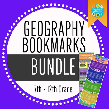
Geography Bookmark Bundle + 2 Freebies
By Geography & Math Made Easy
Simply cut out and laminate and give to your student to use as an ongoing reference guide.
Includes PEG Bookmark + 2 FREEBIES
OR BUILD YOUR OWN BUNDLE HERE
By The Academic Architect
Use this Reading Response Assignment and Battle Royale style activity to teach about Bushcraft and Primitive Survival Techniques while reinforcing simple geographical knowledge about world geography and the basic biomes of the world. Any fan of fortnite or other battle royale style video games will love this assignment! But even the students who don't play fortnite will enjoy making their battle royale survival plan.
I normally use this assignment during my Ancient History unit on early humans as a way to help students understand the hardship of surviving without modern technology. I've also used it directly after my unit on the Fall of Rome when we discuss the collapse of civilization before diving into Feudalism in Europe.
Really this assignment is a plug and play that you can use in many different class periods. Thinking tactically about survival never goes out of style, and students are always engaged during this assignment. I've also used it as a last minute sub plan and have never gotten a bad note!
Continents and Oceans Worksheets | Blank World Map with Countries | Geography
By Innovative Classroom Ideas
This set of printable pages on the seven continents is a fantastic way to practice geography. With the help of this continents and oceans worksheet pdf, students will enjoy learning about the seven major continents. Use these maps with kindergarten, first, second, third, fourth, fifth, and sixth grade elementary students as part of a social studies subject, as a stand-alone review, or as additional practice.
These 7 Continents and 5 Oceans worksheets will be a hit with your pupils as they practice labeling the different continents and discover fascinating facts about each one. You only need to print the continents and oceans worksheet to begin teaching kindergarteners, first-graders, second-graders, third-graders, fourth-graders, fifth-graders, and sixth-graders. This no-prep geography lesson will help children learn about Asia, Africa, Australia, North America, Antarctica, South America, and Europe. It is perfect for parents, teachers, and homeschoolers. Now that you have these continents worksheets, you can start learning! The answer key is provided!!
>>>> ⭐ More Similar Activities ⭐ <<<<<
We adore FEEDBACK! You also obtain CREDITS! :
- Access your TeachShare account by logging in.
- Select "My TeachShare" from the drop-down menu.
- Click on "My Purchases."
- Select ratings and provide feedback.
Terms of Use: By purchasing and/or downloading this electronic file, you are allowed to use the product for personal use as you like, but you are not allowed to resell or redistribute.
Follow my store and get all the newest product updates and freebies by clicking the green star ★ above.
♥ Search Key Terms: Continents and oceans, the continents and oceans of the world worksheet, continents and oceans for kids, free continents and oceans for kids, continents and oceans workbook, continents and oceans free course, continents and oceans printables, homeschool continents and oceans, free teaching resources continents and oceans, teaching kids about continents and oceans, classroom continents and oceans resources, homeschool continents and oceans resources, oceans and continents, World map, world maps, world, world geography, map of the world, world map is wrong, world map for kids, world facts, map of world, #world, new world map, free world map, accurate world map, world puzzle, world oceans, fixing the world map, World map, world, blank map, how to draw world map easily, world map drawing, how to draw world map, world maps,European school draw world map, world map drawing easy, world map draw kaise kare, world map flat, world map draw in ias mains exam, how to draw a world map in easy steps, world map quiz, easy world map, how to draw world map in examination, how to dry world map in upsc mains exam,
Geography | Analysing and Interpreting Population Pyramids worksheet
By Yugen Learning
Analyzing and Interpreting Population Pyramids
In this no prep lesson is an activity for students learn to analyse and interpret the various types and shapes of population pyramids in a single activity.
Resources Included:
- 10 slide editable Introduction and overview PowerPoint on reading and analysing Population pyramids
- A3 Population Pyramid Worksheet to apply skills
Australian Geography Curriculum link:
Represent data in a range of appropriate forms, for example climate graphs, compound column graphs, population pyramids (ACHGS049)
Students will begin to see that certain features and shapes are often associated with particular population structures e.g. a wide base indicates a high birth rate, a narrow apex often indicates a high death rate, etc.
Within the lesson, students will be expected to apply this new knowledge and understanding by analyzing and interpreting a population pyramid from a range of countries.
Students also learn how variations in shape and size also relate to the dependency ratio (the amount of the population that is dependent on the working population) of a particular country. Students practice calculating and interpreting dependency ratio through a number of examples.
These slides can also be printed and displayed within the classroom or given to students as review notes.
Enjoy this resource! Don't forget to follow my store for more awesome products and rate this product for your TeachShare credits :)
SUBSCRIBE NOW to my list for a free copy of the eBook "ChatGPT for history Teachers" and a Story, Source, Scholarships resources to see how well they work in your classroom.
Request a resource:
If you like my resources but I have uploaded a particular one you would love, please email me and tell me what you would like me to deign:
kane@yugenlearning,com or Subscribe to Our Enlightening Educators’ Mailing List Now!
People that have purchased this resource have also purchased -
More great curriculum resources
✅ ➡ USA History
✅ ➡ USA History Unit One
✅ ➡ USA History Unit Two
✅ ➡ USA History Unit Three
✅ ➡ USA History Unit Four
✅ ➡ USA History Unit Five
✅ ➡ American Revolution
✅ ➡ ⚔ US Civil War
✅ ➡ Medieval History
✅ ➡ World War One
✅ ➡ Nazi Germany
✅ ➡ ✈ World War Two
✅ ➡ ☭️ Cold War
✅ ➡ Australian History
✅ ➡ ⚙ Industrial Revolution
and
Subscribe to my Teaching Newsletter
Follow us!!!!!
https://www.instagram.com/yugenlearning/
https://www.pinterest.com.au/yugenlearning/
TeachShare Store
https://www.TeachShare.com/Store/Yugen-Learning
Please share feedback to help me improve my resources for you.
Special Education Task Box: Continents Puzzle (Life Skills Activity)
By Specifically Sped
Adapted Special Education Task Box Activity for Life Skills
Continents
Task Box Picture Puzzle
Have students cut and glue the puzzle pieces to match the board for fine motor practice or laminate and velcro for repeated use.
- North America
- South America
- Asia
- Africa
- Europe
- Antarctica
- Australia
- Central America
Geography & Science: Layer of the Earth Poster and Printable
By Geography & Math Made Easy
A printable created by Geography and Math Made Easy.
Use this in your class to show the layers of the earth. This can be printed on 8x10 or enlarged to postersize.
Disclaimer:
One purchase is for the use of one teacher. If additional teachers would like to use this product, please purchase additional licenses. Not to be used to create resources for profit.
Geography | Analysing and Interpreting Population Pyramids worksheet
By Yugen Learning
Analyzing and Interpreting Population Pyramids
In this no prep lesson is an activity for students learn to analyse and interpret the various types and shapes of population pyramids in a single activity.
Resources Included:
- 10 slide editable Introduction and overview PowerPoint on reading and analysing Population pyramids
- A3 Population Pyramid Worksheet to apply skills
Australian Geography Curriculum link:
Represent data in a range of appropriate forms, for example climate graphs, compound column graphs, population pyramids (ACHGS049)
Students will begin to see that certain features and shapes are often associated with particular population structures e.g. a wide base indicates a high birth rate, a narrow apex often indicates a high death rate, etc.
Within the lesson, students will be expected to apply this new knowledge and understanding by analyzing and interpreting a population pyramid from a range of countries.
Students also learn how variations in shape and size also relate to the dependency ratio (the amount of the population that is dependent on the working population) of a particular country. Students practice calculating and interpreting dependency ratio through a number of examples.
These slides can also be printed and displayed within the classroom or given to students as review notes.
Enjoy this resource! Don't forget to follow my store for more awesome products and rate this product for your TeachShare credits :)
SUBSCRIBE NOW to my list for a free copy of the eBook "ChatGPT for history Teachers" and a Story, Source, Scholarships resources to see how well they work in your classroom.
Request a resource:
If you like my resources but I have uploaded a particular one you would love, please email me and tell me what you would like me to deign:
kane@yugenlearning,com or Subscribe to Our Enlightening Educators’ Mailing List Now!
People that have purchased this resource have also purchased -
More great curriculum resources
✅ ➡ USA History
✅ ➡ USA History Unit One
✅ ➡ USA History Unit Two
✅ ➡ USA History Unit Three
✅ ➡ USA History Unit Four
✅ ➡ USA History Unit Five
✅ ➡ American Revolution
✅ ➡ ⚔ US Civil War
✅ ➡ Medieval History
✅ ➡ World War One
✅ ➡ Nazi Germany
✅ ➡ ✈ World War Two
✅ ➡ ☭️ Cold War
✅ ➡ Australian History
✅ ➡ ⚙ Industrial Revolution
and
Subscribe to my Teaching Newsletter
Follow us!!!!!
https://www.instagram.com/yugenlearning/
https://www.pinterest.com.au/yugenlearning/
TeachShare Store
https://www.TeachShare.com/Store/Yugen-Learning
Please share feedback to help me improve my resources for you.
Social Studies: Facebook Character Analysis / Sketch Template
By Geography & Math Made Easy
Kids love Facebook! What better way to get kids engaged in their learning than to create a Facebook page of a character they are studying. Whether a historical character, a present-day character, or future historical character, this template can be adapted to any one of these.
Includes:
Wrap-up/Closure activities
2-page template (printable)
Although this was designed to use in a Geography classroom, it is adaptable to all subjects: math, science, social studies, and language arts.
Geography: World Postcard Day October 1 Template + Blank Card
By Geography & Math Made Easy
The purpose of World Postcard Day is to promote awareness of the role of the postal sector in people’s and businesses’ everyday lives and its contribution to the social and economic development of countries. The current template has the 2022 postcard design. But new designs for future years can be found on the World Postcard Day Website.
Using the resources on the World Postcard Day Website, this is a free template that you can print off to have your students create their own postcards without having to spend money on one.
Using all the resources on the World Postcard Day Website, find activities and lessons that your students and you will enjoy.
All credits are given to World Postcard Day. No design or other information is claimed as property of G&M Made Easy. This resource is to make prep a little easier and to direct educators to use the World Postcard Day Website to obtain activities, information, and lesson plans in different languages.