6th Grade Geography Research
Africa Geography, Solving Environmental Issues In Africa (Easel Included)
By Geography & Math Made Easy
Through this problem-solving activity, students will enjoy and learn about
Africa's environmental problems and issues, while developing higher-level thinking skills. This activity is centered around students, working in cooperative teams of two, to identify environmental issues and solutions to the issues that lead to the wide-spread poverty concerns throughout Africa.
This was used with middle school students of various learning abilities.
INCLUDES
- Detailed Teacher Instructions
- Optional links to a video and autobiographical short story of a teen in Africa,
- 2-Page printable problem-solving activity sheet
- Printable map
- Practice and procedure activity (Teacher-guided)
- Grading rubric
☑Check out the preview to see what is included.
Visit our store Geography & Math Made Easy to view other related resources.
OTHER RESOURCES YOU MAY LIKE:
✧ Links here to similar categories
✧ Africa Bundle
✧ Geography Scavenger Hunts
........................................................................................................................................................
CREATE A CUSTOM BUNDLE & SAVE UP TO 20%
Do you need $25 or more of resources from our store and want to save up to 20%? Just let me know and a customized bundle can be created for you. Learn more about how to Create Your Custom Bundle.
.........................................................................................................................................................
Disclaimer:
One purchase is for the use of one teacher. If additional teachers wish to use this product, please purchase additional licenses.
.........................................................................................................................................................
CUSTOMER TIPS
When do I post new products? Throw sales? Be the first to know:
- Click the green star next to my picture to become my newest follower and be notified of up-to-date information, sales, and new resources.
Leave A Review and Earn TeachShare Credit to Use on Future Purchases:
- Go under “My TeachShare”, and click on “My Purchases”. Then, click the provide feedback button next to your purchase. Every time you leave feedback on a purchase, TeachShare gives you credits that you can use to save money on future purchases. I value your feedback as it helps me determine what types of new products I should create for you and other buyers.
........................................................................................................................................................
© Geography & Math Made Easy Resources. Created by Martha Boykin ^ Will Boykin. All rights reserved. Purchase of this product grants the purchaser the right to reproduce pages for classroom use only. If you are not the original purchaser, please download the item from my store before making copies. Copying, editing, selling, redistributing, or posting any part of this product on the internet is strictly forbidden. Violations are subject to the penalties of the Digital Millennium Copyright Act.
.........................................................................................................................................................
Related Topics:
Africa, africa geography, african american history, africa map, south Africa, geography, geography and math made easy, africa issues, renewable and nonrenewable resources, renewable and nonrenewable resources worksheets, renewable and nonrenewable resource activities, renewable and nonrenewable resources, eastern africa, africa culture, africa physical, africa government, issues in africa, stations,map of africa
World Religions- Independent Research Worksheets - Social Studies - Geography
By The Classroom Globetrotter
In the independent research activity, students will study key aspects of the major world religions: Judaism, Hinduism, Buddhism, Christianity, Islam, Sikhism.
The handouts include sections relating to: Founder, Followers, Main Beliefs, Important Events and People, and more!
Great for World Geography, World History, or World Cultures classrooms!
ANSWER KEY INCLUDED WITH THE HANDOUTS!
By Beth Hammett
Ready for a road trip? My Road Trip to the Top Ten National U.S. Parks lets you think about and plan to visit the top ten U.S. national parks:
Great Smoky Mountains National Park
Grand Canyon National Park
Yosemite National Park
Yellowstone National Park
Rocky Mountain National Park
Olympic National Park
Zion Canyon National Park
Grand Teton National Park
Acadia National Park
Glacier National Park
35 pages of fact-based fun and interesting facts, such as how many visitors pass through parks and scenic and wildlife information, along with where each park is located. Note park spellings are based on National Park Service website for student research purposes.
Includes:
Directions with Ideas for Implementation and for Assessment
Includes writing prompts, diorama, research ideas, and more...
Research and Writing Components
Math and Science Skills Connections
Info Sheet Handout with Junior Ranger Motto and core values of the
National Park Service
My Road Trip U.S. Map to plot itineraries
My Road Trip Mileage Chart for incorporating math skills
Location of Parks
Established Dates of Parks
Sizes of Parks
Scenic Beauty coloring sheet for each park
Scenic Beauty facts
Fact Boxes to add visitor/researched info
Fun Sheet to List the Top 5 places to visit in each park
Record Yearly Temperatures and Averages (Science)
Best Time to Visit
Best Features
Excellent across curriculum lesson plan that encourages critical thinking and planning skills for a fun U.S. national parks road trip! Students who have visited listed parks can be class experts as the lesson plan progresses.
Meets CCSS.
Need a great accompanying packet?
Try "Dialects of the U.S." at Educator Helper storefront.

FULL YEAR/ANNÉE COMPLÈTE BUNDLE 6E ANNÉE | ALL SUBJECTS | 130+ DOCUMENTS
By French Made Fun!
Welcome to the Mega Massive Grade 6 Bundle—your ultimate resource for an entire year's worth of curriculum! This extraordinary bundle includes 131 documents and a staggering 4,000+ pages of content, covering every aspect of Grade 6 Math, French Language Arts, Science, "Transdisciplinary" Units, Cross-Curricular Units, and Project-Based Learning.
Here's what you'll find packed into this 131 document crypt:
Language Arts:
- Complete Genre Studies: Detailed lessons and activities for all genres.
- Mini-Lessons and Workshops: Comprehensive tools for reading and writing instruction.
- Reading and Writing Prompts: Engaging activities to boost literacy skills.
- Excerpts and Writing Pieces: Diverse texts for comprehension and writing practice.
- Modelled Examples and Lesson Plans: Clear guides to support effective teaching.
- Verb and Grammar Units: Thorough resources for mastering French language skills.
- Task and Flash Cards: Interactive tools for grammar and vocabulary practice.
- Posters and Anchor Charts: Essential visual aids for classroom support.
Math:
- Paperless Teaching Slides: Digital slides for all math outcomes, ideal for projection.
- Assessments with Answer Keys: Complete evaluation tools to track student progress.
- Activities and Games: Fun, interactive ways to reinforce math concepts.
- Printable and Digital Games: Versatile resources for various teaching styles.
- Enrichment Material: Advanced content to challenge high-achieving students.
- No-Prep Lessons: Ready-to-go activities that require minimal preparation.
Project-Based Learning:
- Science and Social Studies Projects: Inquiry-based units including Dragons' Den, Sustainable Future projects, Endangered Species studies, Political Platform creation, Haunted House design, and Space Food exploration.
- Health Documents: Comprehensive materials on sexuality, puberty, and other health topics.
- Themed Day Content: Engaging projects for Orange Shirt Day, Pink Shirt Day, Remembrance Day, Earth Day, and a project on O Canada.
Why You'll Love It:
- Massive Content Collection: Over 4,000 pages and 131 documents covering every subject.
- No-Prep, Ready-to-Go: Perfect for busy teachers and easy to leave with a substitute.
- Engaging and Comprehensive: Promotes student independence with project-based and inquiry learning.
- Constantly Growing: New materials added regularly to keep your curriculum up-to-date.
- Versatile and Easy to Use: Printable and digital formats for flexible teaching options.
Get the Mega Massive Grade 6 Bundle today and transform your classroom with this all-encompassing resource, designed to make planning easier and teaching more effective!
** Buying these individually would cost you WELL over $530 USD (that's like OVER $725 CAD). So save yourself time and money and get ready for the next school year! **
Join me on Facebook! I share freebies, keep you up-to-date on sales and deals and welcome your collaboration and feedback.
You can earn TeachShare CREDITS by leaving feedback on any of the products you purchase. You can do so by going to MY PURCHASES your page and clicking on the "Provide Feedback" button. You will earn 1 TeachShare Credit for every dollar you spend!
For goodness sakes, don't forget to have fun!
Mme Kaitlyn
By Mark Holmes
The project is divided into fourteen sections, including the front pages. Sections include Language/Population, Habitat/Geography, Family Structure, Government, and several others. Each section has a list of criteria and questions that must be answered to complete the section.
I would expect a single student to take about ten weeks, with a weekly goal (perhaps a little faster) of completing one section.
There is a score for each section and teacher info on ways to make it work.
The project contains a cover sheet, a teacher's page, two student pages and a sheet to help students select an appropriate civilization.
There is also a list of civilizations that have an abundance of information available on line.
Mount Everest Informational Writing Unit 5th Grade & 6th Grade
By Creative Primary Literacy
An informational writing unit about Mount Everest. The unit looks at key facts about the world's highest mountain, then looks at its history; from the first summit attempts until the present day problems that have been caused by human waste. It has been split into three separate lessons and is perfect for students in fifth grade and sixth grade.
Included in this PDF printable resource:
- Four fact sheets which students need to cut out and sort into paragraphs
- Writing templates for four draft paragraphs
- A template for students to write up their neat informational text
- A crossword puzzle & wordsearch activity
⎻⎻⎻⎻⎻⎻⎻⎻⎻⎻⎻⎻⎻⎻⎻⎻⎻⎻⎻⎻⎻⎻⎻⎻⎻⎻⎻⎻⎻⎻⎻⎻⎻⎻⎻⎻⎻⎻⎻⎻⎻⎻⎻⎻⎻⎻⎻⎻⎻⎻⎻⎻⎻⎻⎻⎻⎻⎻
This resource is great for:
- In class learning
- Independent work
- Homework
- Creative writing sessions
- Assessment practice
- Emergency sub plans
The first lesson is interactive and involves them cutting out facts, and then sorting these facts into paragraphs. In the second lesson the children need to use these facts to write four paragraphs. Then, in the final lesson your class will need to use the format provided to write an introduction for the text before checking their draft paragraphs for mistakes and writing up their work into a neat copy on the template provided.
For a digital version of this resource that can be completed on tablets or computers check out my Mount Everest 5th & 6th Grade Informational Writing Unit | Digital & Print.
⎻⎻⎻⎻⎻⎻⎻⎻⎻⎻⎻⎻⎻⎻⎻⎻⎻⎻⎻⎻⎻⎻⎻⎻⎻⎻⎻⎻⎻⎻⎻⎻⎻⎻⎻⎻⎻⎻⎻⎻⎻⎻⎻⎻⎻⎻⎻⎻⎻⎻⎻⎻⎻⎻⎻⎻⎻⎻
If you would like to add another lesson, download my Mount Everest Close Reading Activity | 5th & 6th Grade . This would give the students more background knowledge before they start writing the text.
Other similar or relevant resources:
- Distance Learning Resources
- U.S. History Resources
⏚⏚⏚⏚⏚⏚⏚⏚⏚⏚⏚⏚⏚⏚⏚⏚⏚⏚⏚⏚⏚⏚⏚⏚⏚⏚⏚⏚⏚⏚⏚⏚⏚⏚⏚
For more great resources follow my store ⇉⇉ CLICK HERE
Also, don't forget to leave feedback to earn TeachShare credits to spend!
Alaska Research Project with Reading Comprehension and Time Line
By Jennifer Connett
Learn about the history of Alaska and its state symbols with this state research project. This Alaska research project contains cards with real pictures, reading passages with comprehension questions, and two forms of research recording activities. Students can use the passages, posters and cards to answer the research questions in the two books, or conduct their own research through books or the internet. The preview shows a sampling of each part of this packet.
What is included?
Basic State Poster
State Symbol Cards with real photographs where available
History Time Line Cards with real photographs where available
Reading Comprehension Passages
- Alaska History
- Weather and Climate
- Agriculture and Industry
Fun Facts and Information Pages
Writing Activities
State Research Flip Book Pages
- Basic Facts
- Where is this State?
- Major Landmarks
- Flag
- State Symbols
- Interesting Facts
State Report Book Pages (Choose the pages according to what your focus is.)
- Basic Facts
- Location
- Flag
- State Map
- State Symbols
- Major Landmarks
- Weather and Climate
- Industry and Agriculture
- Famous Person
- Fun Facts
Related Links:
More United States Activities
State Research Project Alaska: Our Scrappy Patchwork Quilt
By The Emergency Sub
Alaska Research Project
Scrappy Patchwork Quilts
A scrappy quilt uses a variety of different fabrics that may or may not use a consistent theme. In this new version of cut and paste, students will make a scrappy quilt using a variety of pattern blocks included in the activity. The students must complete a set of questions or activities to know what numbered pattern to use and where it should be placed on their quilt. Each quilt has its own color scheme (color chart) and those are the colors students will need to create a one-of-a-kind scrappy quilt. Each quilt comes with a header, and some have additional activities students must complete to finish their quilts. Each quilt once assembled with header is 11x14 inches (does not include the size if a quilt has an additional activity).
Alaska State Scrappy Patchwork Quilt: Research Project
The Alaska State Scrappy Patchwork Quilt Research Project - a unique way to explore all that Alaska has to offer! This project is designed to engage students in a fun and interactive learning experience, allowing them to dive deep into the history, geography, and culture of the Last Frontier.
This activity is a great way to connect art and social studies together.
Geography - Dive Deep into the Seven Continents! Worksheet Booklet
By Yugen Learning
Overview: Introduce your students to the wonders of our world with this comprehensive 7-page no prep for you or an emergency sub Geography research booklet! Each page is dedicated to one of the seven continents, providing a detailed map and thought-provoking questions that will ignite their curiosity and deepen their understanding of global geography.
What's Inside:
Detailed Maps: Each continent is beautifully illustrated, offering students a clear visual representation to aid their research.
Research Questions: For every continent, students will delve into:
- Size/Area: Understand the vastness of each landmass.
- Number of Countries: Not just the count, but labeling them too!
- Population & Largest City: Dive into demographics.
- Highest Point: Reach the peak of knowledge!
- Climate: Discover the diverse weather patterns.
- Top Landmark: Identify iconic sights.
- Major Rivers and Lakes: Flow with the world's waterways.
- Mountain Ranges: Scale the heights of knowledge.
- Nearby Oceans and Seas: Explore the surrounding waters.
Benefits:
- Integrated Learning: This booklet promotes research skills, reading comprehension, and map reading all in one!
- Flexibility: Suitable for independent study, group work, or as a homework assignment.
- Engagement: The hands-on approach ensures students are actively involved in their learning journey.
Why Choose This Resource? As educators, we understand the importance of making learning engaging and relevant. This booklet has been meticulously designed to ensure students not only learn but also appreciate the diverse wonders our world has to offer. Whether you're introducing continents for the first time or looking for a resource to deepen existing knowledge, this booklet is your perfect companion.
Embark on a global adventure with your students today!
In this fun and back to school, no prep lesson your Geography program, students will embark on a geographical journey to find specific countries using an atlas or google earth skills to develop their country finding ability, before labelling and coloring in the map. All neatly contained within a single A4 sheet.
Enjoy this resource! Don't forget to follow my store for more awesome products and rate this product for your TeachShare credits :)
People that have purchased this resource have also purchased -
Geography | What Causes Hunger lesson activity
Geography | Analysing and Interpreting Population Pyramids
Geography | Geographical Scavenger Hunt
Geography | Hemispheres, Continents and Lines of Latitude Worksheet
Please leave a review.
Regions of the United States Digital Research Project - Google Slides
By Kile's Classroom
Your students create a digital presentation of the 5 regions of the United States.
The student’s presentation must cover the following information for each region:
~A map showing the location of the region
~Important information about the region’s history.
~Landforms
~Landmarks and famous places
~Climate
~Fun Facts
See preview for more details.
More Great Activities from Kile's Classroom
Figurative Language Bundle.
Author's Purpose Interactive Set.
Writing Graphic Organizer Bundle.
Language Interactive Notebook Pages for the Whole Year.
Compare and Contrast Interactive Notebook and Student Activities.
*****************************************************************************
Customer Tips:
How to get TeachShare credit to use on future purchases:
• Please go to your My Purchases page (you may need to
login). Beside each purchase you'll see a Provide Feedback button.
Simply click it and you will be taken to a page where you can give a quick rating and
leave a short comment for the product. Each time you give feedback, TeachShare gives you
feedback credits that you use to lower the cost of your future purchases. I value your
feedback greatly as it helps me determine which products are most valuable for your
classroom so I can create more for you. ?
Be the first to know about my new discounts, freebies and product launches:
strong>
• Look for the green star next to my store logo and
click it to become a follower. Voila! You will now receive email updates
about this store. ?
*****************************************************************************

TOM APPLEBY CONVICT BOY Novel Study and AUSTRALIA Country Study
By The Book Bandit
This bundle includes a novel study for TOM APPLEBY CONVICT BOY and a 40 page country study for AUSTRALIA.
GEOGRAPHY: Adopt A Friend For Christmas: Christmas Celebrations Around The World
By Geography & Math Made Easy
This lesson is easy enough for 5th graders to understand yet works well with students up to 12th graders. Modifications can be made as needed.
A fun and exciting Christmas holiday geography project to engage students in learning about winter holidays and traditions around the world. Implement this activity days prior to Christmas break to keep your students motivated and learning. Make every moment a teaching moment!
Through this lesson, students will catch a glimpse into the life of another child, discovering how the winter holiday season is celebrated within their culture/country—whether it is Christmas, Kwanza, Ramadan, Hanukkah, or other winter holidays. Students will be introduced to various ways of life, from South America to Europe to Africa, and will gain an understanding of each winter tradition and celebration.
Students will Adopt a Friend for the holiday Kwanza/ Ramadan / Hanukkah season and will explore ways of life during the holiday season.
Note: (1) This is a research project. Will need a zip file reader to open the file.
WHAT IT INCLUDES
- Detailed Teacher Instructions
- Suggested Introduction Videos (optional for lesson)
- 9 Pages of Christmas Ornaments Reproducible (For Tree)
- A Word File With Editable Ornaments
- Christmas Ornament Reproducible Activity Sheet
- Christmas Ornaments Reproducible (With Writing Lines)
- Grading Rubric
Note: This lesson calls for the instructor to supply an artificial tree or cut a large human-sized tree out of butcher paper. Although, this activity can be modified so that the tree is not necessary.
(TO EDIT THE EDITABLE ORNAMENTS, CLICK ON THE TEXT BOX INSIDE EACH ORNAMENT AND ADD THE NAME, GENDER AND COUNTRY OF THE FRIEND/CHILD. )
☑ Check out the preview to see what is included.
Visit our store Geography & Math Made Easy to view other related resources:
Similar Resources & Skills:
✧ Geography Christmas Resources
✧ Other Fun Seasonal Activities
✧ Seasonal Year Around Puzzle Pack
.........................................................................................................................................................
CREATE A CUSTOM BUNDLE & SAVE UP TO 20%
Do you need 25 dollars or more of lessons and want to save up to 20%? Just let me know and a customized bundle can be created for you. Learn more about how to ****Create Your Custom Bundle.
.........................................................................................................................................................
Disclaimer:
One purchase is for the use of one teacher. If additional teachers would like to use this product, please purchase additional licenses.
.........................................................................................................................................................
CUSTOMER TIPS
When do I post new products? Throw sales? Be the first to know:
- Click the green star next to my picture to become my newest follower.
Leave A Review and Earn TeachShare Credit to Use on Future Purchases:
- Go under “My TeachShare”, and click on “My Purchases”. Then, click the provide feedback button next to your purchase. Every time you leave feedback on a purchase, TPT gives you credits that you can use to save money on future purchases. I value your feedback as it helps me determine what types of new products I should create for you and other buyers.
........................................................................................................................................................
© Geography & Math Made Easy Resources. Created by Martha Boykin ^ Will Boykin. All rights reserved. Purchase of this product grants the purchaser the right to reproduce pages for classroom use only. If you are not the original purchaser, please download the item from my store before making copies. Copying, editing, selling, redistributing, or posting any part of this product on the internet is strictly forbidden. Violations are subject to the penalties of the Digital Millennium Copyright Act.
.........................................................................................................................................................
Related Topics:
Google Earth, Christmas, xmas, Christmas traditions, Christmas bulletin board, Christmas craft. Christmas around the world, geography, world geography, Christmas around the world, Christmas around the world research project, Christmas around the world passport, Christmas around the world unit, Christmas around the world crafts, geography, geography activities, geography unit, geography skills, geography games, cultures, social studies, social studies, social studies Christmas activities, social studies worksheets, social studies thanksgiving
World Religions: Christianity Notes and Graphic Organizer for Social Studies
By The Classroom Globetrotter
Explore the Foundations of Christianity with This Comprehensive Notes and Graphic Organizer Resource!
Introduce your students to the rich history, teachings, and impact of Christianity with this engaging and NO-PREP social studies lesson. Perfect for middle and high school history or world religions classes, this resource will help students connect with the material in a meaningful way.
What’s Included:
Detailed Notes:
Overview of Christianity’s origins, key beliefs, and sacred texts.
Explains the life of Jesus Christ, the development of the Church, and the global influence of Christianity.
Graphic Organizer:
Interactive tool for students to summarize key concepts and retain essential information.
Promotes active engagement with the material.
Teacher-Friendly Layout:
Saves time with a ready-to-use and flexible lesson plan.
Can be used in class, for homework, or as a study guide.
Key Features:
- Focus on Key Themes: Students will explore the life of Jesus, Christian doctrines, and the spread of Christianity worldwide.
- Interactive & Engaging: The graphic organizer encourages students to connect the dots between major concepts.
- Standards-Aligned: Meets social studies curriculum standards for world history and religious studies.
- Time-Efficient: Prepped and ready for easy implementation.
Perfect For:
- World History Teachers: Enhance your unit on world religions with a focus on Christianity.
- Religious Studies Classes: Offer an in-depth and approachable resource on Christian history and beliefs.
- Lesson Prep Savers: Ready-to-go material for immediate classroom use.
(FR) ÉTUDES SOCIALES - LA BROCHURE TOURISTIQUE DES PROVINCES CANADIENNES
By French Made Fun!
Modifié fév. 2021!
Ce document de 30 pages contient tout ce dont vous avez besoin pour que vos élèves puissent effectuer des recherches indépendantes sur une province ou un territoire canadien. Créé pour être utilisé pour les élèves d'immersion française de 6e année à l'ÎPÉ, il comprend les éléments suivants:
- Un aperçu vierge de chaque province et territoire canadien;
- Une explication détaillée et un aperçu de la recherche;
- Des critères de réussite détaillés;
- Une auto-évaluation avec objectifs et réflexion.
Vos élèves rechercheront des éléments tels que des attractions, des symboles, des capitales, des populations, etc. et pourront ensuite utiliser la carte vierge de leur province / territoire pour dessiner / colorier ce que vous choisissez comme objectif: capitales, routes, élévation, etc. C'est à vous le choix!
Mes élèves ont aimé utiliser Canva pour leurs cartes postales / affiches; mais n'importe quel support fonctionne bien et un 'template' est donné pour un dépliant/pamphlet à plier.
Mes documents ont tous été créés pour des suppléants et remplaçants; donc ils sont faciles à utiliser, comprendre et effectuer.
Détendez-vous - j'ai celui-ci!
♡ Mme. Kaitlyn
Mount Everest Informational Writing Unit Digital & Print | 5th Grade & 6th Grade
By Creative Primary Literacy
A Google Slides informational report writing unit about Mount Everest, and the first attempts at summiting the famous mountain. The NO PREP unit has been split into three separate lessons and is perfect for students in fifth grade or sixth grade. Students will learn about geography and World History whilst working on their comprehension skills and developing their creative writing.
Included in the Google Slides Activity:
- Four fact sheets & blank sheets for students to copy and paste key facts
- Writing templates for four draft paragraphs
- A prompt sheet for students to write their introduction
- A template for students to write up their neat informational text
Included in the PDF printable resource:
Four fact sheets which students need to cut out and sort into paragraphs
Writing templates for four draft paragraphs
A prompt sheet for students to write their introduction
A template for students to write up their neat biography text
A crossword puzzle and wordsearch to consolidate learning
⎻⎻⎻⎻⎻⎻⎻⎻⎻⎻⎻⎻⎻⎻⎻⎻⎻⎻⎻⎻⎻⎻⎻⎻⎻⎻⎻⎻⎻⎻⎻⎻⎻⎻⎻⎻⎻⎻⎻⎻⎻⎻⎻⎻⎻⎻⎻⎻⎻⎻⎻⎻⎻⎻⎻⎻⎻⎻
This resource is great for:
In class learning
Independent work
Homework
Creative writing sessions
Assessment practice
Emergency sub plans
⎻⎻⎻⎻⎻⎻⎻⎻⎻⎻⎻⎻⎻⎻⎻⎻⎻⎻⎻⎻⎻⎻⎻⎻⎻⎻⎻⎻⎻⎻⎻⎻⎻⎻⎻⎻⎻⎻⎻⎻⎻⎻⎻⎻⎻⎻⎻⎻⎻⎻⎻⎻⎻⎻⎻⎻⎻⎻
The first lesson is interactive and involves students reading facts, and then sorting and ordering these facts into paragraphs by copying and pasting. In the second lesson the children need sort the facts in order before typing four draft paragraphs. Then, in the third lesson they need to choose the most important facts and include these in an introduction; before checking their draft paragraphs and typing up their work on to the template provided.
This activity is an online resource, that uses Google Slides, and is linked to your Google Drive. It can be completed by students online using tablets or computers. If you are unsure how to allow the students to have their own individual copy take a look at the instructional video below:
Google Classroom - How to make a copy for each student - Assignment
The resource also comes in a PDF format, which can be printed.
Please ensure when you download this resource into Google Drive that you are logged in to the gmail account where you wish to store the activity. In the past teachers have downloaded resources into their school account in error. Thanks :)
Other similar or relevant resources:
- Distance Learning Resources
- World War 2 Resources
⏚⏚⏚⏚⏚⏚⏚⏚⏚⏚⏚⏚⏚⏚⏚⏚⏚⏚⏚⏚⏚⏚⏚⏚⏚⏚⏚⏚⏚⏚⏚⏚⏚⏚⏚
For more great resources follow my store ⇉⇉ CLICK HERE
Also, don't forget to leave feedback to earn TeachShare credits to spend!
Geography US Cities Reading Comprehension Anchorage, Alaska
By The Emergency Sub
Dive into the wonders of the northernmost state’s largest city with this engaging reading comprehension resource.
Great addition to your unit on Alaska or US Cities!
Included in this set:
- Detailed passages about Anchorage, Alaska
- Comprehension questions to help reinforce understanding of the text
- Graphic organizer to help students organize their thoughts and stay on track
- Link to a Visit Alaska Promotional Video
Geography - Dive Deep into the Seven Continents! Worksheet Booklet
By Yugen Learning
Overview: Introduce your students to the wonders of our world with this comprehensive 7-page no prep for you or an emergency sub Geography research booklet! Each page is dedicated to one of the seven continents, providing a detailed map and thought-provoking questions that will ignite their curiosity and deepen their understanding of global geography.
What's Inside:
Detailed Maps: Each continent is beautifully illustrated, offering students a clear visual representation to aid their research.
Research Questions: For every continent, students will delve into:
- Size/Area: Understand the vastness of each landmass.
- Number of Countries: Not just the count, but labeling them too!
- Population & Largest City: Dive into demographics.
- Highest Point: Reach the peak of knowledge!
- Climate: Discover the diverse weather patterns.
- Top Landmark: Identify iconic sights.
- Major Rivers and Lakes: Flow with the world's waterways.
- Mountain Ranges: Scale the heights of knowledge.
- Nearby Oceans and Seas: Explore the surrounding waters.
Benefits:
- Integrated Learning: This booklet promotes research skills, reading comprehension, and map reading all in one!
- Flexibility: Suitable for independent study, group work, or as a homework assignment.
- Engagement: The hands-on approach ensures students are actively involved in their learning journey.
Why Choose This Resource? As educators, we understand the importance of making learning engaging and relevant. This booklet has been meticulously designed to ensure students not only learn but also appreciate the diverse wonders our world has to offer. Whether you're introducing continents for the first time or looking for a resource to deepen existing knowledge, this booklet is your perfect companion.
Embark on a global adventure with your students today!
In this fun and back to school, no prep lesson your Geography program, students will embark on a geographical journey to find specific countries using an atlas or google earth skills to develop their country finding ability, before labelling and coloring in the map. All neatly contained within a single A4 sheet.
Enjoy this resource! Don't forget to follow my store for more awesome products and rate this product for your TeachShare credits :)
People that have purchased this resource have also purchased -
Geography | What Causes Hunger lesson activity
Geography | Analysing and Interpreting Population Pyramids
Geography | Geographical Scavenger Hunt
Geography | Hemispheres, Continents and Lines of Latitude Worksheet
Please leave a review.

THE GREAT GALLIPOLI ESCAPE Novel Study and AUSTRALIA Country Study BUNDLE
By The Book Bandit
This bundle includes a novel study for THE GREAT GALLIPOLI ESCAPE and a 40 page country study for AUSTRALIA.
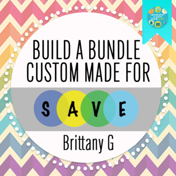
By Geography & Math Made Easy
Bundle for Brittany G.
Please note as stated in the Build Bundle guidelines, other bundles cannot be included within a bundle.
OR BUILD YOUR OWN BUNDLE HERE

World History Bundle - Yearlong Activities, Worksheets, Lessons, Games, Projects
By The Classroom Globetrotter
World History Ultimate Bundle! Yearlong Activities, Worksheets, Lessons, Games & Projects for Your Classroom
Bring world history to life and save time with this ultimate yearlong bundle! This comprehensive collection includes over 125 engaging activities covering major historical periods, from Prehistory, Ancient Civilizations, and the Middle Ages to World War II and the 21st Century. Designed for middle school, high school, and homeschool students, this bundle provides an extensive range of resources to enhance your world history curriculum, making history interactive, fun, and memorable.
What’s Included:
- Reading Comprehension Worksheets: This is a new product line, currently covering key historical periods from Prehistory to Ancient Greece, with more added throughout the year!
- Interactive Reading Lessons: Explore historical events and figures with guided questions and in-depth analysis.
- Worksheets & Notes: Perfect for classwork, homework, and review.
- Projects & Research Assignments: Encourage deep dives into specific historical topics, fostering critical thinking.
- Crossword Puzzles & Word Searches: Fun ways to reinforce vocabulary and key historical concepts.
- Classroom Games: Make history fun with interactive activities that engage all learners.
- Teacher Guides & Answer Keys: Detailed guides, rubrics, and answer keys for easy lesson planning and grading.
This Bundle is Ideal For:
- New teachers building a robust collection of classroom activities.
- Experienced teachers seeking fresh, creative resources.
- Homeschool families wanting structured, engaging lessons.
Stay tuned for even more resources added throughout the year as the reading comprehension series continues to expand. Check out the previews to see how these activities can enrich your classroom today!