$5 - $10 Middle School Geography Activities (by price, high to low)

Geography - ALL CONTINENTS BUNDLE - 20 Atlas / Google Maps Questions
By Quick Assignment Central
Includes an individual assignment for each continent. 7 Individual assignments.
Unlock an exciting geography quiz that brings the continent to life! This set features 20 thoughtfully designed questions covering landforms, countries, capitals, and more.
Students will need an atlas or Google Maps to answer the questions, making it a fun and interactive learning experience.
Includes a complete answer key for easy review.
Perfect for sparking curiosity and building knowledge!
Don’t forget to explore my store for more engaging educational resources!

Geography & Map Types & Skills & Activities 4th 5th 6th grades Social Studies
By The Magical Avocado
Teaching Geography? This bundle has everything you need to teach different map types, map skills, latitude and longitude, and more! This bundle includes a combination of ready-to-print reading and response, activity sheets, maze puzzles, cut-and-paste activities, writing prompts, and assessments. Perfect for upper elementary (4th, 5th, and 6th grade), this complete bundle is great for substitute work, centers, the beginning of the year, introduction and review of geography, enrichment, home school assignments, and centers!
Specifically, this bundle includes:
- 8 read and respond
- 6 Maze Activities
- 4 Cut and Paste
- 4 skills practice pages
- 2 USA Maps for practice
- 2 writing pages
- 1 short answer quiz
- 1 matching quiz
- 1 mini project
- 3 Teaching Guides
This bundle covers the following concepts:
- Absolute Location
- Cardinal Directions
- Cartographer
- Compass Rose
- Coordinates
- Equator
- Intermediate Directions
- Latitude
- Legend
- Longitude
- Prime Meridian
- Relative Location
- Scale
- Symbols
and the following map types
- choropleth
- general reference map
- globe
- physical map
- political map
- special purpose map
- topographical map
- weather map

Ancient Egypt Massive Vocabulary Game and Activity Bundle!
By The Magical Avocado
Gamify your vocabulary lessons with this massive Ancient Egypt Vocabulary Game Bundle!
This bundle includes BINGO, Matching Cards, Crossword Puzzles, and Word Searches using the same set of words to encourage recognition through repetition!
This bundle also includes the Ancient Egypt Vocabulary Presentation and Word Wall Slides to help introduce the vocabulary terms, as well as three scaffolded vocabulary sheets for students to keep track of the terms and definitions!
**Vocabulary included** amulet, ankh, book, of the dead, bureaucrat, Canopic jars, caravans, cartouche, cataract, delta, demotic, dynasty, embalming, hieroglyphics, ideogram, monotheistic, mummification, obelisk, papyrus, pharaoh, phonogram, pictograms, polytheistic, pyramid, sarcophagus, scarab, shadoof, theocracy, vizier
Blue Planet - Season 1 - Complete Set of Episode Questions
By Quick Assignment Central
Includes a set of 10 questions for each of the 8 episodes from season 1 of Blue Planet. Each episode comes with a separate answer key.
Written at a 9th grade level.
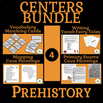
Prehistory Centers BUNDLE- Vocabulary, Writing, Maps, Primary Sources
By The Magical Avocado
Bring Prehistory to life in your class with this centers bundle! Have students practice vocabulary recognition with a ready to print and cut matching game, integrate ELA in a prehistory story assignment, work on geography skills while mapping cave paintings online, and use the tools of historians and anthropologists while analyzing primary sources.
Centers are a great way to keep students engaged while introducing a variety of information and skills.
In addition to the four activities included, this bundle introduces a Prehistory Centers Teaching Guide which includes:
- An overview of the centers as activities working together
- A planning guide describing the skills, knowledge, materials, and grading for each center
- A plan for introducing the centers along with directions for the INCLUDED fully editable centers introduction powerpoint slide
- A guide on timing of centers based on class schedules
- Center Rotation Suggestions for using four or five centers
- Printable Title Pages for the Centers
****** Also included is a list of 15 Suggested Reflection Questions to use as closure for the centers
NEW! World Geography Summer Camp Week 1 — Geography Basics Map Skills
By Geography & Math Made Easy
Geography summer school and camps don't give us enough time to cover all the concepts and topics that need to be covered. Squeezing the curriculum
8 months is difficult; covering it over 6-8 weeks is impossible. There is so much information and so little time. This leaves us as educators with the question of what are the important aspects to cover. Having taught middle school level and high school level geography for 11 years, I have pulled out what I feel is a must!
A working knowledge of geography concepts is helpful in teaching this material. If you do not understand geography or if you have never taught geography before, no problem! Simply, read through the student material so you can help your students understand and complete the included activities. Before presenting it to your students, this will require a little mental preparation; however, this resource will save you 20+ hours of resource prep.
This lesson is composed of the first five days (Week 1).
Day 1: 5 Geography Themes
- What is geography & ways to study it? 5 geographical themes
- What is Geography? Reading Activity
- 5 Themes Geography Review Game
- Introduction to the 5 Geographical Themes + Activity (Current Events)
Day 2: Maps, Graphs & Charts + Follow-up Quiz
(Pie Chart, Bar Graph, Line Graph, Cartogram, Political Map, Physical Map, Climate Map, Learning to read Latitude and Longitude.)
- 20 Facts About Maps, Graphs, Charts. Cheatsheet
- Maps, Graphs, Charts Activity
- Maps, Graphs, Charts Quiz
Day 3: Looking at geography through a social, economic, political and cultural lens + Follow-up Quiz
(Understanding the meaning behind social, economic, political and cultural aspects)
- Social, Economic, Political & Cultural Lenses Cheat Sheet
- Geography Through Different Lenses Activity
- Geography Lenses Quiz
Day 4: World Governments & Three Branches of Government+ Follow-up Quiz (Direct Democracy, Constitutional Democracy, Absolute Monarchy, Constitutional Monarchy, Oligarchy, Communism, Socialism)
- World Government Systems Cheatsheet
- World Government Systems Activity
- World Government Systems Quiz
Day 5: Types of Economic Industries + Follow-up Quiz
(Four Types of Economy, Pure market economy, a pure command economy, a mixed economy, and a traditional economy, Free Enterprise + Four Industries: primary, secondary, tertiary, quaternary)
- Economic Industries Cheat Sheet
- Economic Industries Activity
- Economic Activity Quiz
Week 2-8 Coming Soon!
...............................................................................................................................
Permissions are given to the purchaser to make modifications to the game board using the Word document provided in the zip file. No other modifications may be made to this document.
................................................................................................................................
Customer Tips:
When do I post new products? Throw sales? Be the first to know:
• Click the green star next to my picture to become my newest follower.
How to get TeachShare credit to use on future purchases:
• Go under “My TeachShare”, and click on “My Purchases”. Then, click the provide feedback button next to your purchase. Every time you leave feedback on a purchase, TPT gives you credits that you can use to save money on future purchases. I value your feedback as it helps me determine what types of new products I should create for you and other buyers.
................................................................................................................................
© Martha Boykin Products. All rights reserved. Purchase of this product grants the purchaser the right to reproduce pages for classroom use only. If you are not the original purchaser, please download the item from my store before making copies. Copying, editing, selling, redistributing, or posting any part of this product on the internet is strictly forbidden. Violations are subject to the penalties of the Digital Millennium Copyright Act.

World Map Worksheets | 7 Continents and 5 Oceans Blank Map Skills & Activities
By Innovative Classroom Ideas
Kids enjoy studying about the world in which they live! With the help of these entertaining printable Continents and Oceans Worksheets, they will love learning about the seven continents and the corresponding geography. For students in kindergarten, first grade, second grade, third grade, fourth grade, fifth grade, and sixth grade, these worksheets offer a fun and interactive way to explore our planet. Through engaging activities like coloring, labeling, and matching, students will develop a solid understanding of the continents and oceans while sparking their curiosity about the diverse cultures and natural wonders of the world. Let’s embark on a global adventure together!
By completing the various activities, children will enhance their map skills, vocabulary, and critical thinking abilities. These printable resources are perfect for homeschooling, classroom use, or simply as a fun activity to do at home.
These no prep worksheets offer a wide range of activities to keep young learners engaged. From simple tracing and coloring to more challenging puzzles and word searches, there’s something for everyone. With these worksheets, learning about the continents and oceans is both educational and enjoyable.
✅ Save more than 50% when you get a bundle ✅
This bundle contains the following resources:
⭐ Blank World Map with Countries | 7 Continents and 5 Oceans | United States Map
These printable maps will be useful whether you are studying geography, world history, countries around the world, or you are just trying to show your kids the route you are taking on your next vacation! For kids learning about states, we’ve included a printable map of the world, as well as maps of North and South America, Europe, Asia, Australia, Africa, and Antarctica. Furthermore, the world map printable set comprises labeled and blank options for printing. To print the printable map pdf file simply download this ressource and use it for students in pre-kindergarten, first grade, second grade, third grade, fourth grade, fifth grade, sixth grade, seventh grade, junior high, and even high school.
The blank world map is particularly useful for providing a bird’s eye perspective of the globe, oceans, continents, and major nations. It also helps locate me on the map with children of various ages.
That ressource countains:
- Blank World Map (with /without country names)
- North America Map (with / without country names)
- South America Map (with / without country names)
- Australia Map (with / without country names)
- Asia Map (with / without country names)
- Europe Map (with / without country names)
- Antarctica Map (with / without country names)
- Africa Map (with / without country names)
- United States Map (with / without country names)
⭐ World Map with Countries Worksheets | 7 Continents and 5 Oceans Blank Map
Kids enjoy studying the world they live in! They will enjoy learning about the seven continents and the corresponding geography with these fun and printable Continents Worksheets. For kindergarteners, first graders, second graders, third graders, fourth graders, and fifth graders, use these continents and oceans worksheets. You may start playing and learning as soon as you print the continents and oceans worksheet PDF.
These 7 continents and 5 oceans worksheets are perfect for parents, teachers, and homeschoolers who want to assist their kids learn about the globe we live in and improve their science skills. For kindergarteners, first-graders, second-graders, third-graders, fourth-graders, and fifth-graders, this pack is ideal. Use these no prep 7 Continents worksheets for science centers, additional practice, at home or at school, or as a component of a continent study. Children will learn about the seven continents that today make up the world in which we live with this bundle. Answers are provided and this pack comes mainly in black and white with a few color pages thrown in.
There are lots of activities in this pack:
- Continent poster in color
- Color in the continents on the world map following the key
- Cut out and paste the labels onto the continents
- Write the names of the seven continents next to the corresponding number
- Color in the continents using the key
- Unscramble the names of the continents
- One page for each of the seven continents with facts that include the hemisphere the continent is in, the oceans that surround it, and the amount of countries that are in that continent
- Write the names of the continents in alphabetical order
- Continent word search
⭐ Continents and Oceans Worksheets | Blank World Map with Countries | Map Skills
This set of printable pages on the seven continents is a fantastic way to practice geography. With the help of this continents and oceans worksheet pdf, students will enjoy learning about the seven major continents. Use these maps with kindergarten, first, second, third, fourth, fifth, and sixth grade elementary students as part of a social studies subject, as a stand-alone review, or as additional practice.
These 7 Continents and 5 Oceans worksheets will be a hit with your pupils as they practice labeling the different continents and discover fascinating facts about each one. You only need to print the continents and oceans worksheet to begin teaching kindergarteners, first-graders, second-graders, third-graders, fourth-graders, fifth-graders, and sixth-graders. This no-prep geography lesson will help children learn about Asia, Africa, Australia, North America, Antarctica, South America, and Europe. It is perfect for parents, teachers, and homeschoolers. Now that you have these continents worksheets, you can start learning! The answer key is provided!!
⭐ World Map Skills Worksheets | 7 Continents and 5 Oceans | Geography Activities
This printable page pack featuring the seven continents is an excellent tool for honing geography skills. These continents and oceans worksheet pdf will make learning about the seven major continents enjoyable for students. Utilize these no prep worksheets with kindergarten, first, second, third, fourth, fifth, and even sixth graders! With vibrant colors and engaging activities, these worksheets turn geography into an adventure. Children will love coloring the continents, labeling oceans, and matching animals to their habitats. Perfect for homeschooling, classroom use, or simply for curious young minds. Let’s explore the world together!
From basic map skills to understanding cultural differences, these no prep continents and oceans worksheets provide a solid foundation for future learning. Download your set today and start your global exploration! Students will love searching for hidden objects, solving puzzles, and creating their own maps. These engaging activities will spark their curiosity and inspire a lifelong love of geography. Plus, they’re a great way to reinforce essential skills like following directions and problem-solving.
>>>> ⭐ More Similar Activities ⭐ <<<<<
We adore FEEDBACK! You also obtain CREDITS! :
- Access your TeachShare account by logging in.
- Select "My TeachShare" from the drop-down menu.
- Click on "My Purchases."
- Select ratings and provide feedback.
Terms of Use: By purchasing and/or downloading this electronic file, you are allowed to use the product for personal use as you like, but you are not allowed to resell or redistribute.
Follow my store and get all the newest product updates and freebies by clicking the green star ★ above.
♥ Search Key Terms: World map, world maps, world, world geography, map of the world, world map is wrong, world map for kids, world facts, map of world, #world, new world map, free world map, accurate world map, world puzzle, world oceans, fixing the world map, World map, world,blank map, how to draw world map easily, world map drawing, how to draw world map, world maps,European school draw world map, world map drawing easy, world map draw kaise kare, world map flat, world map draw in ias mains exam, how to draw a world map in easy steps, world map quiz, easy world map, how to draw world map in examination, how to dry world map in upsc mains exam, Continents and oceans, the continents and oceans of the world worksheet, continents and oceans for kids, continents and oceans for kids, continents and oceans workbook, continents and oceans free course, continents and oceans printables, homeschool continents and oceans, classroom continents and oceans resources, homeschool continents and oceans resources, oceans and continents, Map skills, map skills for kids, map skill, skills,map symbols,, map,map skills tutorial, map skills geography,map skill of India, reading a map, map reading skills, map skill for third grade, map scales, how to teach map skills to students, how to teach map skills to students, mapping skills, map skill of ch 3 drainage class 9 geography, navigational skills., #maps, reading a map for kids, map legends, hiking skills, how to make a map, how to read a map
By TxMAP Teacher
In this multiplayer geography-themed board game, players roll dice to move around the game board, answering questions and collecting points and monuments.
Included in the product:
- 2 different board games (dimensions set at 17x11)
- Monument Cards and other game cards
- Question Cards about the Geographical Regions of the World.
- Game Instructions
Not Included:
- Dice and Player Pieces
Blue Planet Season 2 - Complete Question Set Episodes 1-7
By Quick Assignment Central
Includes a set of 10 questions with separate answer key. Written at a 9th grade level.
Includes 1 set for each of the 7 episodes of season 2 of Blue Planet.

By Nardine Mettry
Spare some time in your class? How about this FUN & DIVERSE TASK CARDS BUNDLE!
How to Use This Resource?
- Whole Class Game: Scoot! Get your students moving with a fun game of Scoot. Place the task cards around the classroom and have students rotate, answering the question at each station before moving on.
- Fast Finishers' Challenge: Challenge early finishers to tackle these task cards as an enriching activity to solidify their understanding.
- Scientific Scavenger Hunt: Turn your classroom or schoolyard into a scientific scavenger hunt! Hide the task cards around the designated area and have students hunt for them, answering the questions they find.
- Science Jenga! Add a scientific twist to the classic game of Jenga! Number the Jenga blocks and assign each number to a specific task card. When a player pulls a block, another player reads the corresponding card and the first player answers the question.
- Formative Assessments: Use these task cards as quick quizzes or formative assessments to gauge student understanding of various science concepts.
- Interactive Whiteboard Fun: Project the task cards on your interactive whiteboard and have students brainstorm answers together as a class.
Geography | What Causes Hunger lesson activity worksheet
By Yugen Learning
In this no prep lesson, students learn to analyse and interpret the information on what causes Hunger's part of your Geography program.
This comprehensive and interactive lesson plan, entitled "What Causes Hunger?", guides students through a thoughtful exploration of the various factors contributing to global hunger.
It engages students in a detailed understanding of the cycle of poverty, lack of agricultural investment, effects of climate and weather, war and displacement, unstable markets, and food wastage, and how each of these components plays a role in the prevalence of hunger.
Resources included:
- Guided instruction and links to external resources, such as the World Food Programme video "$1 a day," to provide a broader context and real-life representation of the issues.
- Individual activities and reflection prompts that encourage students to form their own conclusions, as well as express and validate their ideas.
- Discussion questions, both true or false and open-ended, to stimulate critical thinking and facilitate lively, thoughtful conversation in the classroom.
- A concluding reflection, challenging students to make connections between hunger, poverty, and economic development.
This comprehensive lesson is designed to cultivate an empathetic, global perspective among students and inspire them to think critically about worldwide issues like hunger. Suitable for Social Studies, Geography, Economics, and Global Studies courses for middle and high school levels.
Aligned with Common Core Standards, this lesson also encourages students to apply their knowledge, analyze various viewpoints, and build strong argumentation skills. Download now to open your classroom to a comprehensive and compassionate study of world hunger.
Australian Geography Curriculum link:
Challenges to food production, including land and water degradation, shortage of fresh water, competing land uses, and climate change, for Australia and other areas of the world (ACHGK063)
Students will begin to see that certain features and shapes are often associated with particular population structures e.g. a wide base indicates a high birth rate, a narrow apex often indicates a high death rate, etc.
Within the lesson, students will be expected to apply this new knowledge and understanding by analyzing and interpreting a population pyramid from a range of countries.
Students also learn how variations in shape and size also relate to the dependency ratio (the amount of the population that is dependent on the working population) of a particular country. Students practice calculating and interpreting dependency ratio through a number of examples.
These slides can also be printed and displayed within the classroom or given to students as review notes.
Enjoy this resource! Don't forget to follow my store for more awesome products and rate this product for your TeachShare credits :)
SUBSCRIBE NOW to my list for a free copy of the eBook "ChatGPT for history Teachers" and a Story, Source, Scholarships resources to see how well they work in your classroom.
Request a resource:
If you like my resources but I have uploaded a particular one you would love, please email me and tell me what you would like me to deign:
kane@yugenlearning,com or Subscribe to Our Enlightening Educators’ Mailing List Now!
People that have purchased this resource have also purchased -
More great curriculum resources
✅ ➡ USA History
✅ ➡ USA History Unit One
✅ ➡ USA History Unit Two
✅ ➡ USA History Unit Three
✅ ➡ USA History Unit Four
✅ ➡ USA History Unit Five
✅ ➡ American Revolution
✅ ➡ ⚔ US Civil War
✅ ➡ Medieval History
✅ ➡ World War One
✅ ➡ Nazi Germany
✅ ➡ ✈ World War Two
✅ ➡ ☭️ Cold War
✅ ➡ Australian History
✅ ➡ ⚙ Industrial Revolution
and
Subscribe to my Teaching Newsletter
Follow us!!!!!
https://www.instagram.com/yugenlearning/
https://www.pinterest.com.au/yugenlearning/
TeachShare Store
https://www.TeachShare.com/Store/Yugen-Learning
Please share feedback to help me improve my resources for you.
By ARIANA PEREZ
Peru Field Trip
Take your students to Peru without leaving the classroom!
This Field Trip is in SPANISH.
As part of my Game Based Learning I have created these virtual field trips that can easily be accessed and navigated.
Clickable icons and amazing visuals.
- SUBSTITUTE FRIENDLY
- NO PREP NEEDED
- INTERACTIVE
- FUN
- CREATIVE
- ENGAGING
- ONE-OF-A-KIND
This product can not be shared, duplicated, re-distributed, sold, or given away for free– in parts or in total- in person or online. Emailing or sharing this product, or the file where you might store it, is prohibited. Sharing the link to this product in my TeachShare store for others to purchase is allowed and appreciated.
Please Leave FEEDBACK so you will earn TeachShare credits, which may be applied to your future purchases.
Thank you,
Ariana Perez-Urbina
©TheSpanglishMom
World Geography - Geographical Scavenger Hunt Printable and Digital activity
By Yugen Learning
If you are looking for a creative and no-prep, self contained for emergency sub resource for middle of high school to teach about world geography Map Labelling Challenge. This printable and digital activity works as bellringer or ongoing task to teach or assess your students about geographical knowledge locations from oceans to countries for your Geography program.
In this no prep lesson, Geographical Scavenger Hunt to identify continents, oceans, seas, mountains ranges, bays, gulfs, rivers, countries, latitude & longitude lines on world map and is suitable for students for a back to school tasks to to test and revise their geographical information.
Geographical Map Labelling Challenge
Objective: To enhance students' knowledge of the world's geography by identifying and naming various geographical features using a numbered world map.
Task:
Using the numbers as references, students must identify and label the following:
- Continents: All the continents marked on the map.
- Oceans: All the major oceans indicated.
- Rivers: Major rivers that are numbered.
- Mountain Ranges: Identify the mountain ranges marked on the map.
- Bays and Gulfs: Label the bays and gulfs indicated.
- Lines of Latitude & Longitude: Identify and label the major lines of latitude (e.g., Equator, Tropics) and longitude (e.g., Prime Meridian).
- Countries: Label as many countries as possible that are numbered on the map.
Resources includes
- Digital worksheet
- Printable worksheet
- Marking key
I like starting with them working singly to answer as many as they can, then moving on working in groups. Finally using an atlas to complete the sheet. Or you can use it as an ongoing start/end of lesson task for the first/last 5 minutes. Student love the challenge.
Extension Activities:
- Ask students to research and write a brief description of a geographical feature they found challenging to identify.
- Organize a group discussion where students can share interesting facts about a particular country or geographical feature they labeled.
- Encourage students to create a visual presentation or poster showcasing a specific continent and its unique geographical features.
This task promotes active learning as students engage with the map, utilize their geographical knowledge, and collaborate with peers to identify and label the world's major features.
Common Core
RH.6-8.7 Integrate visual information (e.g., in charts, graphs, photographs, videos, or maps) with other information in print and digital texts.
Australian Geography Curriculum link:
Challenges to food production, including land and water degradation, shortage of fresh water, competing land uses, and climate change, for Australia and other areas of the world (ACHGK063)
Upon completing your purchase, you will click on the green button that says Add to Google Drive. Then, you will be able to find this resource in the TeachShare Purchases folder of your Google Drive account! If you have any technical issues, reach out to us at yugenlearning@gmail.com or contact TeachShare.
Enjoy this resource! Don't forget to follow my store for more awesome products and rate this product for your TeachShare credits :)
People that have purchased this resource have also purchased -
Curriculum resources can be accessed here
Geography
$ Economics
Medieval History
✅ ➡ World War One
✅ ➡ Nazi Germany
✅ ➡ ✈ World War Two
✅ ➡ v ☭️ Cold War
✅ ➡ Australian History
✅ ➡ ⚙ Industrial Revolution
✅ ➡ USA History
✅ ➡ American Revolution
✅ ➡ ⚔ US Civil War
✊ USA Civil Rights
and
Subscribe to my Teaching Newsletter for a History Teachers AI guide and one of my best selling history resources.
Follow us!!!!!
https://www.instagram.com/yugenlearning/
https://www.pinterest.com.au/yugenlearning/
TeachShare Store
https://www.TeachShare.com/Store/Yugen-Learning
Please share feedback to help me improve my resources for you.
Geography - Hemispheres, Continents and Lines of Latitude Worksheet
By Yugen Learning
In this no prep lesson for you or an emergency sub in your Geography program, students will embark on a geographical journey to explore the intricate details of our world's layout. They will be provided with a detailed map, which will serve as their canvas to mark and identify the lines of latitude, distinguish between the different hemispheres, and pinpoint the continents. As they navigate through the map, students will also encounter a series of questions designed to test their understanding and observation skills.
Task:
Using the numbers as references, students must identify and label the following:
- Continents
- Oceans
- Continents
- Hemispheres
- Lines of Latitude
Develop mate reading skills and visual recombination skills
Resources:
A3 size sheet
Marking key
Enjoy this resource! Don't forget to follow my store for more awesome products and rate this product for your TeachShare credits :)
People that have purchased this resource have also purchased -
Geography | What Causes Hunger lesson activity
Geography | Analysing and Interpreting Population Pyramids
Geography | Geographical Scavenger Hunt
Please leave a review.
World Geography - Geographical Scavenger Hunt Printable and Digital activity
By Yugen Learning
If you are looking for a creative and no-prep, self contained for emergency sub resource for middle of high school to teach about world geography Map Labelling Challenge. This printable and digital activity works as bellringer or ongoing task to teach or assess your students about geographical knowledge locations from oceans to countries for your Geography program.
In this no prep lesson, Geographical Scavenger Hunt to identify continents, oceans, seas, mountains ranges, bays, gulfs, rivers, countries, latitude & longitude lines on world map and is suitable for students for a back to school tasks to to test and revise their geographical information.
Geographical Map Labelling Challenge
Objective: To enhance students' knowledge of the world's geography by identifying and naming various geographical features using a numbered world map.
Task:
Using the numbers as references, students must identify and label the following:
- Continents: All the continents marked on the map.
- Oceans: All the major oceans indicated.
- Rivers: Major rivers that are numbered.
- Mountain Ranges: Identify the mountain ranges marked on the map.
- Bays and Gulfs: Label the bays and gulfs indicated.
- Lines of Latitude & Longitude: Identify and label the major lines of latitude (e.g., Equator, Tropics) and longitude (e.g., Prime Meridian).
- Countries: Label as many countries as possible that are numbered on the map.
Resources includes
- Digital worksheet
- Printable worksheet
- Marking key
I like starting with them working singly to answer as many as they can, then moving on working in groups. Finally using an atlas to complete the sheet. Or you can use it as an ongoing start/end of lesson task for the first/last 5 minutes. Student love the challenge.
Extension Activities:
- Ask students to research and write a brief description of a geographical feature they found challenging to identify.
- Organize a group discussion where students can share interesting facts about a particular country or geographical feature they labeled.
- Encourage students to create a visual presentation or poster showcasing a specific continent and its unique geographical features.
This task promotes active learning as students engage with the map, utilize their geographical knowledge, and collaborate with peers to identify and label the world's major features.
Common Core
RH.6-8.7 Integrate visual information (e.g., in charts, graphs, photographs, videos, or maps) with other information in print and digital texts.
Australian Geography Curriculum link:
Challenges to food production, including land and water degradation, shortage of fresh water, competing land uses, and climate change, for Australia and other areas of the world (ACHGK063)
Upon completing your purchase, you will click on the green button that says Add to Google Drive. Then, you will be able to find this resource in the TeachShare Purchases folder of your Google Drive account! If you have any technical issues, reach out to us at yugenlearning@gmail.com or contact TeachShare.
Enjoy this resource! Don't forget to follow my store for more awesome products and rate this product for your TeachShare credits :)
People that have purchased this resource have also purchased -
Curriculum resources can be accessed here
Geography
$ Economics
Medieval History
✅ ➡ World War One
✅ ➡ Nazi Germany
✅ ➡ ✈ World War Two
✅ ➡ v ☭️ Cold War
✅ ➡ Australian History
✅ ➡ ⚙ Industrial Revolution
✅ ➡ USA History
✅ ➡ American Revolution
✅ ➡ ⚔ US Civil War
✊ USA Civil Rights
and
Subscribe to my Teaching Newsletter for a History Teachers AI guide and one of my best selling history resources.
Follow us!!!!!
https://www.instagram.com/yugenlearning/
https://www.pinterest.com.au/yugenlearning/
TeachShare Store
https://www.TeachShare.com/Store/Yugen-Learning
Please share feedback to help me improve my resources for you.
Geography | What Causes Hunger lesson activity worksheet
By Yugen Learning
In this no prep lesson, students learn to analyse and interpret the information on what causes Hunger's part of your Geography program.
This comprehensive and interactive lesson plan, entitled "What Causes Hunger?", guides students through a thoughtful exploration of the various factors contributing to global hunger.
It engages students in a detailed understanding of the cycle of poverty, lack of agricultural investment, effects of climate and weather, war and displacement, unstable markets, and food wastage, and how each of these components plays a role in the prevalence of hunger.
Resources included:
- Guided instruction and links to external resources, such as the World Food Programme video "$1 a day," to provide a broader context and real-life representation of the issues.
- Individual activities and reflection prompts that encourage students to form their own conclusions, as well as express and validate their ideas.
- Discussion questions, both true or false and open-ended, to stimulate critical thinking and facilitate lively, thoughtful conversation in the classroom.
- A concluding reflection, challenging students to make connections between hunger, poverty, and economic development.
This comprehensive lesson is designed to cultivate an empathetic, global perspective among students and inspire them to think critically about worldwide issues like hunger. Suitable for Social Studies, Geography, Economics, and Global Studies courses for middle and high school levels.
Aligned with Common Core Standards, this lesson also encourages students to apply their knowledge, analyze various viewpoints, and build strong argumentation skills. Download now to open your classroom to a comprehensive and compassionate study of world hunger.
Australian Geography Curriculum link:
Challenges to food production, including land and water degradation, shortage of fresh water, competing land uses, and climate change, for Australia and other areas of the world (ACHGK063)
Students will begin to see that certain features and shapes are often associated with particular population structures e.g. a wide base indicates a high birth rate, a narrow apex often indicates a high death rate, etc.
Within the lesson, students will be expected to apply this new knowledge and understanding by analyzing and interpreting a population pyramid from a range of countries.
Students also learn how variations in shape and size also relate to the dependency ratio (the amount of the population that is dependent on the working population) of a particular country. Students practice calculating and interpreting dependency ratio through a number of examples.
These slides can also be printed and displayed within the classroom or given to students as review notes.
Enjoy this resource! Don't forget to follow my store for more awesome products and rate this product for your TeachShare credits :)
SUBSCRIBE NOW to my list for a free copy of the eBook "ChatGPT for history Teachers" and a Story, Source, Scholarships resources to see how well they work in your classroom.
Request a resource:
If you like my resources but I have uploaded a particular one you would love, please email me and tell me what you would like me to deign:
kane@yugenlearning,com or Subscribe to Our Enlightening Educators’ Mailing List Now!
People that have purchased this resource have also purchased -
More great curriculum resources
✅ ➡ USA History
✅ ➡ USA History Unit One
✅ ➡ USA History Unit Two
✅ ➡ USA History Unit Three
✅ ➡ USA History Unit Four
✅ ➡ USA History Unit Five
✅ ➡ American Revolution
✅ ➡ ⚔ US Civil War
✅ ➡ Medieval History
✅ ➡ World War One
✅ ➡ Nazi Germany
✅ ➡ ✈ World War Two
✅ ➡ ☭️ Cold War
✅ ➡ Australian History
✅ ➡ ⚙ Industrial Revolution
and
Subscribe to my Teaching Newsletter
Follow us!!!!!
https://www.instagram.com/yugenlearning/
https://www.pinterest.com.au/yugenlearning/
TeachShare Store
https://www.TeachShare.com/Store/Yugen-Learning
Please share feedback to help me improve my resources for you.
NEW! Geography — A Safe Pace to Land Push & Pull Human Migration
By Geography & Math Made Easy
This is a comprehensive lesson on the reasons for migration and how push and pull factors play a part in the process. Students will watch a PowerPoint on Migration and participate in a group reading activity. As a group students will explore a time in history when people migrated based on economic, social, political, environmental, and demographic reasons based on Ravenstein’s 7 Laws of Migration.
OBJECTIVES:
- The learner will understand how migration impacts society.
- The learner will understand how and why people migrate internally and internationally.
- The learner will examine migration throughout history, examining the push and pull factors of migration.
- The learner will become familiar with the five influences of push and pull factors.
- The learner will become familiar with who Ravenstein was and his 7 Laws of Migration.
MATERIALS:
- Introduction Activity: Watch the Human Migration PowerPoint
- Teacher guide to PowerPoint
- A Safe Place to Land Group Reading Activity (Included)
- A Safe Place to Land Comprehension Research Activity Migration Cards. Find a time in history when people migrated based on economic, social, political, environmental and demographic reasons
- Online access for research for each group
- A Safe Place to Land Character Analysis and Peer Teaching (Included)
- A Safe Place to Land Migration Cards (Front and back - Included)
- Ravenstein’s 7 Laws of Migration Chart (Included) + a way to display it for the class
- Timer for peer teaching activity.
PREPARATION:
- A Safe Place to Land Group Reading Activity (suggest one per group member to be used throughout the day with other classes.)
- Cut, glue (front to back), laminate and place in a paper bag cards for the drawing.
- Paper bag for the drawing Comprehension Research Activity
- Print A Safe Place to Land Character Analysis and Peer Teaching, one per group.
- Print Safe Place to Land Migration Cards, enough for one card per student.
- Print off Ravenstein’s 7 Laws of Migration Chart.
INCLUDES:
- Detailed Teacher Instruction
- An Introduction
- The procedure which includes the Reading Activity, Game, and Character Analysis
- Closure activity
☑ Check out the preview to see what is included.
Visit our store Geography & Math Made Easy to view other related resources:
Similar Resources & Skills
✧ Population Issues & Studies
✧ Cultural, Environmental, & Human Issues
✧ Geography Skills & Basics
.........................................................................................................................................................
CREATE A CUSTOM BUNDLE & SAVE UP TO 20%
Do you need 25 dollars or more of lessons and want to save up to 20%? Just let me know and a customized bundle can be created for you. Learn more about how to ****Create Your Custom Bundle.
.........................................................................................................................................................
Disclaimer:
One purchase is for the use of one teacher. If additional teachers would like to use this product, please purchase additional licenses.
.........................................................................................................................................................
CUSTOMER TIPS
When do I post new products? Throw sales? Be the first to know:
- Click the green star next to my picture to become my newest follower.
Leave A Review and Earn TeachShare Credit to Use on Future Purchases:
- Go under “My TeachShare”, and click on “My Purchases”. Then, click the provide feedback button next to your purchase. Every time you leave feedback on a purchase, TPT gives you credits that you can use to save money on future purchases. I value your feedback as it helps me determine what types of new products I should create for you and other buyers.
.........................................................................................................................................................
© Geography & Math Made Easy Resources. Created by Martha Boykin ^ Will Boykin. All rights reserved. Purchase of this product grants the purchaser the right to reproduce pages for classroom use only. If you are not the original purchaser, please download the item from my store before making copies. Copying, editing, selling, redistributing, or posting any part of this product on the internet is strictly forbidden. Violations are subject to the penalties of the Digital Millennium Copyright Act.
.........................................................................................................................................................
Related Topics:
Push and pull. push and pull worksheets, push and pull sort, push and pull factors, push and pull activities, human migration, human immigration, human emigration, immigration, immigration, immigration project, immigration project, immigration project, migration
Geography: The Road To The White House: Electoral College (PowerPoint Included)
By Geography & Math Made Easy
What does the United States Constitution say about electing a U.S. President and Vice President? How were they originally elected and what led to the changes in our system, leading to developing the Electoral College? It is essential that our students, as future voters, understand how our President and Vice President are elected every four years through the Electoral College. Students will explore, analyze, and summarize political parties using various avenues. In addition, they will look at the Electoral Process system and how events in history led to the ratification of the 12th Amendment. The lesson begins with a Road to the White House PowerPoint and Doodle Notes and a discussion, a student cooperative reading activity, a creation of the perfect candidate, and more.
✧ Shorter Version _ PowerPoint Only With Doodle Notes ⭐️
OBJECTIVES:
(1) The learner will analyze the processes involved the reasons we use the electoral college system of presidential selection and the strategy required for a successful victory.
(2) The learner will decipher the difference between the popular vote and the Electoral College as a means of electing government officials.
(3) The learner will evaluate the importance in the ratification of Amendment 12 in establishing a process for electing the President.
(4) The learner will use the information gained through the lessons to work cooperatively and create their perfect candidate.
(5) The learner will track the election process and calculate the outcome.
(6) The learner will research two upcoming candidates and compare their views and stances.
INCLUDES:
- Teacher Detailed Guided Instructions.
- Introductory Activity: Doodle Notes + PowerPoint
- PowerPoint on Political Parities + Electoral Process + History of Elections
- Create the Perfect Candidate activity
- Compare the current candidates
- Counting the votes on election day
- Answer Keys
- Exit Cards
- And More.
☑ For secondary — middle school and high school students
☑Check out the preview to see what is included.
☑Proofread by other educators
Visit our store Geography & Math Made Easy to view other related resources.
OTHER RESOURCES YOU MAY LIKE:
✧ Shorter Version _ PowerPoint Only With Doodle Notes ⭐️
✧ Other Government Resources
✧ United States Government Lessons
✧ Governments Bundles
........................................................................................................................................................
CREATE A CUSTOM BUNDLE & SAVE UP TO 20%
Do you need $25 or more of resources from our store and want to save up to 20%? Just let me know and a customized bundle can be created for you. Learn more about how to Create Your Custom Bundle.
.........................................................................................................................................................
DISCLAIMER
One purchase is for the use of one teacher. If additional teachers wish to use this product, please purchase additional licenses.
.........................................................................................................................................................
CUSTOMER TIPS
When do I post new products? Throw sales? Be the first to know:
- Click the green star next to my picture to become my newest follower and be notified of up-to-date information, sales and new resources.
Leave A Review and Earn TeachShare Credit to Use on Future Purchases:
- Go under “My TeachShare”, and click on “My Purchases”. Then, click the provide feedback button next to your purchase. Every time you leave feedback on a purchase, TeachShare gives you credits that you can use to save money on future purchases. I value your feedback as it helps me determine what types of new products I should create for you and other buyers.
........................................................................................................................................................
© Geography & Math Made Easy Resources. Created by Martha Boykin ^ Will Boykin. All rights reserved. Purchase of this product grants the purchaser the right to reproduce pages for classroom use only. If you are not the original purchaser, please download the item from my store before making copies. Copying, editing, selling, redistributing, or posting any part of this product on the Internet is strictly forbidden. Violations are subject to the penalties of the Digital Millennium Copyright Act.
.........................................................................................................................................................
Related Topics:
geography and math made easy, geography, geography activities, geography unit, voting, electoral college, political parties, United States Presidental Elections, Congress, Representatives, Counting the votes, President, Vice President, voting for president, green party, democratic party, republican party, independent party, libertarian party, election day activities, election process, election day, 2024 election
NEW! Let's Map It! Maps & Projections Interactive Notebook, Includes PowerPoint
By Geography & Math Made Easy
Students will become familiar with 11 maps and 4 map projections. This is an interactive notebook activity that students can use throughout the year to refer to. It is suggested that students complete 3-4 per class period.
This is more than simply reading the maps, but asking questions that will have students become familiar with and be able to recognize and make connections. This lesson asks connection questions such as: What does the word "plat" mean? What do you think this is called a plat map? What does this map use to communicate information? Why would this map be referred to as a locator map?
If you wish, you could modify this lesson to be a carousel activity instead of an interactive notebook activity, placing the maps around the room and having students move from one station to the next. Modify to meet your students needs.
Reading Activity ............................................................... page 1
Political Map ..................................................................... page 2
Physical Map ..................................................................... page 3
Road Map .......................................................................... page 4
Plat Map .............................................................................. page 5
Locator Map ....................................................................... page 6
Choropleth Map ................................................................. page 7
Dot Distribution Map ........................................................ page 8
Graduated Symbol Map ................................................. page 9
Isoline Map ......................................................................... page 10
Cartogram Map.................................................................. page 11
Topographical Map .......................................................... page 12
Mercator Projection .......................................................... page 13
Robinson's Projection ....................................................... page 14
Goode's Interrupted Pojection ........................................ page 15
Peter's Projection ............................................................... page 16
MATERIALS:
o Let’s Map It PowerPoint (Included) + Technology to show PP and/or suggested videos.
o One notebook per student, composition notebooks work best (Will act as their interactive notebook)
o Glue, double-sided tape, colored pencils, scissors, and other needed art supplies.
o Title Page (Full page copy)
o Table of Content (Full page copy)
o Page 1 (Full page copy)
o Page 2-13 (2 per page to save paper & ink) If you have the capability to print full-page, do so.
o Page 14-15 (Full pages copies)
o Internet access and books on maps for reference.
INCLUDES:
o Introduction PowerPoint
o Reading Activity
o Table of Contents
o Student title page to decorate for the cover of the notebook.
o 15 pages of map interactive notebook activities.
o Grading checklist
This lesson is laid out to last 5 days but can be shortened to last 3-4 days.
Disclaimer:
One purchase is for the use of one teacher. If additional teachers would like to use this product, please purchase additional licenses.