12th Grade Geography Printables
Geography: My Life in 5 Themes Beginning of the Year Icebreaker (Music & PP)
By Geography & Math Made Easy
Engage, Connect, and Review Geography from Day One!
Looking for a meaningful and interactive back-to-school activity that goes beyond the usual icebreakers?
This “My Life in 5 Themes” beginning-of-the-year icebreaker resource is the perfect way to get to know your students while reviewing or introducing the 5 Themes of Geography: *Location, Place, Human-Environment Interaction, Movement, and Region. *Students will work in groups to explore themselves and their city or town. This is not only a great way to get students working together and familiar with one another, but a great start to understanding geography!
This lesson incorporated music to grab students' attention and then moved into an introduction on how the 5 Themes relate to each student's life.
WHAT’S INCLUDED?
- Detailed Teacher-Guided Instructions + Objectives
- Music Lyric Sheets for "Wavin' Flag"
- **Guiding questions **for each theme
- **Printable Flag **of the United States
- 2-Page My Life in 5 Themes Doodle Notes
- Editable Teacher-Guided PowerPoint Slides Activity for easy customization (Goes with the Doodle Notes)
- Exit Cards
WHAT IS NEEDED:
- Sticky notes, round dot stickers or a magnet.
- iPads or laptops for light research
- A way to project a map onto the screen
- Technology to project the video and map on the screen
☑ For secondary — middle school and high school students
☑Check out the preview to see what is included.
Visit our store Geography & Math Made Easy to view other related resources.
OTHER RESOURCES YOU MAY LIKE:
**✧ **Geography, Mapping Me: Exploring Our World Through Each Other Ice-Breaker
**✧ **Getting To Know You Through Geography: A Beginning of The Year Carousel
**✧ **Human Geography Bingo: A Beginning of the Year Icebreaker Activity
**✧**First Week of Geography Lessons & Activities
**✧ **Geography Trivia Bell Ringers Bundle — Full Year — 186 Trivia Question Slides
**✧ **180 DAYS of Geography Bell Ringers, PowerPoint BUNDLE, Atlas Activities
.......................................................................................................................................
CREATE A CUSTOM BUNDLE & SAVE UP TO 20%
Do you need $25 or more of resources from our store and want to save up to 20%? Just let me know and a customized bundle can be created for you. Learn more about how to Create Your Custom Bundle.
.......................................................................................................................................
DISCLAIMER
One purchase is for the use of one teacher. If additional teachers wish to use this product, please purchase additional licenses.
.......................................................................................................................................
CUSTOMER TIPS
When do I post new products? Throw sales? Be the first to know:
- Click the green star next to my picture to become my newest follower and be notified of up-to-date information, sales and new resources.
Leave A Review and Earn TeachShare Credit to Use on Future Purchases:
- Go under “My TeachShare”, and click on “My Purchases”. Then, click the provide feedback button next to your purchase. Every time you leave feedback on a purchase, TeachShare gives you credits that you can use to save money on future purchases. I value your feedback as it helps me determine what types of new products I should create for you and other buyers.
.......................................................................................................................................
© Geography & Math Made Easy Resources. Created by Martha Boykin ^ Will Boykin. All rights reserved. Purchase of this product grants the purchaser the right to reproduce pages for classroom use only. If you are not the original purchaser, please download the item from my store before making copies. Copying, editing, selling, redistributing, or posting any part of this product on the Internet is strictly forbidden. Violations are subject to the penalties of the Digital Millennium Copyright Act.
.......................................................................................................................................
Related Topics:
geography and math made easy, geography, geography activities, geography unit, five themes of geography, 5 themes, icebreaker, getting to know you,
Dollar Deals Word Search USA 50 States And Capitals Worksheet Activities
By You Are Special
Word Search USA 50 States And Capitals Worksheet Activities Morning Work. Explore the USA with this engaging word search activity! Perfect for morning work, early finishers, or geography lessons, this product helps students learn and reinforce their knowledge of all 50 states and capitals.
What’s Included:
- 4 Unique Word Search Worksheets: Each worksheet highlights a mix of U.S. states and their capitals to keep students challenged and engaged.
- 4 Answer Keys: Quickly and easily check student work with complete solutions provided for each word search.
Key Features:
- Promotes geography knowledge in a fun and interactive way.
- Suitable for upper elementary and middle school students.
- Perfect for classroom use, homework assignments, or independent study.
How to Use:
- Assign as morning work or bell-ringer activities.
- Use as part of a geography unit to reinforce state and capital recognition.
- Encourage collaboration by having students work in pairs or groups to complete the puzzles.
This USA-themed word search pack is a fun and educational addition to your classroom resources.
NOTE: Before making your purchase, we highly recommend checking out the product preview!
If you have any questions related to this product, feel free to email me at youarespecial377@gmail.com
I value your feedback, so please take a moment to share your thoughts.
Thank you for being so considerate.
50 United States Coloring Sheets Activity - coloring pages to USA Regions Maps
By EduTeachers Toolbox
Explore the United States with our detailed and educational coloring sheets! This activity set includes 50 individual coloring pages, each dedicated to a specific state. In addition, the set features maps of different USA regions, making it an excellent tool for both fun and learning.
Each coloring sheet represents a different state, allowing your child to learn about its unique shape, flag, and notable features while unleashing their creativity through coloring.
Perfect for teachers, parents, and homeschoolers, these coloring sheets are designed to help children learn about the United States in an engaging and interactive way. these coloring pages can be used in classrooms, at home, or on the go. Enhance your geography lessons with this comprehensive and creative activity set!
Spanish Speaking Country Digital and Printable Maps
By ARIANA PEREZ
Includes:
Boom Cards
Easel
and 2 printables maps for students!
By The Academic Architect
Use this Reading Response Assignment and Battle Royale style activity to teach about Bushcraft and Primitive Survival Techniques while reinforcing simple geographical knowledge about world geography and the basic biomes of the world. Any fan of fortnite or other battle royale style video games will love this assignment! But even the students who don't play fortnite will enjoy making their battle royale survival plan.
I normally use this assignment during my Ancient History unit on early humans as a way to help students understand the hardship of surviving without modern technology. I've also used it directly after my unit on the Fall of Rome when we discuss the collapse of civilization before diving into Feudalism in Europe.
Really this assignment is a plug and play that you can use in many different class periods. Thinking tactically about survival never goes out of style, and students are always engaged during this assignment. I've also used it as a last minute sub plan and have never gotten a bad note!
Christmas Around The World Word Sleuth
By Homeschool with Big Easy Homeschooling Mom
This word sleuth will provide your students/children with a fun journey of Christmas Around The World with key vocabulary words. It can be done in class, centers, or as a fun homework assignment.
Word sleuth is in PPTX format along with the answer key.
If you and your students/children, enjoy this activity, please go to your purchases and let me a review.
Tina
Big Easy Homeschooling Mom
Please follow me on social media: linktr.ee/tidewindacademy
Coloring Pages - Flags of Europe
By Bright Classroom Ideas Marketplace
With more than 750 million inhabitants, Europe is the third most populated continent in the world while being the second smallest, after Australia. It is largely located in the Eastern Hemisphere and all of it is in the Northern Hemisphere.
Africa and Asia share the continent of Europe, which is referred to as Afro-Eurasia. Approximately 10.53 million square kilometers (4.06 million square miles) make up the continent of Europe. The Atlantic Ocean borders Europe to the west, and the Arctic Ocean borders Europe to the north. The Mediterranean Sea lies to the south, while the Black Sea, Caspian Sea, and Ural Mountains form its eastern borders.
This ebook includes 50 coloring pages with the flags of all countries of Europe. Each coloring page features the name of the country, the original flag in full color, and the flag in black and white line drawing ready to be colored. The countries are presented in alphabetical order.
Geography & Maths - Teaching Grid Coordinates with a Game with lesson plan
By Yugen Learning
Ahoy, educators! Dive into the world of coordinates with our engaging no prep Battleship Coordinates Game for you or an emergency sub lesson for your Geography and Maths programs.. Designed meticulously with students in mind, especially those who find coordinates challenging, this game offers a hands-on, interactive approach to mastering the X and Y axis f
Master Coordinates with the Battleship Game: A Fun & Engaging Learning Tool!
Resources:
- Lesson plan to help your implement
- Complete single A4 page with instructions and supporting information for all students (Simply duplicate and distribute)
Why Choose the Battleship Coordinates Game?
- Engaging Learning: Transform the daunting task of understanding coordinates into an exciting naval adventure!
- Tailored for Strugglers: Specifically crafted for students who find coordinates tricky, serving as an excellent introduction.
- Aligned with Standards: Our game is in sync with Common Core outcomes, ensuring your students are on track with curriculum standards.
- Dual Learning: While students immerse in strategic gameplay, they're simultaneously reinforcing their understanding of basic coordinates.
Common Core Outcomes:
- CCSS.Math.Content.5.G.A.1: Use a pair of perpendicular number lines, called axes, to define a coordinate system.
- CCSS.Math.Content.5.G.A.2: Represent real-world and mathematical problems by graphing points in the first quadrant of the coordinate plane.
Australian curriculum links: for teaching coordinates in geography and mathematics:
- ACGSE037: Use maps, globes, and other spatial representations to locate places and features.
- ACGSE043: Analyze the spatial distribution of people, places, and things.
- ACGSE051: Understand the impact of human activities on the environment.
- ACMNA066: Understand the concepts of coordinate geometry, including the Cartesian coordinate system.
- ACMNA067: Be able to plot points and lines in the Cartesian coordinate system.
- ACMNA068: Use coordinate geometry to solve problems.
- ACMNA069: Understand the relationship between coordinate geometry and other areas of mathematics, such as geometry and algebra.
Bring coordinates to life in your classroom and watch as your students navigate their way to success. Set sail into the world of interactive learning today!
Grab Your Battleship Coordinates Game Now!
Enjoy this resource! Don't forget to follow my store for more awesome products and rate this product for your TeachShare credits :)
People that have purchased this resource have also purchased -
Geography | What Causes Hunger lesson activity
Geography | Analysing and Interpreting Population Pyramids
Geography | Geographical Scavenger Hunt
Geography | Hemispheres, Continents and Lines of Latitude Worksheet
Please leave a review.
Geography: World Government Types Legislation Structure Large Poster Size
By Geography & Math Made Easy
A zip file reader is needed to open the file.
Includes:
- 8x11 Free Small Printable
- Poster Size (500 Dpi Jpg - Very Large File)
Government legislative structure can be hard to understand and grasp, especially when you are discussing types of government systems around the world. Who makes the laws and who approves the laws? Who is the head of government? What is a unicameral versus a bicameral legislation? This printable graphic show students examples of head of state and head of government such as monarchs, presidents, prime ministers, and chancellors. The bottom explains what the difference is between a unicameral and bicameral legislative body and gives examples of what these law-making bodies may be called around the world, such as Senate, House, Parliament, National Assembly, etc. It is important to understand that a Prime Minister in one country may not have the same roles as a Prime Minister in another country, same as a Monarch may be an absolute Monarch may be Head of Government and Head of State, where as in a country such as England which has a constitutional monarchy, the role of the monarch is only ceremonial.
This graphic is designed to bring clarity to various positions a government can have. When students read that a government has a unicameral legislation, they will understand that it only has one body such as a Parliament that makes and passes laws.
Students must understand that every government within each country may have similarities but is usually structured differently.
☑ Check out the preview to see what is included.
Visit our store Geography & Math Made Easy to view other related resources:
Similar Resources & Skills
✧ World Government Lessons
✧ World Economics Lessons
✧ Environmental, Cultural, and Human Issues
.........................................................................................................................................................
Disclaimer:
One purchase is for the use of one teacher. If additional teachers would like to use this product, please purchase additional licenses.
.........................................................................................................................................................
CUSTOMER TIPS
When do I post new products? Throw sales? Be the first to know:
- Click the green star next to my picture to become my newest follower.
Leave A Review and Earn TeachShare Credit to Use on Future Purchases:
- Go under “My TeachShare”, and click on “My Purchases”. Then, click the provide feedback button next to your purchase. Every time you leave feedback on a purchase, TPT gives you credits that you can use to save money on future purchases. I value your feedback as it helps me determine what types of new products I should create for you and other buyers.
........................................................................................................................................................
CREATE A CUSTOM BUNDLE & SAVE UP TO 20%
Do you need 25 dollars or more of lessons and want to save up to 20%? Just let me know and a customized bundle can be created for you. Learn more about how to Create Your Custom Bundle.
.........................................................................................................................................................
© Geography & Math Made Easy Resources. Created by Martha Boykin ^ Will Boykin. All rights reserved. Purchase of this product grants the purchaser the right to reproduce pages for classroom use only. If you are not the original purchaser, please download the item from my store before making copies. Copying, editing, selling, redistributing, or posting any part of this product on the internet is strictly forbidden. Violations are subject to the penalties of the Digital Millennium Copyright Act.
.........................................................................................................................................................
Related Topics:
government, government, world government, world governments, government types, local government, government word search, communism, socialism, democracy, republic, political cartoons, monarchy, constitutional monarchy, absolute monarchy, dictatorship, laws, oligarchy.
Geography - Dive Deep into the Seven Continents! Worksheet Booklet
By Yugen Learning
Overview: Introduce your students to the wonders of our world with this comprehensive 7-page no prep for you or an emergency sub Geography research booklet! Each page is dedicated to one of the seven continents, providing a detailed map and thought-provoking questions that will ignite their curiosity and deepen their understanding of global geography.
What's Inside:
Detailed Maps: Each continent is beautifully illustrated, offering students a clear visual representation to aid their research.
Research Questions: For every continent, students will delve into:
- Size/Area: Understand the vastness of each landmass.
- Number of Countries: Not just the count, but labeling them too!
- Population & Largest City: Dive into demographics.
- Highest Point: Reach the peak of knowledge!
- Climate: Discover the diverse weather patterns.
- Top Landmark: Identify iconic sights.
- Major Rivers and Lakes: Flow with the world's waterways.
- Mountain Ranges: Scale the heights of knowledge.
- Nearby Oceans and Seas: Explore the surrounding waters.
Benefits:
- Integrated Learning: This booklet promotes research skills, reading comprehension, and map reading all in one!
- Flexibility: Suitable for independent study, group work, or as a homework assignment.
- Engagement: The hands-on approach ensures students are actively involved in their learning journey.
Why Choose This Resource? As educators, we understand the importance of making learning engaging and relevant. This booklet has been meticulously designed to ensure students not only learn but also appreciate the diverse wonders our world has to offer. Whether you're introducing continents for the first time or looking for a resource to deepen existing knowledge, this booklet is your perfect companion.
Embark on a global adventure with your students today!
In this fun and back to school, no prep lesson your Geography program, students will embark on a geographical journey to find specific countries using an atlas or google earth skills to develop their country finding ability, before labelling and coloring in the map. All neatly contained within a single A4 sheet.
Enjoy this resource! Don't forget to follow my store for more awesome products and rate this product for your TeachShare credits :)
People that have purchased this resource have also purchased -
Geography | What Causes Hunger lesson activity
Geography | Analysing and Interpreting Population Pyramids
Geography | Geographical Scavenger Hunt
Geography | Hemispheres, Continents and Lines of Latitude Worksheet
Please leave a review.
Geography Types of Geography Chart (Free Resource)
By Geography & Math Made Easy
INCLUDES:
Physical, cultural, political, or economic geography
Students can use this as a guide sheet for studying the types of geography. Laminate them and use them for studying countries and continents.
This is very helpful with our scavenger hunts:
- North America Scavenger Hunt
- Central and South America Scavenger Hunt
- Europe Scavenger Hunt
- Asia Scavenger Hunt
- Africa Scavenger Hunt
- Australia Scavenger Hunt
- Antarctica Scavenger Hunt
Disclaimer:
One purchase is good for one teacher. If additional teachers would like to use this, please purchase additional licenses.
World Geography - Geographical Scavenger Hunt Printable and Digital activity
By Yugen Learning
If you are looking for a creative and no-prep, self contained for emergency sub resource for middle of high school to teach about world geography Map Labelling Challenge. This printable and digital activity works as bellringer or ongoing task to teach or assess your students about geographical knowledge locations from oceans to countries for your Geography program.
In this no prep lesson, Geographical Scavenger Hunt to identify continents, oceans, seas, mountains ranges, bays, gulfs, rivers, countries, latitude & longitude lines on world map and is suitable for students for a back to school tasks to to test and revise their geographical information.
Geographical Map Labelling Challenge
Objective: To enhance students' knowledge of the world's geography by identifying and naming various geographical features using a numbered world map.
Task:
Using the numbers as references, students must identify and label the following:
- Continents: All the continents marked on the map.
- Oceans: All the major oceans indicated.
- Rivers: Major rivers that are numbered.
- Mountain Ranges: Identify the mountain ranges marked on the map.
- Bays and Gulfs: Label the bays and gulfs indicated.
- Lines of Latitude & Longitude: Identify and label the major lines of latitude (e.g., Equator, Tropics) and longitude (e.g., Prime Meridian).
- Countries: Label as many countries as possible that are numbered on the map.
Resources includes
- Digital worksheet
- Printable worksheet
- Marking key
I like starting with them working singly to answer as many as they can, then moving on working in groups. Finally using an atlas to complete the sheet. Or you can use it as an ongoing start/end of lesson task for the first/last 5 minutes. Student love the challenge.
Extension Activities:
- Ask students to research and write a brief description of a geographical feature they found challenging to identify.
- Organize a group discussion where students can share interesting facts about a particular country or geographical feature they labeled.
- Encourage students to create a visual presentation or poster showcasing a specific continent and its unique geographical features.
This task promotes active learning as students engage with the map, utilize their geographical knowledge, and collaborate with peers to identify and label the world's major features.
Common Core
RH.6-8.7 Integrate visual information (e.g., in charts, graphs, photographs, videos, or maps) with other information in print and digital texts.
Australian Geography Curriculum link:
Challenges to food production, including land and water degradation, shortage of fresh water, competing land uses, and climate change, for Australia and other areas of the world (ACHGK063)
Upon completing your purchase, you will click on the green button that says Add to Google Drive. Then, you will be able to find this resource in the TeachShare Purchases folder of your Google Drive account! If you have any technical issues, reach out to us at yugenlearning@gmail.com or contact TeachShare.
Enjoy this resource! Don't forget to follow my store for more awesome products and rate this product for your TeachShare credits :)
People that have purchased this resource have also purchased -
Curriculum resources can be accessed here
Geography
$ Economics
Medieval History
✅ ➡ World War One
✅ ➡ Nazi Germany
✅ ➡ ✈ World War Two
✅ ➡ v ☭️ Cold War
✅ ➡ Australian History
✅ ➡ ⚙ Industrial Revolution
✅ ➡ USA History
✅ ➡ American Revolution
✅ ➡ ⚔ US Civil War
✊ USA Civil Rights
and
Subscribe to my Teaching Newsletter for a History Teachers AI guide and one of my best selling history resources.
Follow us!!!!!
https://www.instagram.com/yugenlearning/
https://www.pinterest.com.au/yugenlearning/
TeachShare Store
https://www.TeachShare.com/Store/Yugen-Learning
Please share feedback to help me improve my resources for you.
NEW! Geography: Ring of Fire & Tectonic Plates (Using "Ring of Fire" Song)
By Geography & Math Made Easy
Music is inspiring and is a great way to help students find interest in the topic being studied and grasp the information. I use it often! This lesson implements June Carter Cash's and Johnny Cash's song, Ring of Fire, as part of the introduction. In addition, the lesson discusses not only the plates but also the boundaries and how they move creating new landforms. Students will, in addition, track and plot earthquakes and volcanoes.
OBJECTIVE:
o The learner will identify the Ring of Fire’s geographical location and will identify it as a region.
o The learner will describe the events that occur along the Ring of Fire—earthquakes and volcanic activity.
o The learner will plot recent earthquakes and volcanoes in the Pacific Ocean on a map to discover the relationship between these events and the plate boundaries.
o The learner will determine the types of boundaries that lie within the Ring of Fire
MATERIAL NEEDED:
o Copies of Ring of Fire lyrics, Johnny Cash version, written by June Carter Cash (Included)
o Technology to play the song as learners follow along with the lyrics. (Find the song on Youtube or Spotify)
o Demonstrations: Graham crackers, peanut butter, a plate, and something with which to spread the peanut butter (or substitute icing or anything creamy) (5) bowl of water (If you want you can have students take part in the demonstration, provide enough for learners to work in groups.)
o Tectonic Plate Puzzle (Included)
o Map to display the Ring of Fire (Included)
o Ring of Fire Tracking Map to identify seismic activity along the Ring of Fire. (Included)
o Technology for the learner to use to track seismic activity during the last 12 months —suggested site USGS.org
o Exit cards (Included)
You will receive with this lesson:
o Detailed teacher instructions
o Copies of the Ring of Fire Lyrics
o Tectonic Plate Puzzle
o Map of the Ring of Fire for display
o Ring of Fire Trancing Map for Student Activity
o Exit Cards
Disclaimer:
One purchase is for the use of one teacher. If additional teachers would like to use this product, please purchase additional licenses. Not to be used to create resources for profit.
World Geography - Geographical Scavenger Hunt Printable and Digital activity
By Yugen Learning
If you are looking for a creative and no-prep, self contained for emergency sub resource for middle of high school to teach about world geography Map Labelling Challenge. This printable and digital activity works as bellringer or ongoing task to teach or assess your students about geographical knowledge locations from oceans to countries for your Geography program.
In this no prep lesson, Geographical Scavenger Hunt to identify continents, oceans, seas, mountains ranges, bays, gulfs, rivers, countries, latitude & longitude lines on world map and is suitable for students for a back to school tasks to to test and revise their geographical information.
Geographical Map Labelling Challenge
Objective: To enhance students' knowledge of the world's geography by identifying and naming various geographical features using a numbered world map.
Task:
Using the numbers as references, students must identify and label the following:
- Continents: All the continents marked on the map.
- Oceans: All the major oceans indicated.
- Rivers: Major rivers that are numbered.
- Mountain Ranges: Identify the mountain ranges marked on the map.
- Bays and Gulfs: Label the bays and gulfs indicated.
- Lines of Latitude & Longitude: Identify and label the major lines of latitude (e.g., Equator, Tropics) and longitude (e.g., Prime Meridian).
- Countries: Label as many countries as possible that are numbered on the map.
Resources includes
- Digital worksheet
- Printable worksheet
- Marking key
I like starting with them working singly to answer as many as they can, then moving on working in groups. Finally using an atlas to complete the sheet. Or you can use it as an ongoing start/end of lesson task for the first/last 5 minutes. Student love the challenge.
Extension Activities:
- Ask students to research and write a brief description of a geographical feature they found challenging to identify.
- Organize a group discussion where students can share interesting facts about a particular country or geographical feature they labeled.
- Encourage students to create a visual presentation or poster showcasing a specific continent and its unique geographical features.
This task promotes active learning as students engage with the map, utilize their geographical knowledge, and collaborate with peers to identify and label the world's major features.
Common Core
RH.6-8.7 Integrate visual information (e.g., in charts, graphs, photographs, videos, or maps) with other information in print and digital texts.
Australian Geography Curriculum link:
Challenges to food production, including land and water degradation, shortage of fresh water, competing land uses, and climate change, for Australia and other areas of the world (ACHGK063)
Upon completing your purchase, you will click on the green button that says Add to Google Drive. Then, you will be able to find this resource in the TeachShare Purchases folder of your Google Drive account! If you have any technical issues, reach out to us at yugenlearning@gmail.com or contact TeachShare.
Enjoy this resource! Don't forget to follow my store for more awesome products and rate this product for your TeachShare credits :)
People that have purchased this resource have also purchased -
Curriculum resources can be accessed here
Geography
$ Economics
Medieval History
✅ ➡ World War One
✅ ➡ Nazi Germany
✅ ➡ ✈ World War Two
✅ ➡ v ☭️ Cold War
✅ ➡ Australian History
✅ ➡ ⚙ Industrial Revolution
✅ ➡ USA History
✅ ➡ American Revolution
✅ ➡ ⚔ US Civil War
✊ USA Civil Rights
and
Subscribe to my Teaching Newsletter for a History Teachers AI guide and one of my best selling history resources.
Follow us!!!!!
https://www.instagram.com/yugenlearning/
https://www.pinterest.com.au/yugenlearning/
TeachShare Store
https://www.TeachShare.com/Store/Yugen-Learning
Please share feedback to help me improve my resources for you.
Geography Pegs (Political, Economic, Social ) Free Bookmarks and Reference Guide
By Geography & Math Made Easy
A bookmark or reference guide for students to keep all year long!
Requires lamination for durability. Covers the 4 PEGS (Political, Economic, Geographical, & Social/Cultural)
Geography - Dive Deep into the Seven Continents! Worksheet Booklet
By Yugen Learning
Overview: Introduce your students to the wonders of our world with this comprehensive 7-page no prep for you or an emergency sub Geography research booklet! Each page is dedicated to one of the seven continents, providing a detailed map and thought-provoking questions that will ignite their curiosity and deepen their understanding of global geography.
What's Inside:
Detailed Maps: Each continent is beautifully illustrated, offering students a clear visual representation to aid their research.
Research Questions: For every continent, students will delve into:
- Size/Area: Understand the vastness of each landmass.
- Number of Countries: Not just the count, but labeling them too!
- Population & Largest City: Dive into demographics.
- Highest Point: Reach the peak of knowledge!
- Climate: Discover the diverse weather patterns.
- Top Landmark: Identify iconic sights.
- Major Rivers and Lakes: Flow with the world's waterways.
- Mountain Ranges: Scale the heights of knowledge.
- Nearby Oceans and Seas: Explore the surrounding waters.
Benefits:
- Integrated Learning: This booklet promotes research skills, reading comprehension, and map reading all in one!
- Flexibility: Suitable for independent study, group work, or as a homework assignment.
- Engagement: The hands-on approach ensures students are actively involved in their learning journey.
Why Choose This Resource? As educators, we understand the importance of making learning engaging and relevant. This booklet has been meticulously designed to ensure students not only learn but also appreciate the diverse wonders our world has to offer. Whether you're introducing continents for the first time or looking for a resource to deepen existing knowledge, this booklet is your perfect companion.
Embark on a global adventure with your students today!
In this fun and back to school, no prep lesson your Geography program, students will embark on a geographical journey to find specific countries using an atlas or google earth skills to develop their country finding ability, before labelling and coloring in the map. All neatly contained within a single A4 sheet.
Enjoy this resource! Don't forget to follow my store for more awesome products and rate this product for your TeachShare credits :)
People that have purchased this resource have also purchased -
Geography | What Causes Hunger lesson activity
Geography | Analysing and Interpreting Population Pyramids
Geography | Geographical Scavenger Hunt
Geography | Hemispheres, Continents and Lines of Latitude Worksheet
Please leave a review.
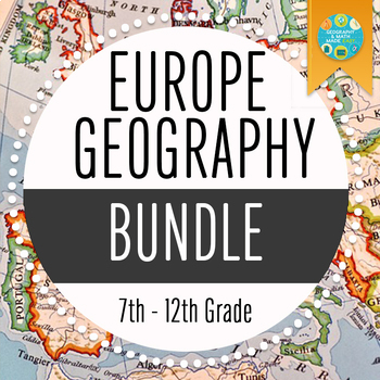
NEW! Europe Geography Bundle + 2 Freebies
By Geography & Math Made Easy
Bundle & Save!
This bundle includes our 5 best-selling Europe Geography Lessons + 2 Freebies
- Eastern & Western Europe Scavenger Hunt
- Examining Political and Protest Music During the Fall of the USSR, Cold War
- European Interactive Notebook
- The Ukraine Crisis 2022
- Geography & Europe Map Quizzes
+ 2 Freebies.
OR BUILD YOUR OWN BUNDLE HERE
Geography - Hemispheres, Continents and Lines of Latitude Worksheet
By Yugen Learning
In this no prep lesson for you or an emergency sub in your Geography program, students will embark on a geographical journey to explore the intricate details of our world's layout. They will be provided with a detailed map, which will serve as their canvas to mark and identify the lines of latitude, distinguish between the different hemispheres, and pinpoint the continents. As they navigate through the map, students will also encounter a series of questions designed to test their understanding and observation skills.
Task:
Using the numbers as references, students must identify and label the following:
- Continents
- Oceans
- Continents
- Hemispheres
- Lines of Latitude
Develop mate reading skills and visual recombination skills
Resources:
A3 size sheet
Marking key
Enjoy this resource! Don't forget to follow my store for more awesome products and rate this product for your TeachShare credits :)
People that have purchased this resource have also purchased -
Geography | What Causes Hunger lesson activity
Geography | Analysing and Interpreting Population Pyramids
Geography | Geographical Scavenger Hunt
Please leave a review.

NEW! Central & South America Geography Bundle
By Geography & Math Made Easy
BUNDLE & SAVE!
This bundle includes our 6 best-selling Central and South America Geography Lessons
- Latin America Carousel Graffiti Activity
- Latin America Passport Activity
- South America Task Cards
- Central & South America Scavenger Hunt
- South America Tic-Tac-Toe
- Central America Tic-Tac-Toe
+ 2 Freebies
OR BUILD YOUR OWN BUNDLE HERE
Geography - Hemispheres, Continents and Lines of Latitude Worksheet
By Yugen Learning
In this no prep lesson for you or an emergency sub in your Geography program, students will embark on a geographical journey to explore the intricate details of our world's layout. They will be provided with a detailed map, which will serve as their canvas to mark and identify the lines of latitude, distinguish between the different hemispheres, and pinpoint the continents. As they navigate through the map, students will also encounter a series of questions designed to test their understanding and observation skills.
Task:
Using the numbers as references, students must identify and label the following:
- Continents
- Oceans
- Continents
- Hemispheres
- Lines of Latitude
Develop mate reading skills and visual recombination skills
Resources:
A3 size sheet
Marking key
Enjoy this resource! Don't forget to follow my store for more awesome products and rate this product for your TeachShare credits :)
People that have purchased this resource have also purchased -
Geography | What Causes Hunger lesson activity
Geography | Analysing and Interpreting Population Pyramids
Geography | Geographical Scavenger Hunt
Please leave a review.