$5 - $10 4th Grade Geography Resources
Geography Map Types Reading & Activities 4th 5th 6th Grades Social Studies
By The Magical Avocado
Understanding geography and types of maps is critical in social science classes! This activity includes reading and answering prompts, cut and paste, maze activity, matching quiz, and teacher guide. Perfect for upper elementary (4th, 5th, and 6th grade), this resource is ready to print and use. Great for a first week of class, substitute plans, centers, and refreshing geography information.
This resource includes:
- four pages of reading and response information sheets
- two pages of cut-and-paste
- one map maze
- one matching quiz
- teaching guide
- answer guides for the activities
This activity includes the following map types:
- choropleth
- general reference map
- globe
- physical map
- political map
- special purpose map
- topographical map
- weather map
Black and White Coloring and Quick Facts of all 50 USA states : unit study
By Tomorrowcomes
Updated with new 2024 flags!
Black and White Quick Facts and Coloring page of all 50 States. Each sheet has the shape and capital of the state, state flower, flag, abbreviation, date and rank of statehood, area and rank, population and rank, region, and state slogan. This is a great resource to introduce basic facts of individual states, while students can engage thru coloring the state flower, map, and flag. Also included is a map of the United States of America. You can have your students label the states and color based on region.
Check out this US President Worksheet covering from George Washington to Joseph Bidden!

Natural Regions of Texas Bundle
By TxMAP Teacher
This Texas History Bundle includes Notes over the Natural Regions of Texas and a Graphic Organizer and Map over the Regions of Texas.
By Creative Soul Printables
Explore the diverse and fascinating United States of America with our 50 States Notebook Pages. This educational and engaging product is designed to help students and travelers of all ages learn more about each of the 50 states that make up this vast and culturally rich nation. Whether you're a student researching state history, a traveler planning a road trip, or an educator looking for engaging teaching resources, these notebook pages are the perfect companion.
Key Features:
- Comprehensive Coverage: Each state has its dedicated page, providing an in-depth overview of its history.
- Beautifully Illustrated: Vibrant and detailed illustrations bring each state to life, making the learning experience more enjoyable and visually appealing.
- Customizable Format: The notebook pages are thoughtfully designed to be easily printable and fit into standard notebooks or binders. You can create your personalized 50 States Notebook by arranging the pages in any order that suits your needs.
- State Flags and Symbols: Learn about the unique state flags, official seals, and other symbols that represent the identity and heritage of each state.
- Great for All Ages: Whether you're a curious youngster or an adult seeking to expand your knowledge, these notebook pages are suitable for learners of all ages and backgrounds.
- Educational Tool: Ideal for homeschooling, classroom teaching, or self-study, the 50 States Notebook Pages are a valuable resource for educators, parents, and students alike.
Uses:
- Education: Perfect for integrating state-specific knowledge into social studies, geography, or history lessons.
- Travel Planning: Plan your dream road trip across the United States, knowing more about each state you'll visit.
*************************************************************
What is included:
Map to write in abbreviations of states to know locations
Notebook Pages for all 50 States
Images for state trees, seals, flags, flowers, birds and flowers
*************************************************************
Other Related Products that May Interest You:
⭐ 50 States Abbreviations BINGO
⭐ 50 States BINGO
**************************************************************
How to get TeachShare credit to use on future purchases:
Please go to your “My Purchases” page (you may need to login). Beside each purchase you'll see a Provide Feedback button. Simply click it and you will be taken to a page where you can give a quick rating and leave a short comment for the product.
Each time you give feedback, TeachShare gives you feedback credits that you use to lower the cost of your future purchases. I value your feedback greatly as it helps me determine which products are most valuable for your classroom so I can create more for you.
Be the first to know about my new discounts, freebies and product launches: Check out my store to know first! **************************************************************

By Nardine Mettry
Spare some time in your class? How about this FUN & DIVERSE TASK CARDS BUNDLE!
How to Use This Resource?
- Whole Class Game: Scoot! Get your students moving with a fun game of Scoot. Place the task cards around the classroom and have students rotate, answering the question at each station before moving on.
- Fast Finishers' Challenge: Challenge early finishers to tackle these task cards as an enriching activity to solidify their understanding.
- Scientific Scavenger Hunt: Turn your classroom or schoolyard into a scientific scavenger hunt! Hide the task cards around the designated area and have students hunt for them, answering the questions they find.
- Science Jenga! Add a scientific twist to the classic game of Jenga! Number the Jenga blocks and assign each number to a specific task card. When a player pulls a block, another player reads the corresponding card and the first player answers the question.
- Formative Assessments: Use these task cards as quick quizzes or formative assessments to gauge student understanding of various science concepts.
- Interactive Whiteboard Fun: Project the task cards on your interactive whiteboard and have students brainstorm answers together as a class.
NEW! Geography, 5 Geographical Themes Puzzle & Printables (High Res, 300DPI)
By Geography & Math Made Easy
These 5 Geography Themes Posters & Printable will come in useful when revisiting the themes throughout the year through activities and assignments.
These are high-resolution images (300dpi) and can be printed as small as 8.5 x 10 or as large as poster size to hang on your wall. Simply print and laminate. Place a set at each group station or place them on our wall for reference. Upload to Google and give access to your students (not other teachers, please). Add them to your online lessons. As you know, it is important that students use the themes regularly to grasp them fully.
Comes in both PDF & JPG formats. All-in-one PDF document is also included.
☑Check out the preview to see what is included.
Visit our store Geography & Math Made Easy to view other related resources.
OTHER RESOURCES YOU MAY LIKE:
✧ Other Related Resources
✧ Beginning-of-the-Year Resources
✧ Assessments Resources
........................................................................................................................................................
CREATE A CUSTOM BUNDLE & SAVE UP TO 20%
Do you need $25 or more of resources from our store and want to save up to 20%? Just let me know and a customized bundle can be created for you. Learn more about how to Create Your Custom Bundle.
.........................................................................................................................................................
Disclaimer:
One purchase is for the use of one teacher. If additional teachers wish to use this product, please purchase additional licenses.
.........................................................................................................................................................
CUSTOMER TIPS
When do I post new products? Throw sales? Be the first to know:
- Click the green star next to my picture to become my newest follower and be notified of up-to-date information, sales and new resources.
Leave A Review and Earn TeachShare Credit to Use on Future Purchases:
- Go under “My TeachShare”, and click on “My Purchases”. Then, click the provide feedback button next to your purchase. Every time you leave feedback on a purchase, TeachShare gives you credits that you can use to save money on future purchases. I value your feedback as it helps me determine what types of new products I should create for you and other buyers.
........................................................................................................................................................
© Geography & Math Made Easy Resources. Created by Martha Boykin ^ Will Boykin. All rights reserved. Purchase of this product grants the purchaser the right to reproduce pages for classroom use only. If you are not the original purchaser, please download the item from my store before making copies. Copying, editing, selling, redistributing, or posting any part of this product on the internet is strictly forbidden. Violations are subject to the penalties of the Digital Millennium Copyright Act.
.........................................................................................................................................................
Related Topics:
5 themes of geography, poster, five geographical themes, beginning of the year, location, place, movement, human-environment interaction, region, geography, geography activities, geography unit, world geography, my world social studies, geography, geography activities, geography unit, world geography, world history, world history curriculum, ap world history, social studies, social studies activities, social studies december, social studies worksheets, social studies, history, word wall, word wall vocabulary cards
ELL Quick 7 Continents Geography Reading with Questions Assignment ESOL
By Quick Assignment Central
Bundle Pack - Includes 7 individual assignments - one for each continent.
Each assignment includes a quick 2 paragraph reading with 3 questions for students to respond to.
Written at a 5th-grade level for English Language Learners.
Alaska Research Project with Reading Comprehension and Time Line
By Jennifer Connett
Learn about the history of Alaska and its state symbols with this state research project. This Alaska research project contains cards with real pictures, reading passages with comprehension questions, and two forms of research recording activities. Students can use the passages, posters and cards to answer the research questions in the two books, or conduct their own research through books or the internet. The preview shows a sampling of each part of this packet.
What is included?
Basic State Poster
State Symbol Cards with real photographs where available
History Time Line Cards with real photographs where available
Reading Comprehension Passages
- Alaska History
- Weather and Climate
- Agriculture and Industry
Fun Facts and Information Pages
Writing Activities
State Research Flip Book Pages
- Basic Facts
- Where is this State?
- Major Landmarks
- Flag
- State Symbols
- Interesting Facts
State Report Book Pages (Choose the pages according to what your focus is.)
- Basic Facts
- Location
- Flag
- State Map
- State Symbols
- Major Landmarks
- Weather and Climate
- Industry and Agriculture
- Famous Person
- Fun Facts
Related Links:
More United States Activities
Susan Wise Bauer "Volume 1: Ancient Times" worksheets
By Peter D
This is a 99-page set of worksheets to accompany Susan Wise Bauer's book "Volume 1: Ancient Times" from the Story of the World.
These worksheets are compatible with both the original edition and the revised edition (published in 2021). Both editions have essentially the same content, and the publisher states that in the revised edition, improvements were made to maps, illustrations, and typesetting, but no new content was added.
For each chapter, there is one page of comprehension questions (multiple choice and short answer questions).
For each set of six chapters, there are eight review pages:
* comprehension questions (multiple choice)
* comprehension questions (short answer questions)
* vocabulary (two pages)
* review activity
* compare and contrast
* illustrations
* paragraph summaries
Also, there is an answer key included at the end of the file.
Worksheets for nonfiction books:
* Carl Sagan: Cosmos
* I Am Malala
* Malala's Magic Pencil
* Roald Dahl: Boy (Tales of Childhood)
* Roald Dahl: Going Solo
* Steck-Vaughn textbook: History of our World Volume 1
* Steck-Vaughn textbook: History of our World Volume 2
* Elie Wiesel: Night
* Susan Wise Bauer: Volume 1 (Ancient Times)
* Susan Wise Bauer: Volume 2 (The Middle Ages)
* Susan Wise Bauer: Volume 3 (Early Modern Times)

World Map Worksheets | 7 Continents and 5 Oceans Blank Map Skills & Activities
By Innovative Classroom Ideas
Kids enjoy studying about the world in which they live! With the help of these entertaining printable Continents and Oceans Worksheets, they will love learning about the seven continents and the corresponding geography. For students in kindergarten, first grade, second grade, third grade, fourth grade, fifth grade, and sixth grade, these worksheets offer a fun and interactive way to explore our planet. Through engaging activities like coloring, labeling, and matching, students will develop a solid understanding of the continents and oceans while sparking their curiosity about the diverse cultures and natural wonders of the world. Let’s embark on a global adventure together!
By completing the various activities, children will enhance their map skills, vocabulary, and critical thinking abilities. These printable resources are perfect for homeschooling, classroom use, or simply as a fun activity to do at home.
These no prep worksheets offer a wide range of activities to keep young learners engaged. From simple tracing and coloring to more challenging puzzles and word searches, there’s something for everyone. With these worksheets, learning about the continents and oceans is both educational and enjoyable.
✅ Save more than 50% when you get a bundle ✅
This bundle contains the following resources:
⭐ Blank World Map with Countries | 7 Continents and 5 Oceans | United States Map
These printable maps will be useful whether you are studying geography, world history, countries around the world, or you are just trying to show your kids the route you are taking on your next vacation! For kids learning about states, we’ve included a printable map of the world, as well as maps of North and South America, Europe, Asia, Australia, Africa, and Antarctica. Furthermore, the world map printable set comprises labeled and blank options for printing. To print the printable map pdf file simply download this ressource and use it for students in pre-kindergarten, first grade, second grade, third grade, fourth grade, fifth grade, sixth grade, seventh grade, junior high, and even high school.
The blank world map is particularly useful for providing a bird’s eye perspective of the globe, oceans, continents, and major nations. It also helps locate me on the map with children of various ages.
That ressource countains:
- Blank World Map (with /without country names)
- North America Map (with / without country names)
- South America Map (with / without country names)
- Australia Map (with / without country names)
- Asia Map (with / without country names)
- Europe Map (with / without country names)
- Antarctica Map (with / without country names)
- Africa Map (with / without country names)
- United States Map (with / without country names)
⭐ World Map with Countries Worksheets | 7 Continents and 5 Oceans Blank Map
Kids enjoy studying the world they live in! They will enjoy learning about the seven continents and the corresponding geography with these fun and printable Continents Worksheets. For kindergarteners, first graders, second graders, third graders, fourth graders, and fifth graders, use these continents and oceans worksheets. You may start playing and learning as soon as you print the continents and oceans worksheet PDF.
These 7 continents and 5 oceans worksheets are perfect for parents, teachers, and homeschoolers who want to assist their kids learn about the globe we live in and improve their science skills. For kindergarteners, first-graders, second-graders, third-graders, fourth-graders, and fifth-graders, this pack is ideal. Use these no prep 7 Continents worksheets for science centers, additional practice, at home or at school, or as a component of a continent study. Children will learn about the seven continents that today make up the world in which we live with this bundle. Answers are provided and this pack comes mainly in black and white with a few color pages thrown in.
There are lots of activities in this pack:
- Continent poster in color
- Color in the continents on the world map following the key
- Cut out and paste the labels onto the continents
- Write the names of the seven continents next to the corresponding number
- Color in the continents using the key
- Unscramble the names of the continents
- One page for each of the seven continents with facts that include the hemisphere the continent is in, the oceans that surround it, and the amount of countries that are in that continent
- Write the names of the continents in alphabetical order
- Continent word search
⭐ Continents and Oceans Worksheets | Blank World Map with Countries | Map Skills
This set of printable pages on the seven continents is a fantastic way to practice geography. With the help of this continents and oceans worksheet pdf, students will enjoy learning about the seven major continents. Use these maps with kindergarten, first, second, third, fourth, fifth, and sixth grade elementary students as part of a social studies subject, as a stand-alone review, or as additional practice.
These 7 Continents and 5 Oceans worksheets will be a hit with your pupils as they practice labeling the different continents and discover fascinating facts about each one. You only need to print the continents and oceans worksheet to begin teaching kindergarteners, first-graders, second-graders, third-graders, fourth-graders, fifth-graders, and sixth-graders. This no-prep geography lesson will help children learn about Asia, Africa, Australia, North America, Antarctica, South America, and Europe. It is perfect for parents, teachers, and homeschoolers. Now that you have these continents worksheets, you can start learning! The answer key is provided!!
⭐ World Map Skills Worksheets | 7 Continents and 5 Oceans | Geography Activities
This printable page pack featuring the seven continents is an excellent tool for honing geography skills. These continents and oceans worksheet pdf will make learning about the seven major continents enjoyable for students. Utilize these no prep worksheets with kindergarten, first, second, third, fourth, fifth, and even sixth graders! With vibrant colors and engaging activities, these worksheets turn geography into an adventure. Children will love coloring the continents, labeling oceans, and matching animals to their habitats. Perfect for homeschooling, classroom use, or simply for curious young minds. Let’s explore the world together!
From basic map skills to understanding cultural differences, these no prep continents and oceans worksheets provide a solid foundation for future learning. Download your set today and start your global exploration! Students will love searching for hidden objects, solving puzzles, and creating their own maps. These engaging activities will spark their curiosity and inspire a lifelong love of geography. Plus, they’re a great way to reinforce essential skills like following directions and problem-solving.
>>>> ⭐ More Similar Activities ⭐ <<<<<
We adore FEEDBACK! You also obtain CREDITS! :
- Access your TeachShare account by logging in.
- Select "My TeachShare" from the drop-down menu.
- Click on "My Purchases."
- Select ratings and provide feedback.
Terms of Use: By purchasing and/or downloading this electronic file, you are allowed to use the product for personal use as you like, but you are not allowed to resell or redistribute.
Follow my store and get all the newest product updates and freebies by clicking the green star ★ above.
♥ Search Key Terms: World map, world maps, world, world geography, map of the world, world map is wrong, world map for kids, world facts, map of world, #world, new world map, free world map, accurate world map, world puzzle, world oceans, fixing the world map, World map, world,blank map, how to draw world map easily, world map drawing, how to draw world map, world maps,European school draw world map, world map drawing easy, world map draw kaise kare, world map flat, world map draw in ias mains exam, how to draw a world map in easy steps, world map quiz, easy world map, how to draw world map in examination, how to dry world map in upsc mains exam, Continents and oceans, the continents and oceans of the world worksheet, continents and oceans for kids, continents and oceans for kids, continents and oceans workbook, continents and oceans free course, continents and oceans printables, homeschool continents and oceans, classroom continents and oceans resources, homeschool continents and oceans resources, oceans and continents, Map skills, map skills for kids, map skill, skills,map symbols,, map,map skills tutorial, map skills geography,map skill of India, reading a map, map reading skills, map skill for third grade, map scales, how to teach map skills to students, how to teach map skills to students, mapping skills, map skill of ch 3 drainage class 9 geography, navigational skills., #maps, reading a map for kids, map legends, hiking skills, how to make a map, how to read a map
New York State Geography Scavenger Hunt (No prep!)
By Miss Yous Clues and Resources
This is a scavenger hunt using task cards that is based on New York State Geography which is aligned with the 4th grade curriculum but would be helpful for grades 3-5 learning about New York State. Students will read about the lakes, rivers, mountain ranges, cities within NYS, the state capital, bordering states, countries and oceans. Check out the preview to see what each task card entails. Students will need to walk around the room reading the task cards. Each task card has a code word on the bottom which is the answer to the question/fill in the blank. The answer will NOT be found on that same task card. For example, the answer to task card #1 is found by reading the passage on task card #8. Students MUST record which task card they found the answer on in their answer sheet under the “FOUND CARDS #” column. That column will be used at the end for the 4 digit lock code. They will follow the clues to find the correct 4 digit code.
This activity would be a great review before assessments, as a center activity, a group activity, etc. Students will be engaged with the learning while having a fun time trying to solve all of the clues!
Geography & Maths - Teaching Grid Coordinates with a Game with lesson plan
By Yugen Learning
Ahoy, educators! Dive into the world of coordinates with our engaging no prep Battleship Coordinates Game for you or an emergency sub lesson for your Geography and Maths programs.. Designed meticulously with students in mind, especially those who find coordinates challenging, this game offers a hands-on, interactive approach to mastering the X and Y axis f
Master Coordinates with the Battleship Game: A Fun & Engaging Learning Tool!
Resources:
- Lesson plan to help your implement
- Complete single A4 page with instructions and supporting information for all students (Simply duplicate and distribute)
Why Choose the Battleship Coordinates Game?
- Engaging Learning: Transform the daunting task of understanding coordinates into an exciting naval adventure!
- Tailored for Strugglers: Specifically crafted for students who find coordinates tricky, serving as an excellent introduction.
- Aligned with Standards: Our game is in sync with Common Core outcomes, ensuring your students are on track with curriculum standards.
- Dual Learning: While students immerse in strategic gameplay, they're simultaneously reinforcing their understanding of basic coordinates.
Common Core Outcomes:
- CCSS.Math.Content.5.G.A.1: Use a pair of perpendicular number lines, called axes, to define a coordinate system.
- CCSS.Math.Content.5.G.A.2: Represent real-world and mathematical problems by graphing points in the first quadrant of the coordinate plane.
Australian curriculum links: for teaching coordinates in geography and mathematics:
- ACGSE037: Use maps, globes, and other spatial representations to locate places and features.
- ACGSE043: Analyze the spatial distribution of people, places, and things.
- ACGSE051: Understand the impact of human activities on the environment.
- ACMNA066: Understand the concepts of coordinate geometry, including the Cartesian coordinate system.
- ACMNA067: Be able to plot points and lines in the Cartesian coordinate system.
- ACMNA068: Use coordinate geometry to solve problems.
- ACMNA069: Understand the relationship between coordinate geometry and other areas of mathematics, such as geometry and algebra.
Bring coordinates to life in your classroom and watch as your students navigate their way to success. Set sail into the world of interactive learning today!
Grab Your Battleship Coordinates Game Now!
Enjoy this resource! Don't forget to follow my store for more awesome products and rate this product for your TeachShare credits :)
People that have purchased this resource have also purchased -
Geography | What Causes Hunger lesson activity
Geography | Analysing and Interpreting Population Pyramids
Geography | Geographical Scavenger Hunt
Geography | Hemispheres, Continents and Lines of Latitude Worksheet
Please leave a review.
3rd-5th Social Studies: Geography Unit Text Passages, Guided Notes & Activities
By Kile's Classroom
Make your Social Studies Lesson SHINE!
This is a single unit of study for Social Studies- Geography. These activities will help your students deepen their knowledge of geography basics. The pages of this unit can be used as a supplemental activity for your current social studies curriculum, or you can use reading from the internet.
Easy-to-understand texts are included with each lesson. These texts can be used as stand-alone reading materials or supplements to your current Social Studies curriculum.
Topics Covered:
Lesson 1: North America
Lesson 2: Regions of the United States
Lesson 3: Canada
Lesson 4: Mexico
Lesson 5: The Caribbean
Unit Assessment Included
Additional Social Studies Resources from Kile's Classroom:
- Regions of the US Digital Project
- Free- Biography Trading Cards Project
- Government
- 4th-6th Grade Social Studies US Colonies Unit, Vocabulary, Texts, Activities
Customer Tips:
How to get TeachShare credit to use on future purchases:
• Please go to your My Purchases page (you may need to
log in). Beside each purchase, you'll see a Provide Feedback button.
Simply click it, and you will be taken to a page where you can give a quick rating and leave a short comment for the product. Each time you give feedback, TeachShare gives you feedback credits that you use to lower the cost of your future purchases. I value your feedback greatly as it helps me determine which products are most valuable for your classroom so I can create more for you. ☺
Be the first to know about my new discounts, freebies, and product launches:
• Look for the green star next to my store logo and
click it to become a follower. Voila! You will now receive email updates
about this store. ☺

Special Education Science Task Box Activity Bundle (Life Skills Activities)
By Specifically Sped
Special Education Science Task Box Puzzle Bundle
This special education science task box bundle is perfect for life skills classes. It is differentiated to meet the needs or multi-level students. The visuals provide students access to the material who may need more academic support.
Students can practice cutting and gluing these visuals to the matching board or laminate and add velcro for repeated use.
Included in the bundle are the following task box puzzles:
- Bodies of Water
- Landforms
- Continents
- Planets
- My Body
- My Organs
- Weather
- Animal Habitats
- Force and Motion
***FREEBIE INCLUDED
There is a free copy of "My Life Cycle Puzzle" available for you to download with this purchase of this bundle.
Mega Bundle
These task box puzzles are included in a mega bundle with corresponding adapted books. For each task box in this bundle their is an adapted book with matching visuals to reinforce the retention of each topic. With nine topics included, you are able to change these out each month.
Check out the Mega Bundle HERE!
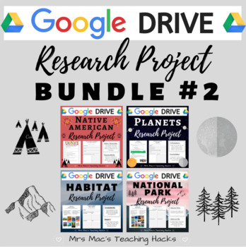
Google Drive Research Project BUNDLE #2
By Abigail J McClellan
Are you looking for online resources to assign your students so they can continuing learning from home? Look no further! This comprehensive GOOGLE DRIVE research project BUNDLE is everything you need in order for students to complete independent research from home or paperless assignments at school. This product encourages research skills using National Geographic Kids & various graphic organizers, content-specific vocabulary knowledge, and self-reflection skills! This resource comes with over 12 pages per product of graphic organizers (with examples!), vocabulary terms, and Google Survey/Quizzes for easy grading. It is easy to use and an awesome independent research project that your students will love! Be sure to check out the individual products for a more detailed description / preview of what is included :)
What is included?
- Access to all 4 Google Drive products, each containing 8-9 resources (30 files total!!):
- How-to-Use Guide - Includes main ideas, student outcomes, materials, standards/curriculum connections, and assessment/grading.
- National Geographic Kids Website Guide - Provides a detailed description of how to use the National Geographic Kids website, including pictures and steps.
- Vocabulary Terms - ½ sheet definitions of 8 vocabulary words related to each project.
- Vocabulary Quiz - This 8 question quiz assesses the students on their knowledge of the vocabulary words from the vocabulary terms given.
- Individual Research Graphic Organizers - Graphic organizers for students to record their individualized research. It includes an example.
- Student Checklist and Project Reflection - This is the final part of the research project. Students are asked to fill out a checklist marking if they completed all aspects of the research project. They then can reflect on a few short answer questions.
- Terms of Use page
THIS BUNDLE #2 INCLUDES:
Google Drive Planet Research Project
Google Drive Native American Research Project
Google Drive Habitat Research Project
Google Drive National Parks Research Project
E-Learning / Home Learning / Remote Learning / Distance Learning / COVID-19 / Coronavirus / Paperless
Freebies & Discounts:
Be sure to follow my store by clicking HERE to stay up to date on all my new products, including products that are FREE and on discount!
Ratings & Reviews:
Please leave a review if you enjoyed this product and found it useful. I really love reading how you are using my products in your classroom :) Every time you give feedback, TeachShare gives you feedback credits that you use towards future products!! Thank you in advance for taking the time to leave a rating & review!
By The Book Bandit
This 42 page NO-PREP resource is a student resource all about New Zealand and is suitable for elementary and primary school aged children. The resource includes information over a wide range of topics with engaging questions and activities to go alongside them.
Topics include:
- New Zealand Map
- New Zealand - General Knowledge and profile
- New Zealand History
- Indigenous New Zealanders
- Language and slang
- Flag
- Legends
- Famous New Zealanders
- Kiwis
- Wildlife
- Sport
- National Icons
- National Treasures
- Tourist Activities
- Opportunities for students to apply their knowledge.
Please see the preview for a snapshot of some of the activities and information in this resource.
The 7 Continents Reading Comprehension
By Elementary divas
Your students will learn about the 7 Continents of the world, while they read and answer the questions from the passages. Asia, Africa, Europe, North America, South America, Oceania, and Antarctica.
You might also be interested in these other resources:
- Opinion writing worksheets
- Sequence of events headings
- Sequence of events worksheets
- 57 Story Starters Picture Writing Prompts
- 384 CVC Words Pocket Chart SUPER Packet
- Compare and Contrast worksheets, Picture Cards and Poster
- CVC Middle Sound Words Pocket Chart
- Fraction Wall with 40 Task Cards, Posters
It is our sincere hope that you can find this resource useful.
If you like this product please be sure to leave positive feedback to earn TeachShare credits toward future purchases.
FIND US HERE!
Instagram
Email
Blog-coming soon!

Geography & Map Types & Skills & Activities 4th 5th 6th grades Social Studies
By The Magical Avocado
Teaching Geography? This bundle has everything you need to teach different map types, map skills, latitude and longitude, and more! This bundle includes a combination of ready-to-print reading and response, activity sheets, maze puzzles, cut-and-paste activities, writing prompts, and assessments. Perfect for upper elementary (4th, 5th, and 6th grade), this complete bundle is great for substitute work, centers, the beginning of the year, introduction and review of geography, enrichment, home school assignments, and centers!
Specifically, this bundle includes:
- 8 read and respond
- 6 Maze Activities
- 4 Cut and Paste
- 4 skills practice pages
- 2 USA Maps for practice
- 2 writing pages
- 1 short answer quiz
- 1 matching quiz
- 1 mini project
- 3 Teaching Guides
This bundle covers the following concepts:
- Absolute Location
- Cardinal Directions
- Cartographer
- Compass Rose
- Coordinates
- Equator
- Intermediate Directions
- Latitude
- Legend
- Longitude
- Prime Meridian
- Relative Location
- Scale
- Symbols
and the following map types
- choropleth
- general reference map
- globe
- physical map
- political map
- special purpose map
- topographical map
- weather map

50 States black and white printable worksheets, facts, and coloring bundle
By Tomorrowcomes
Black and White Quick Facts and Coloring page of all 50 States. Each sheet has the shape and capital of the state, state flower, flag, abbreviation, date and rank of statehood, area and rank, population and rank, region, and state slogan. This is a great resource to introduce basic facts of individual states, while students can engage thru coloring the state flower, map, and flag. Also included is a map of the United States of America. You can have your students label the states and color based on region.
Black and White worksheet for cats on all 50 States. Each sheet asks basic information about individual states for students to fill out. This is a great resource to introduce basic facts of individual states, while students can engage thru drawing the state flower, state bird, state tree, and state shape. A blank worksheet is also included.
Check out this US President Worksheet covering from George Washington to Joseph Bidden!
Geography: "Shake, Rattle, and Roll": Plate Tectonics Task Cards (Earthquakes)
By Geography & Math Made Easy
Need a fun introduction activity or wrap-up activity to a plate tectonic lesson? Task cards are a great way to engage students in the learning process.
This set includes 24 task cards addressing the Pangaea Theory, moving boundaries, major U.S. faults, Mount St. Helen's eruption, Tsunamis, continental drift, layers of the earth and more.
Includes:
24 task cards
Instructions
Answers
Student answer sheet
Get you students moving around the room. They often learn better when they are moving, collaborating and having fun.